
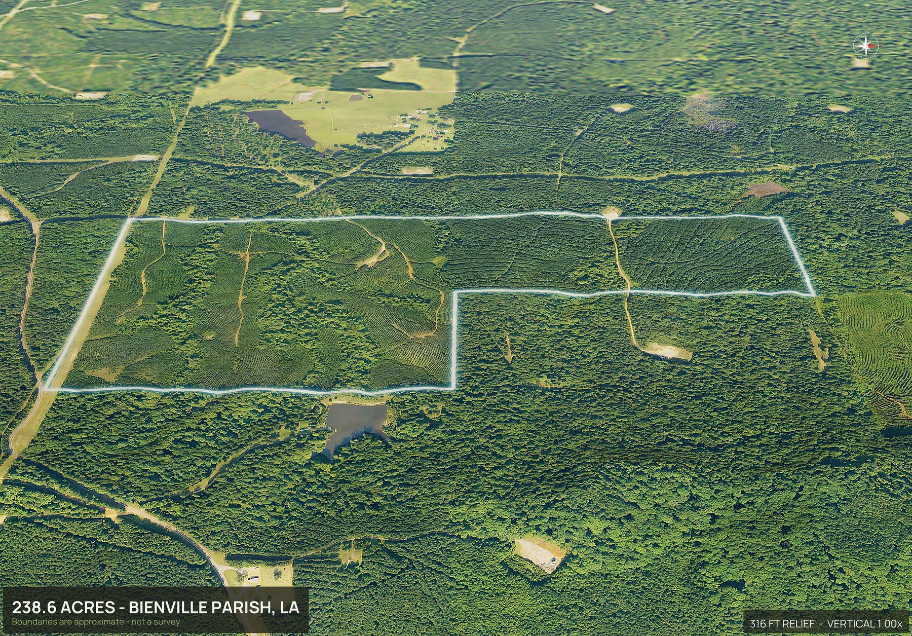
DirtFlight is not a drone photography service. To get aerial photos of land in Louisiana, enter the parish and the APN, or draw the boundary on the map or upload a file. The pack renders in about ten minutes: an outlined top down, four cardinal 3D views, an 18 second orbit video, a hosted listing page and a parcel info sheet, with full resolution files of every view. Nobody flies out, so there is no travel charge, and it works anywhere in Louisiana. Dirt is $29 a parcel and Paydirt $79, or $199 a month for PayDirt Pro (20 Paydirt packs a month). Paydirt adds a contour map, the road frontage hero, the infrared land health view, the full social kit with platform captions, a posting plan and silent reels, pop-out photos from nine directions, the interactive 3D explorer and the measured diligence layers.
- Coverage
- All of Louisiana
- Turnaround
- About 10 minutes
- Travel charge
- None, ever
- Imagery age
- One to three years
Wet, drier, and wet again by season.
In Louisiana the difference between a hunting tract and a flooded one is a couple of feet, and it changes with the month. Buyers want to see the sloughs, the ridges, the pipeline right of way, and where the water sits when it sits. Standing at a gate off the highway tells you none of that.
A tract in Bienville Parish renders in the same ten minutes as a lot in East Baton Rouge Parish, and sloughs, cypress and cutover read clearly from above.
Boundaries are approximate and are not a survey.
One parcel. Everything below.
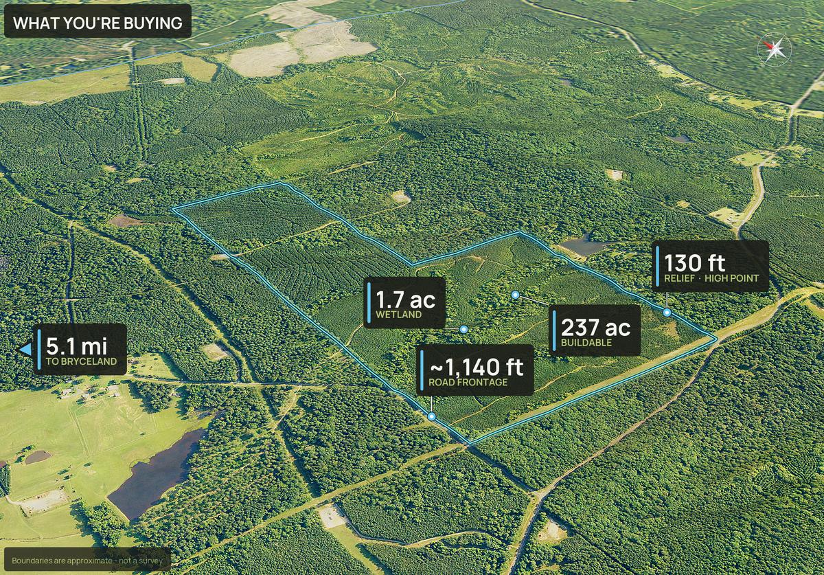
One parcel. Hardwood on the ridge, slough across the back, and a pipeline right of way cutting the northeast corner.
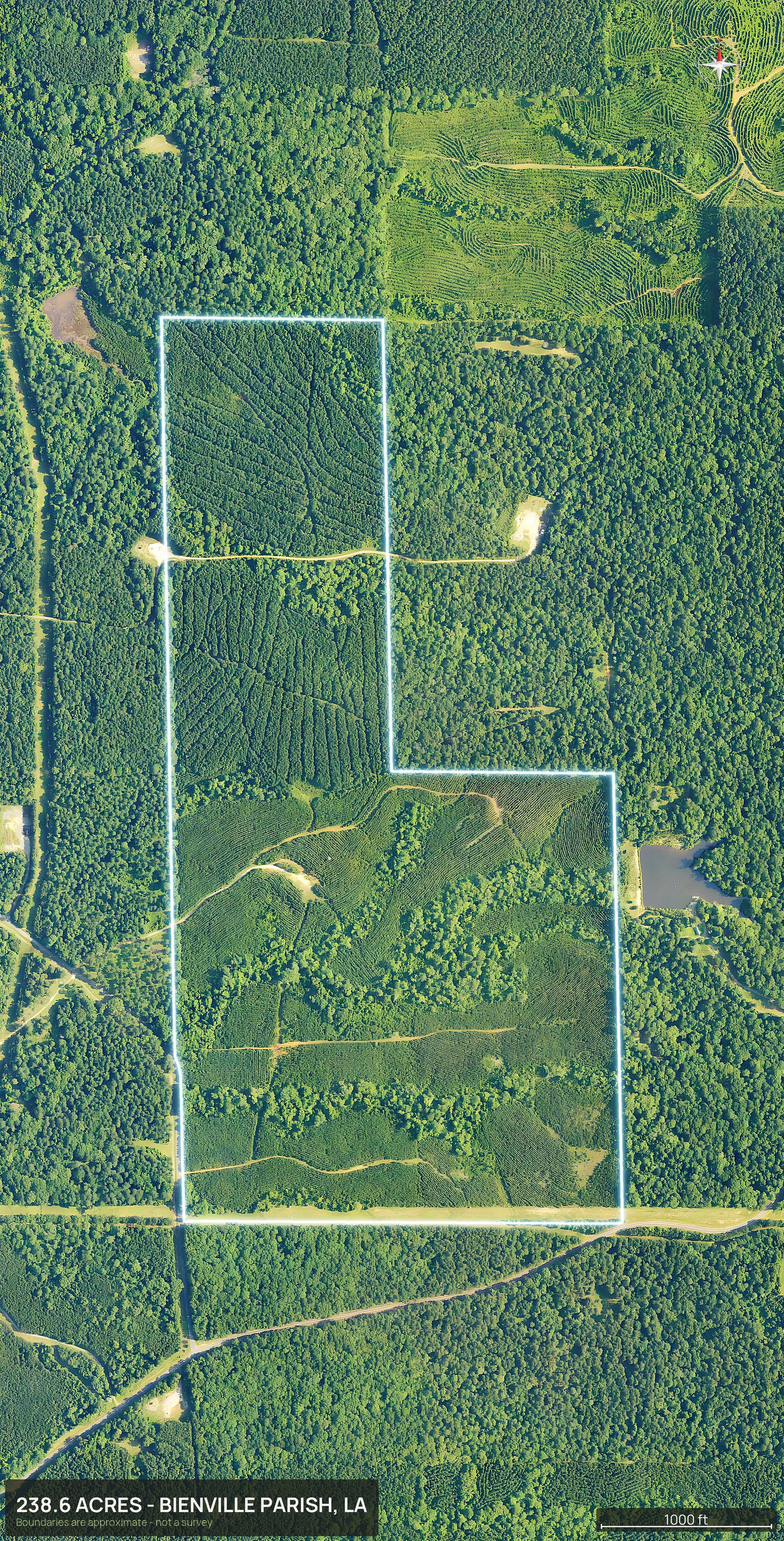
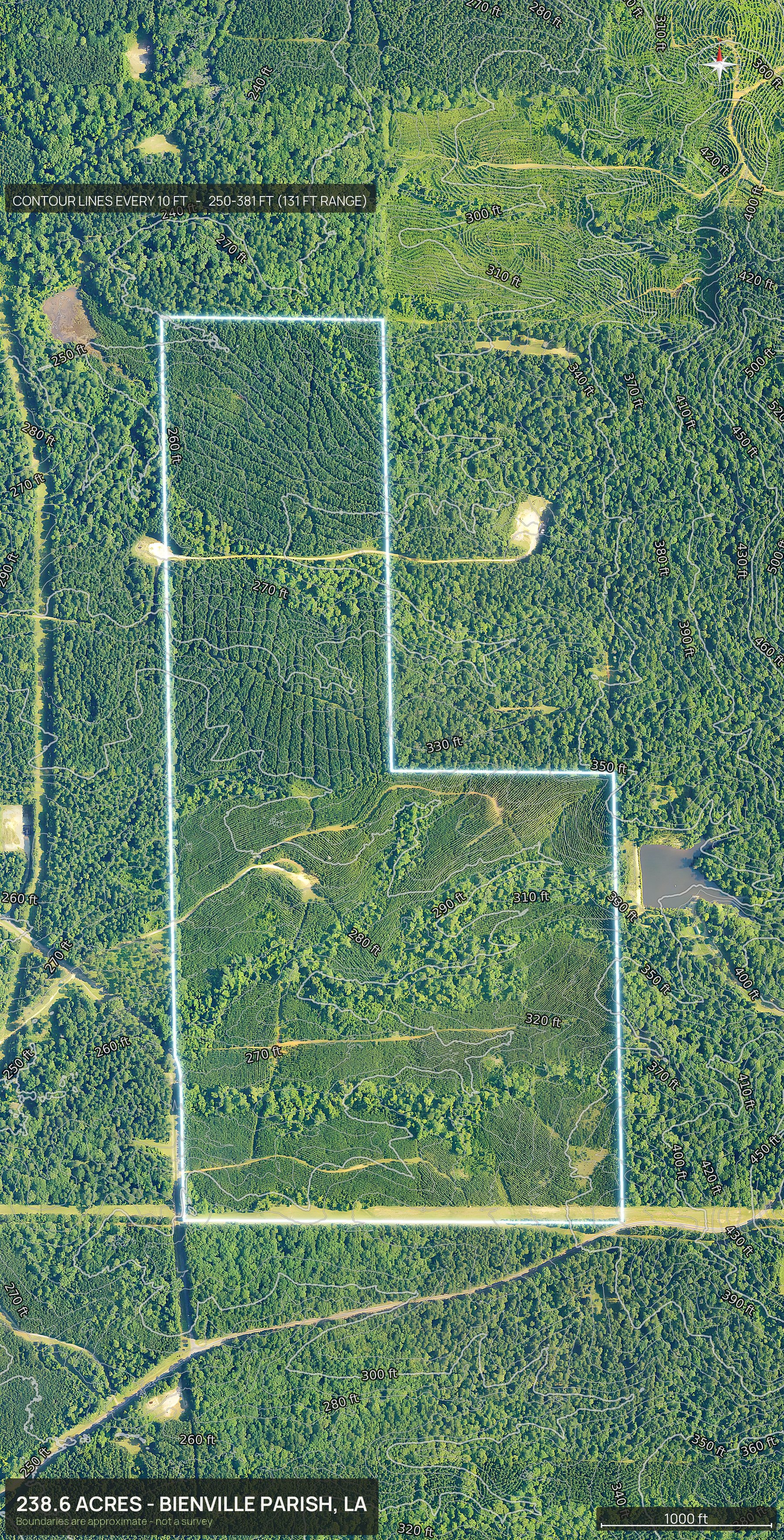
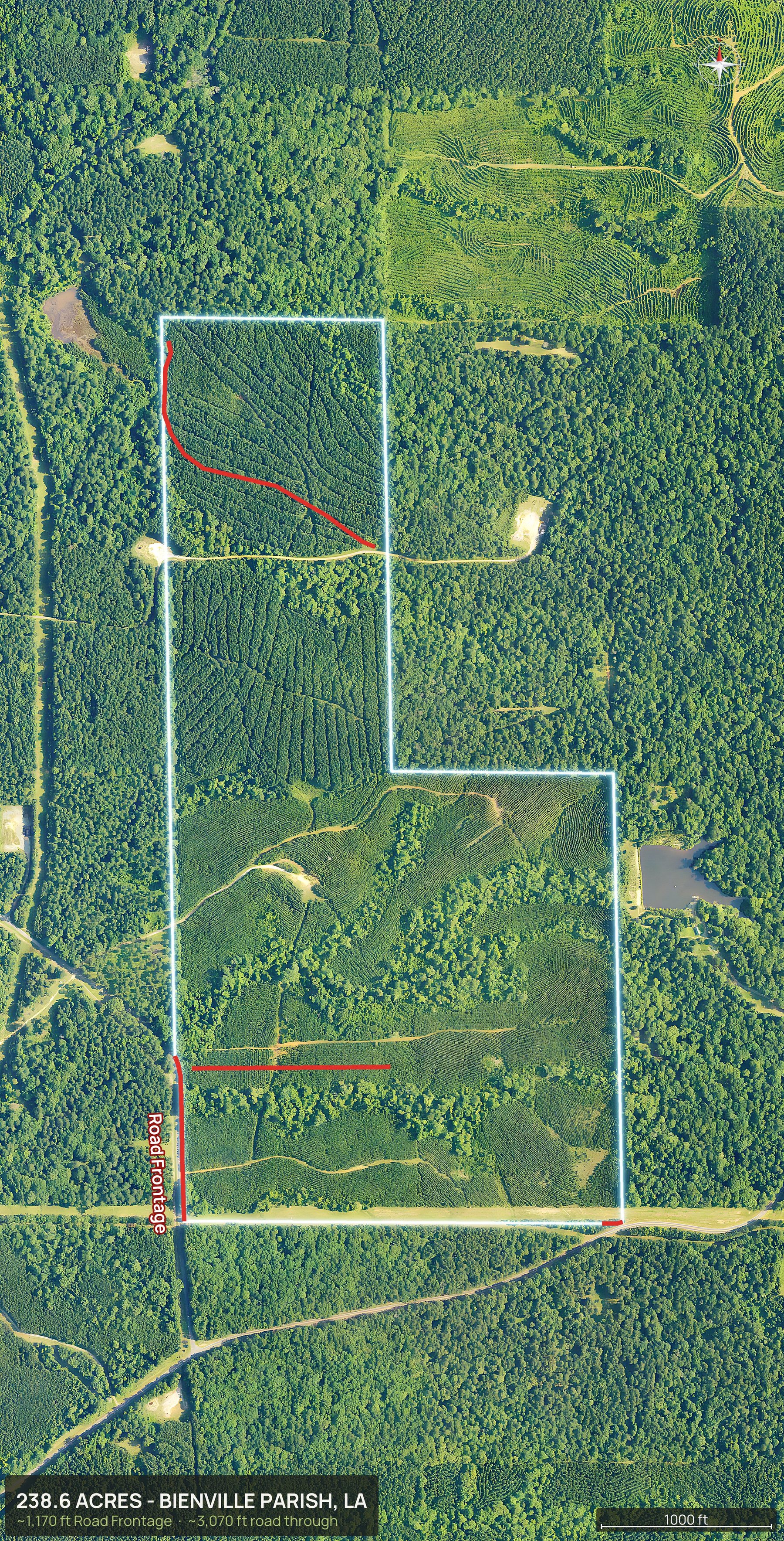
Everything in the pack
This is the whole Louisiana delivery.
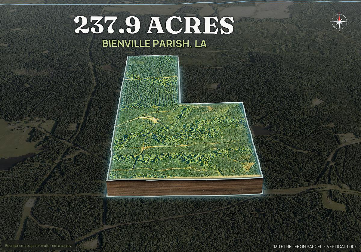
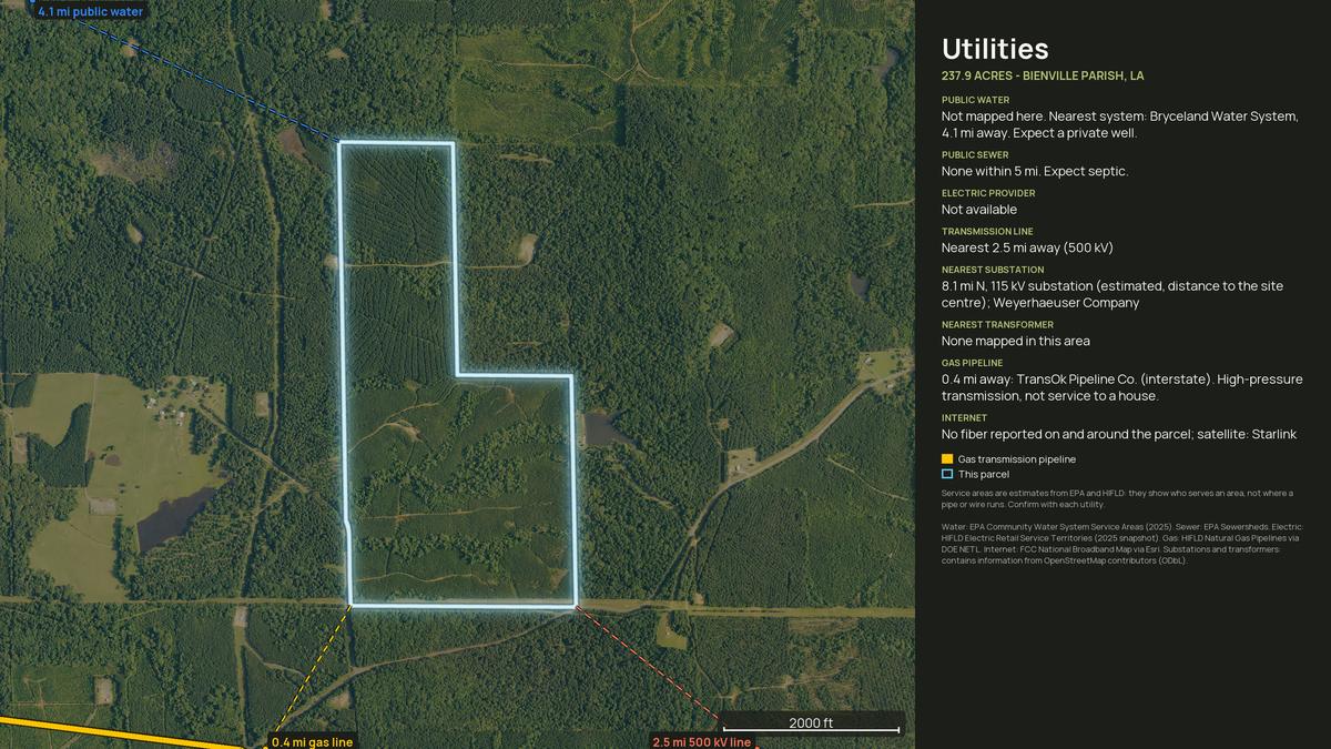
Every view below came back from one parcel, in about ten minutes, with no pilot and no site visit.
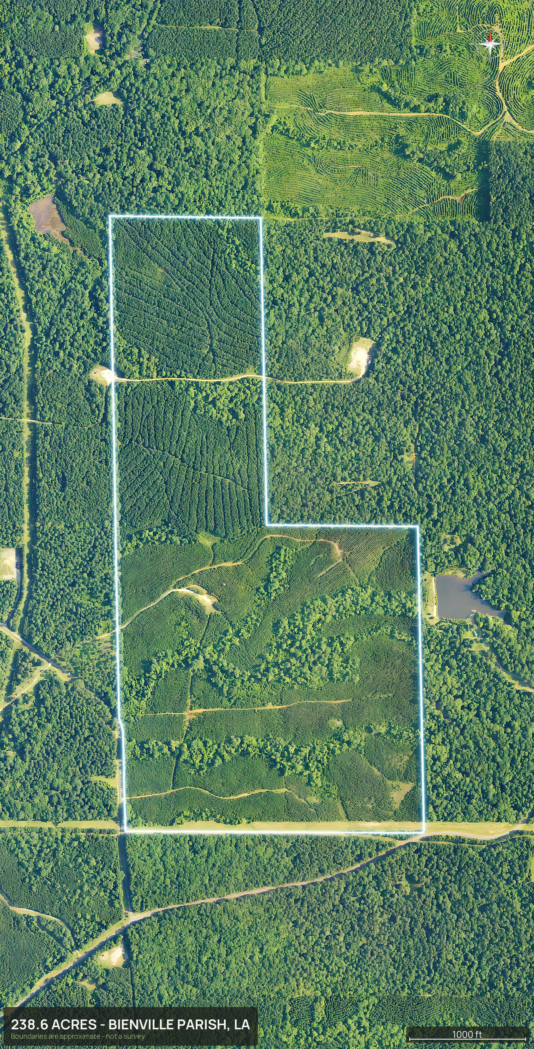
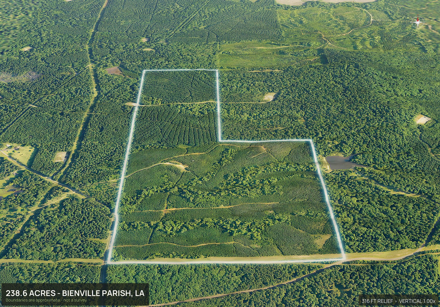
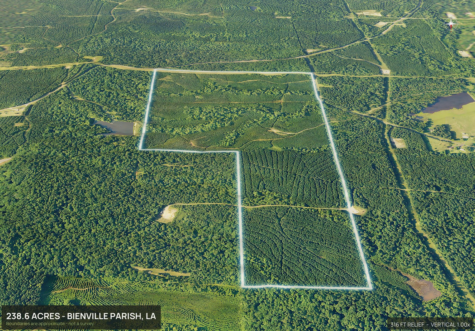
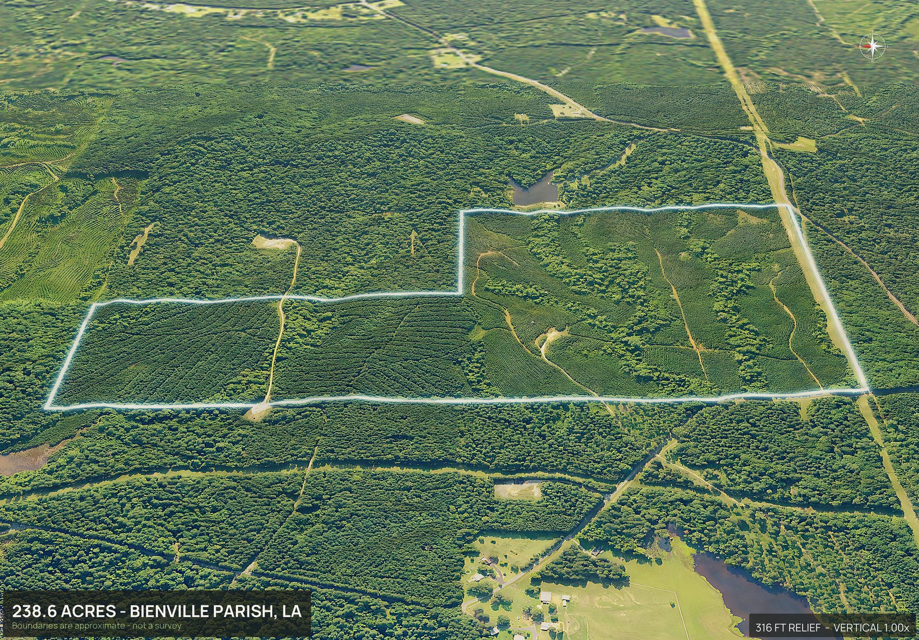
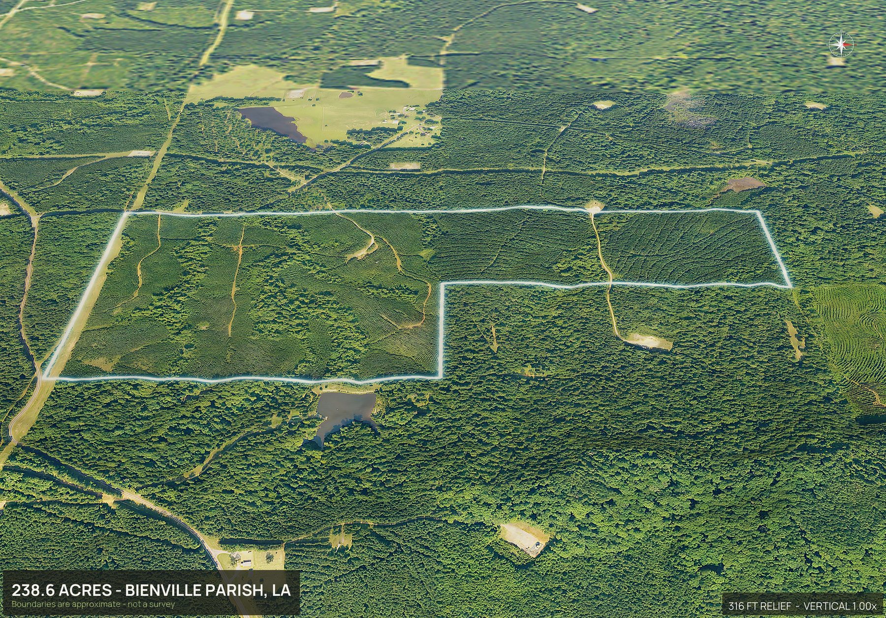
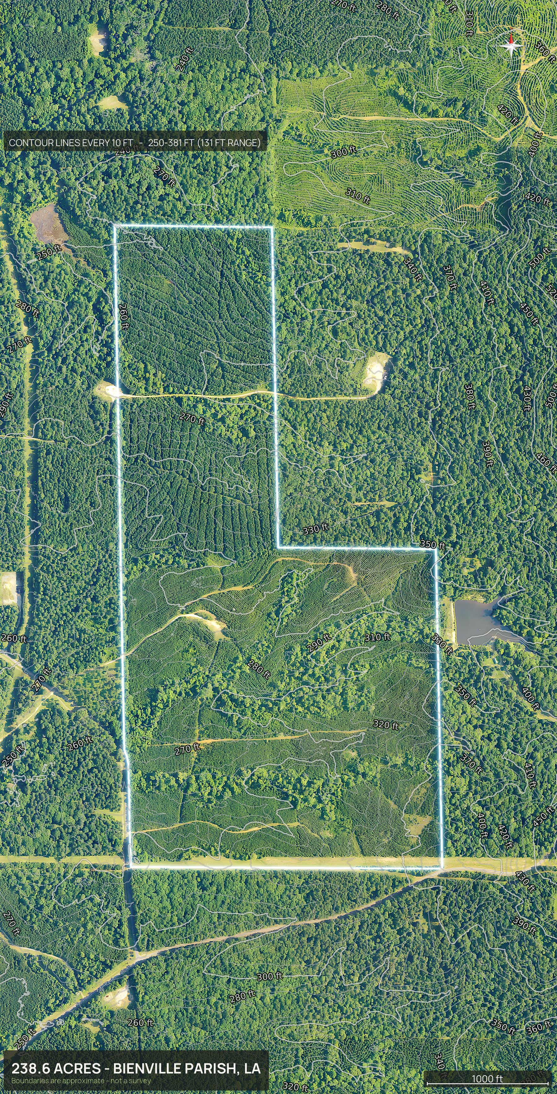
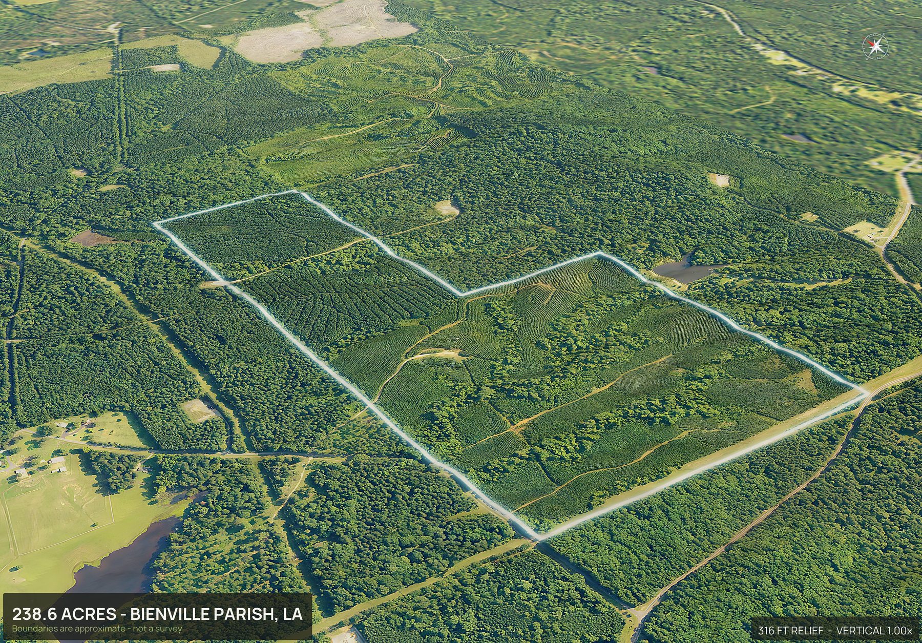
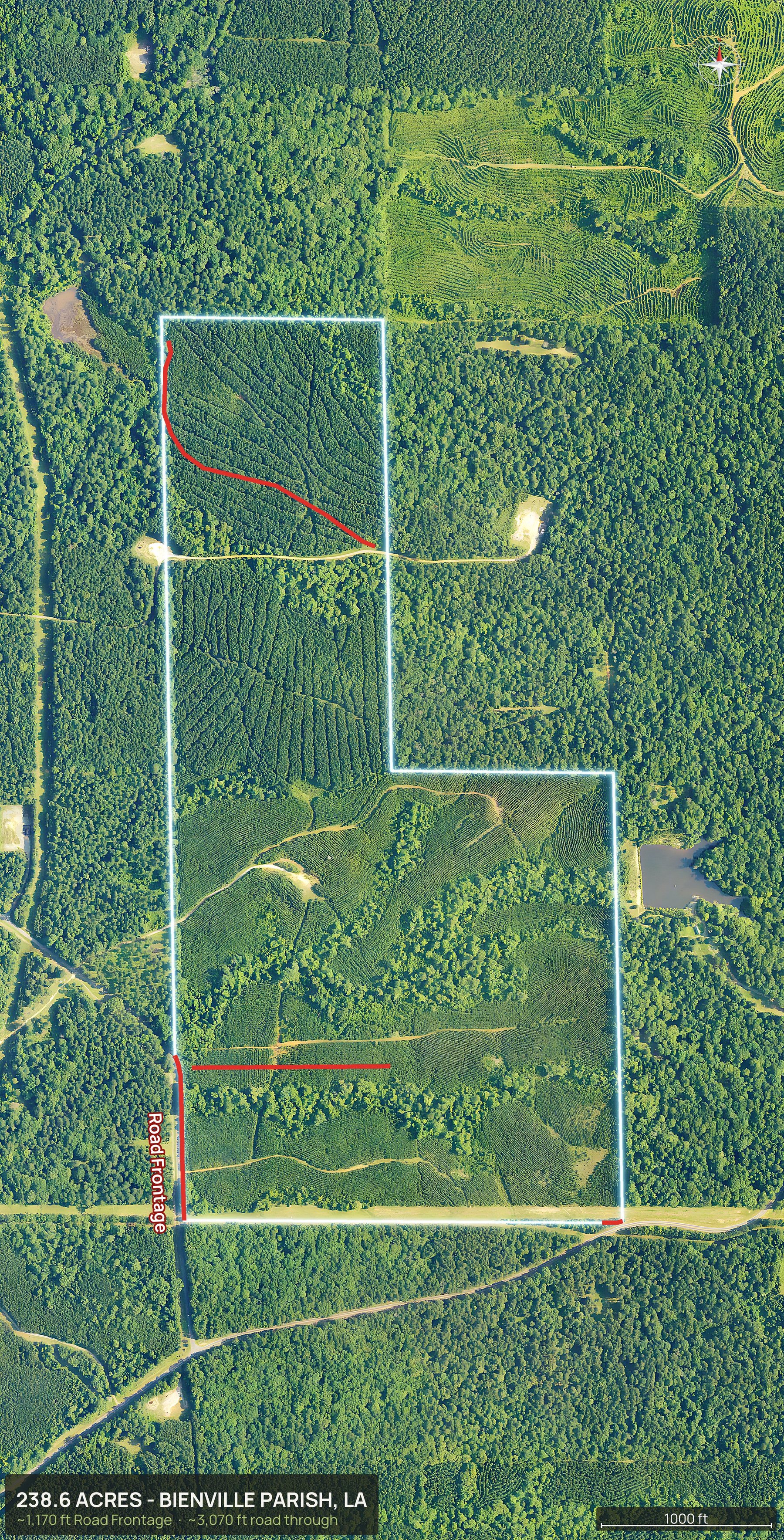
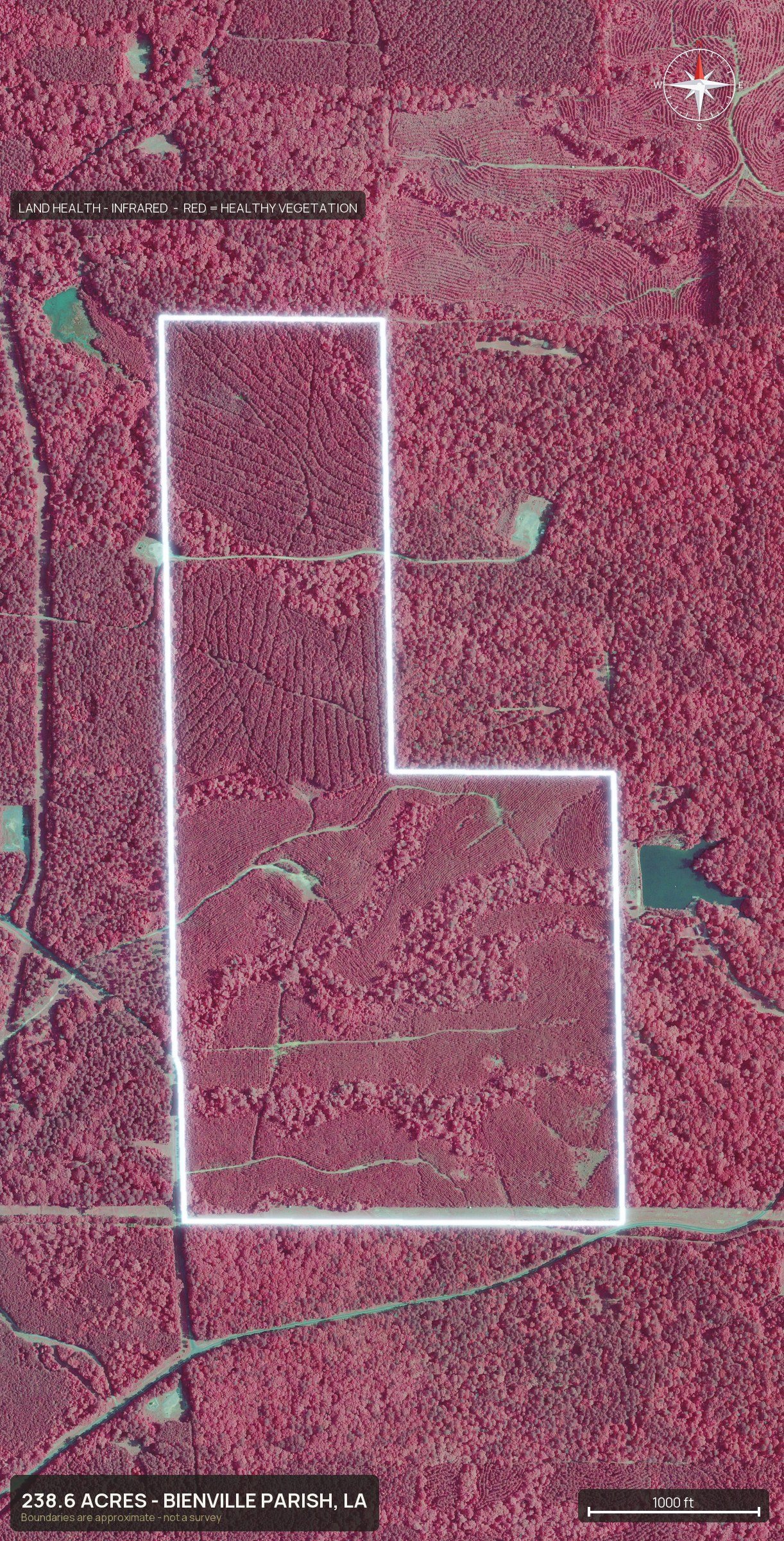
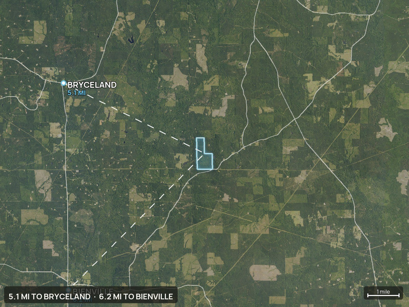
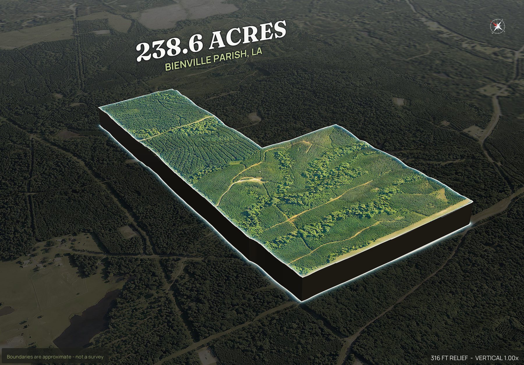
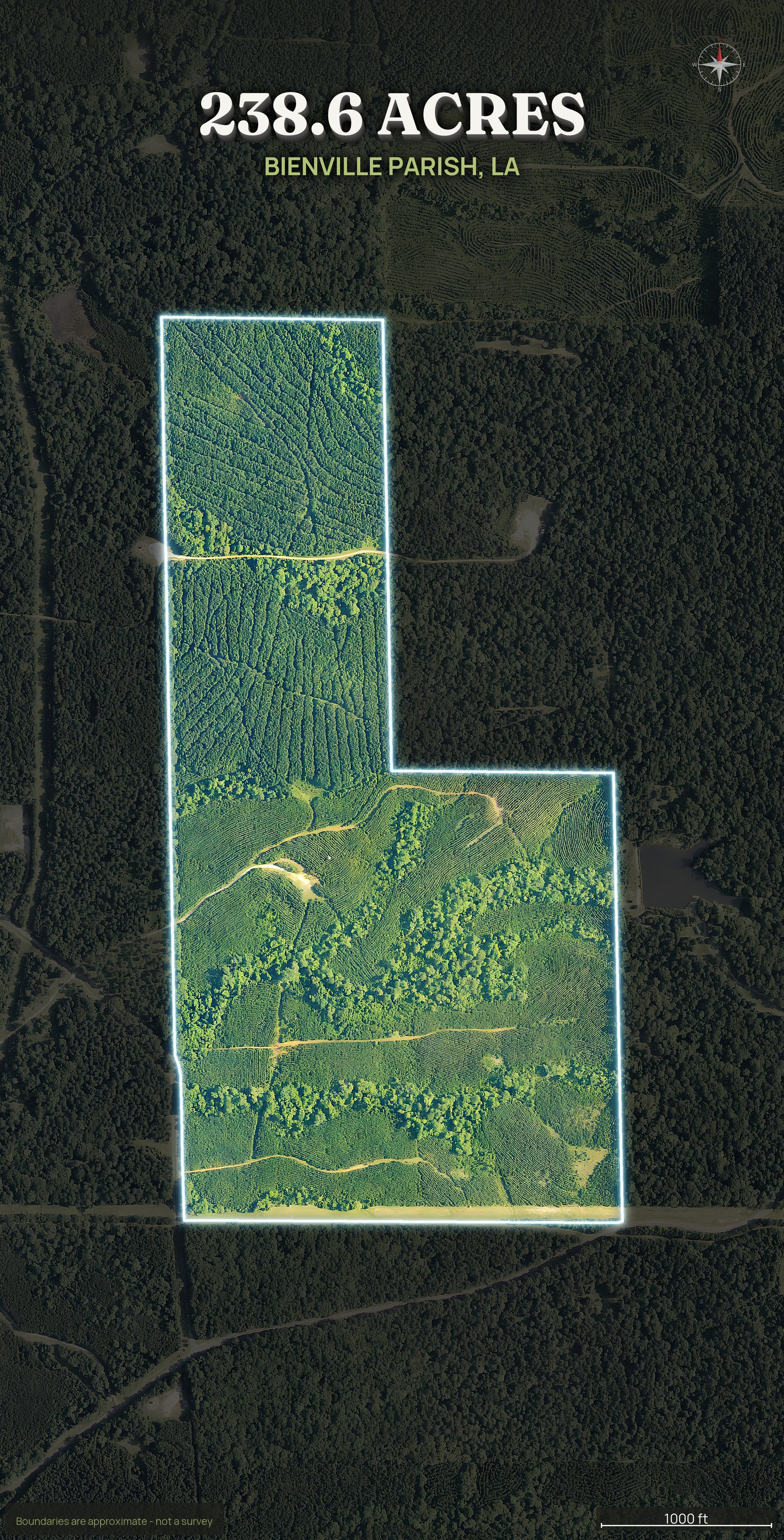
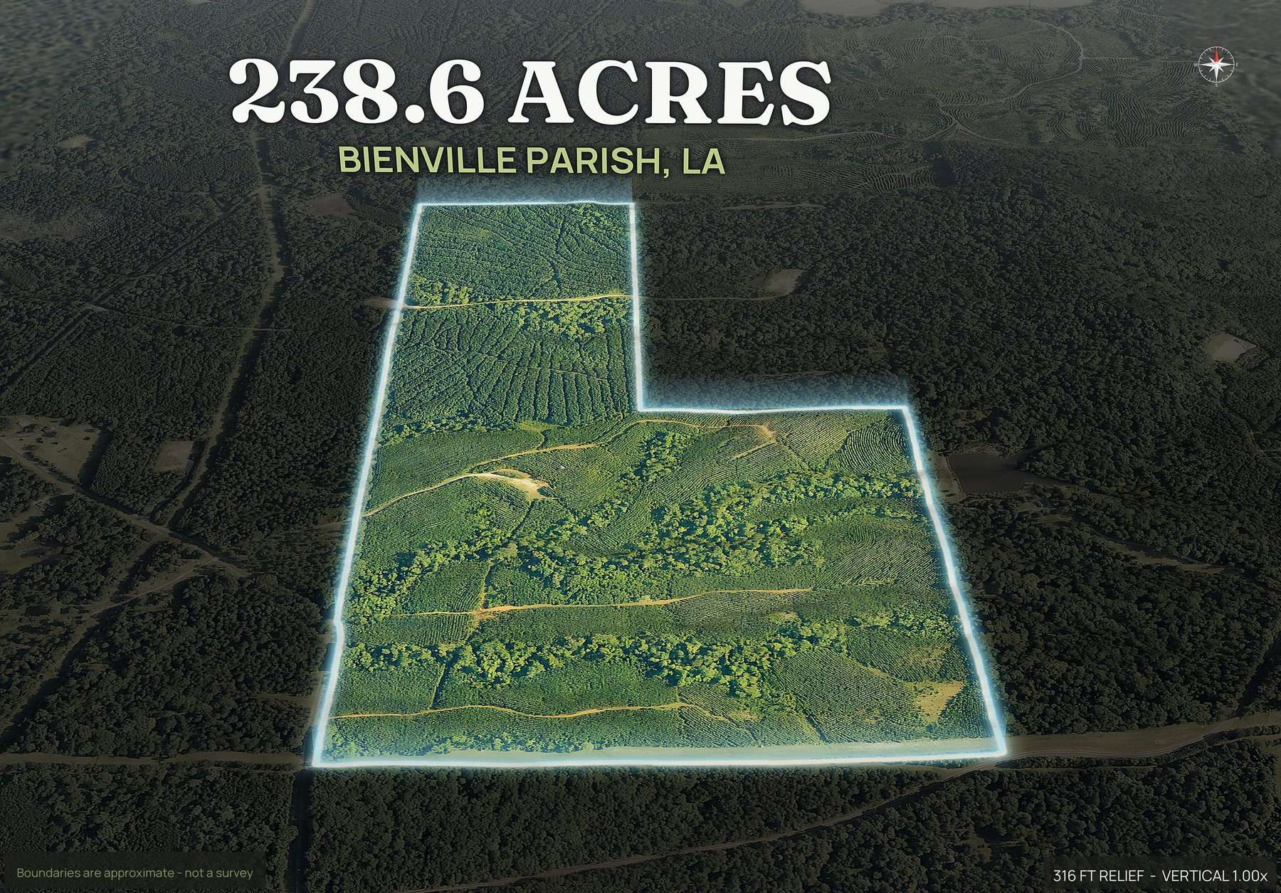
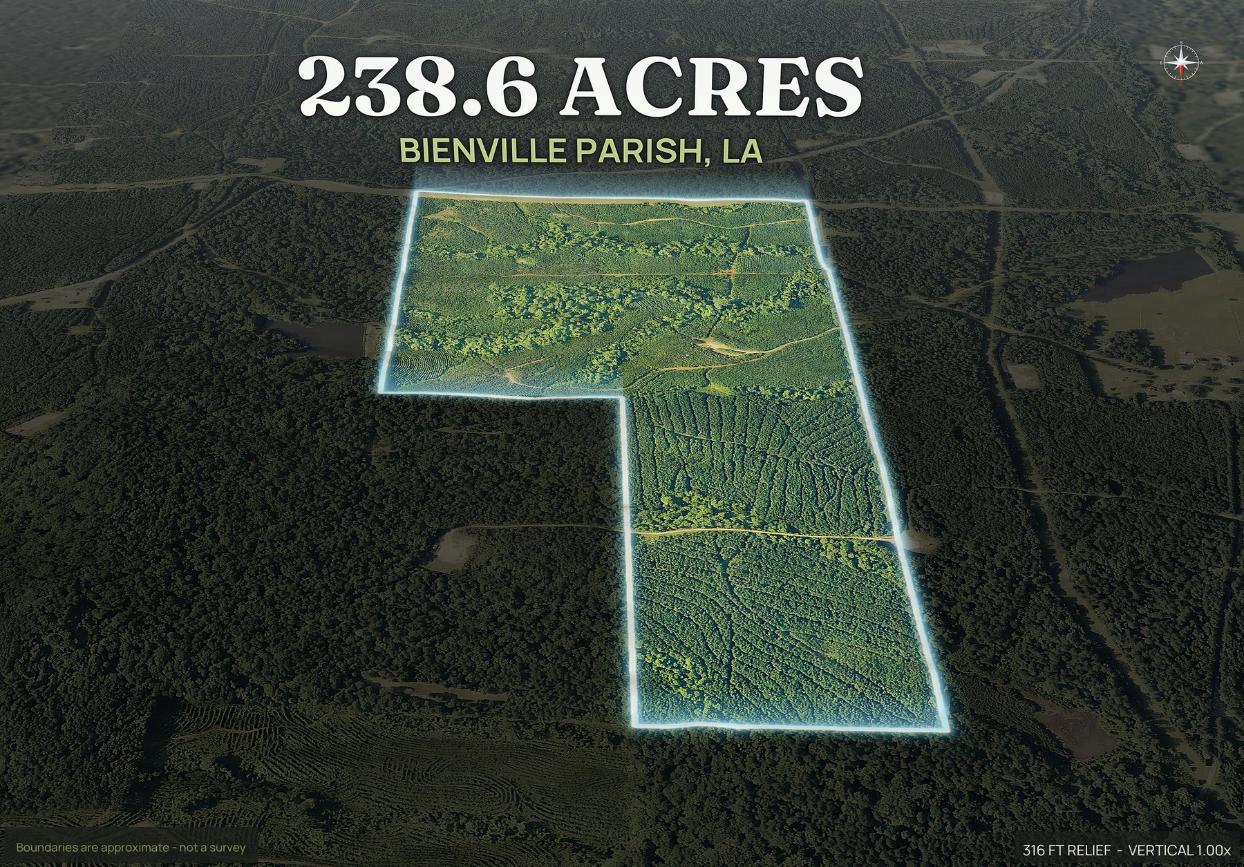
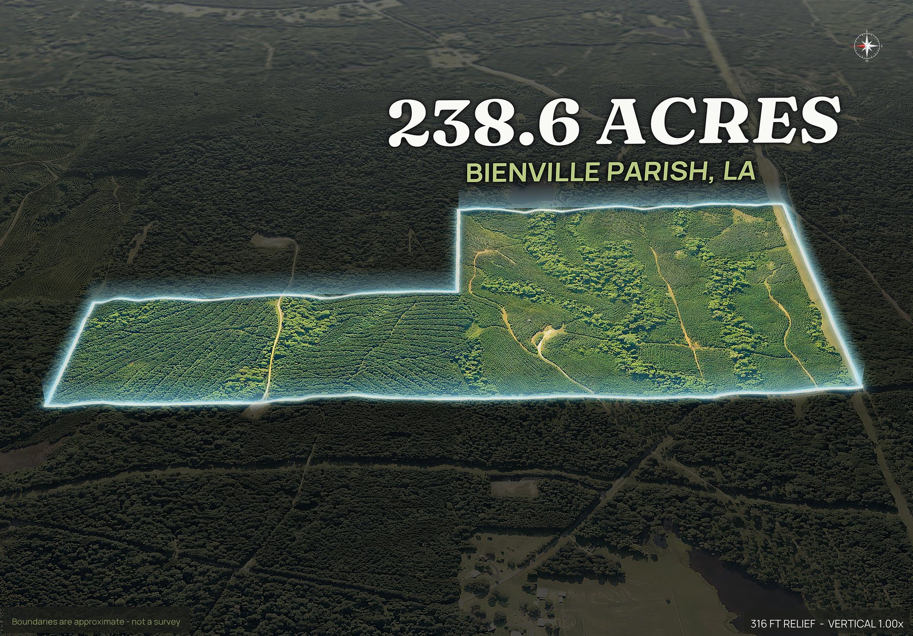
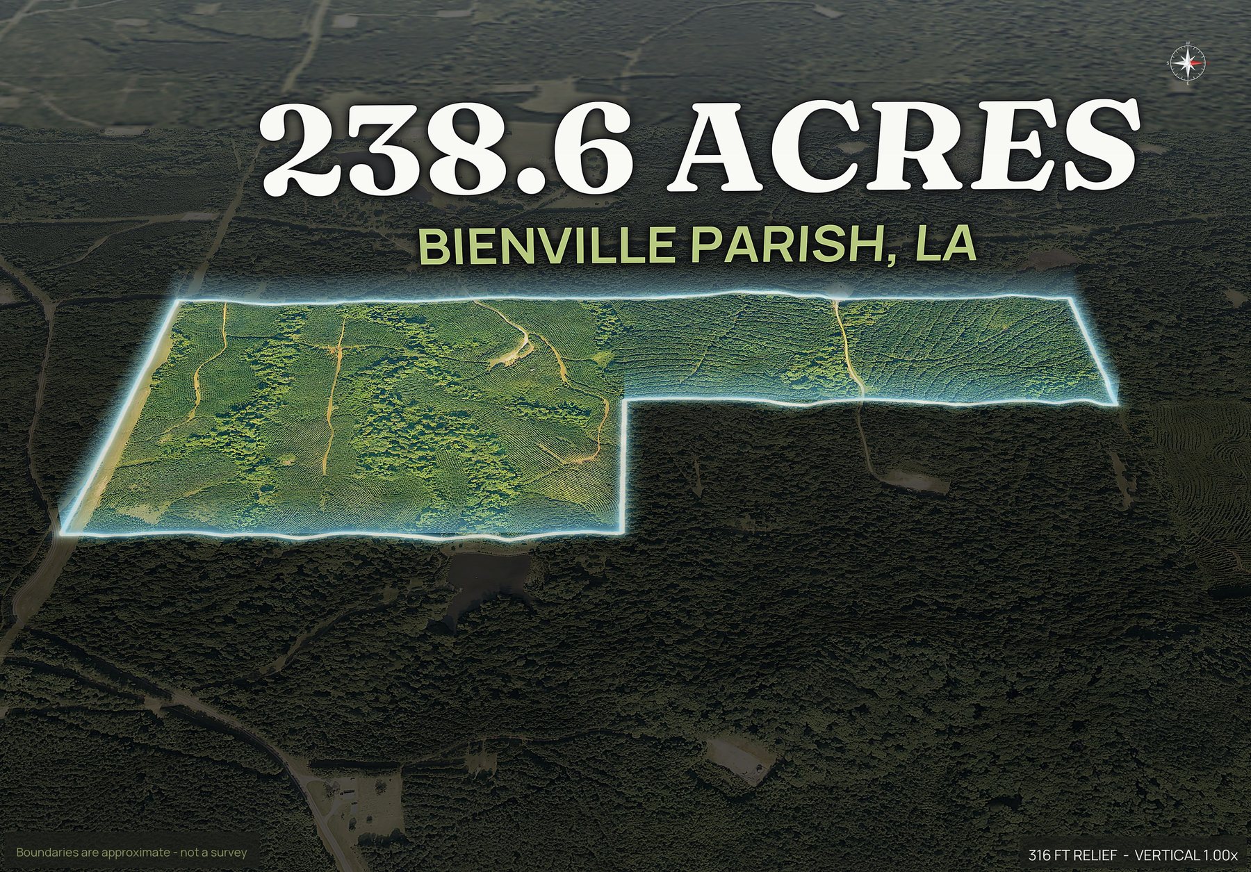
Where Louisiana land actually trades.
These are among the counties land buyers ask about most.
Any Louisiana parish works: type the parcel number, draw the boundary on the map, or upload a KML, KMZ, GeoJSON or zipped shapefile. Try your APN free, and if a parcel will not come up from its number you hear that before anything is charged.
What to know before you order a Louisiana parcel.
- Coverage
- Any Louisiana parish works: type the APN, draw the boundary on the map or upload a file. See coverage.
- Common land
- Bottomland hardwood and swamp, pine timber, sugarcane, rice and row crop ground, marsh, and bayou and waterfront tracts.
- Typical uses
- Hunting and timber, cropland, camp and recreational sites, and rural homesites.
- Reads well from above
- Standing water and sloughs, bayous and canals, timber type from pine to cypress to hardwood, and the elevated ground a camp or house would need.
- Your parcel number
- Louisiana uses parishes rather than counties, and the number to look for is the assessment number on the parish record.
- Boundary and imagery
- The boundary is approximate and is not a survey. Imagery is the most recent aerial available for that county, usually one to three years old.
Rules for splitting a Louisiana tract differ by county, so start with the county planning office. How to subdivide land walks through the steps, subdivide land photos renders a pack for every lot from a plat or a drawn split, and land home packages screens where a home can go on a lot.
Also: drone photography vs DirtFlight · what land aerial photography costs · land listing photos checklist
Asked by people selling Louisiana ground.
Which Louisiana parishes can you do?
Any Louisiana parish works. Send the parish and the APN and DirtFlight renders the pack. If a parcel will not come up from its number, you hear that before anything is charged, and you can draw the boundary on the map or upload a KML, KMZ, GeoJSON or zipped shapefile instead. The pack comes back the same.
What Louisiana land gets a pack, timber, cropland or camp ground?
Bottomland hardwood and swamp, pine timber, sugarcane, rice and row crop ground, marsh, and bayou and waterfront tracts. Typical uses there: hunting and timber, cropland, camp and recreational sites, and rural homesites.
Will wet ground and sloughs show up?
They do. Sloughs, cypress, sitting water and the darker ground that stays wet all read from above, and the contour map shows which way it drains. On Louisiana hunting ground that is the first thing a buyer asks about.
Can you show timber type and cutover?
At a broad level, yes. Pine plantation, hardwood bottom, recent cutover and replant rows are all visible from above, and the boundary shows exactly which of it is inside your line. It is not a cruise or a timber appraisal.
Louisiana uses parishes, so what do I enter for a parcel?
Louisiana uses parishes rather than counties, and the number to look for is the assessment number on the parish record. Enter the county and the APN as it appears on the tax record, or a street address, and DirtFlight draws the boundary. If a parcel will not come up from its number, you are told before anything is charged, and you can draw the boundary on the map or upload a boundary file instead.
What can you read from above on Louisiana bayou and timber land?
Standing water and sloughs, bayous and canals, timber type from pine to cypress to hardwood, and the elevated ground a camp or house would need. The boundary is drawn on every view, and the imagery is the most recent aerial available for that county, usually one to three years old, with the date on the pack.
List your Louisiana parcel today.
Send the parish and the APN, or draw the boundary on the map or upload a file. Free for a limited time.