
DirtFlight / How to read a plat map
Guide
How to read a plat map.
A plat looks like a page of lines and numbers. Read it in the order below and it tells you where each lot is, how big it is, what crosses it and whether the split was approved and recorded.
Short answer
A plat map is a scaled drawing, signed by a licensed surveyor, that shows how a tract of land is divided into lots. Read the title block, scale and north arrow first, then lot numbers and acres, boundary lines with bearings and distances, easements, roads, and finally the recording stamp that makes it official.
The basics
What a plat map shows.
A plat is a map of a division of land. The surveyor measures the tract, draws every lot, and the county approves and records the result. For a buyer it answers four questions: how big is each lot, where exactly does it sit, what crosses it, and how do I get in.
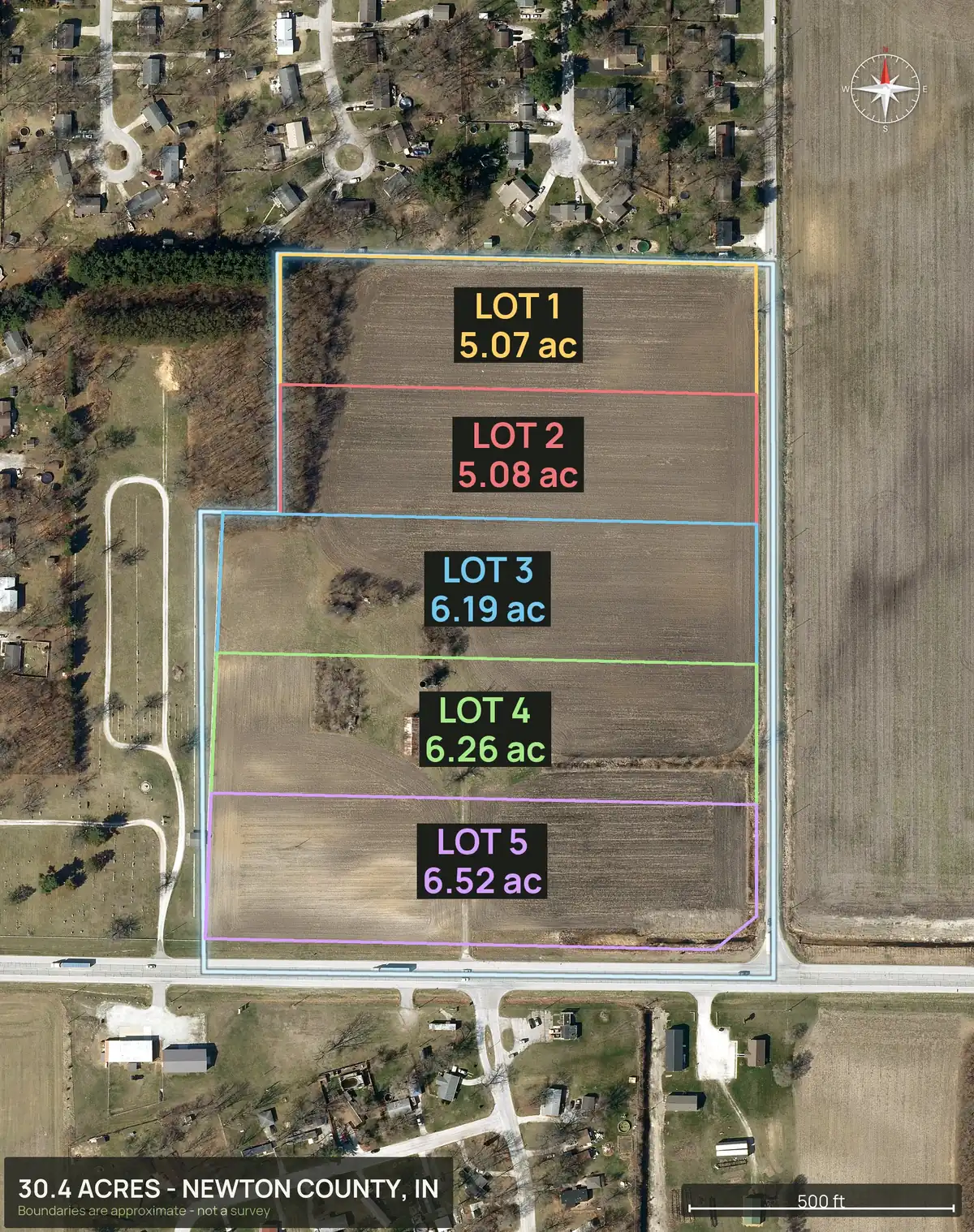
The real example on this page is a 30.4 acre tract in Newton County, Indiana, split into five lots of 5.07 to 6.52 acres. The plat lot lines were drawn on the aerial so each lot can be seen on the ground.
Reference
The parts of a plat, and what each tells you.
| Part | What it is | Why it matters |
|---|---|---|
| Title block | Name, surveyor, date, scale | Tells you who made it, when, and how to measure it |
| North arrow and scale | Orientation and a scale bar | Lets you check distances against the drawing |
| Lot and block numbers | The identifier for each parcel | Ties the drawing to the deed and the tax record |
| Bearings and distances | Direction and length of each boundary line | The legal shape of the lot |
| Curve table | Radius, arc and chord for curved lines | Roads and cul-de-sacs are often curves |
| Easements | Strips reserved for utilities, drainage or access | Can limit building and fencing |
| Roads and right of way | Dedicated streets and their width | Shows legal frontage and access |
| Section, township and range | The public land survey reference where used | Places the tract in the survey grid |
| Notes and certificates | Restrictions, dedications, surveyor's certificate | Setbacks and limits often live here |
| Recording stamp | Recorder's date and book and page or instrument number | Proves the plat is on the public record |
Plat plus imagery
See the plat on the ground.
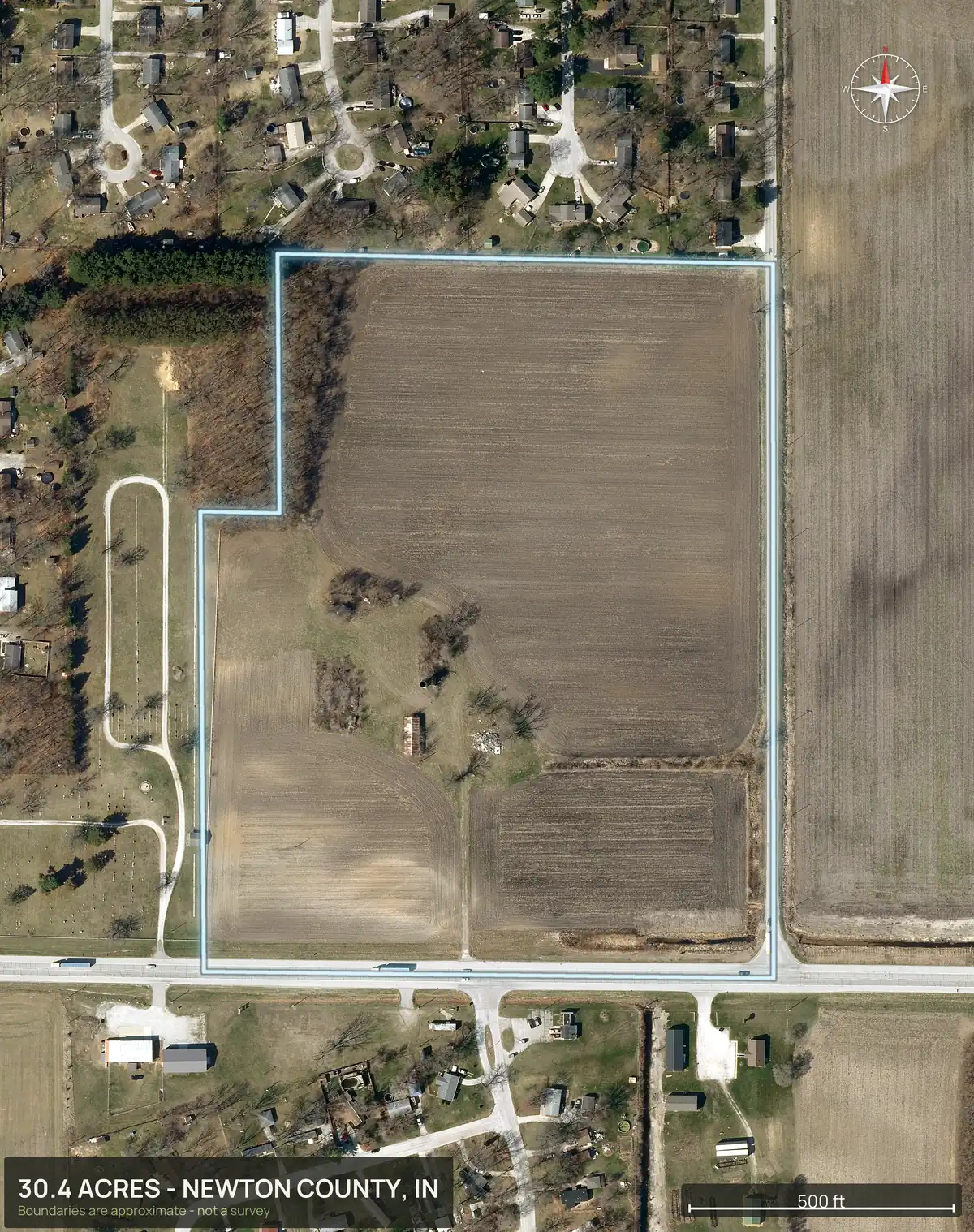
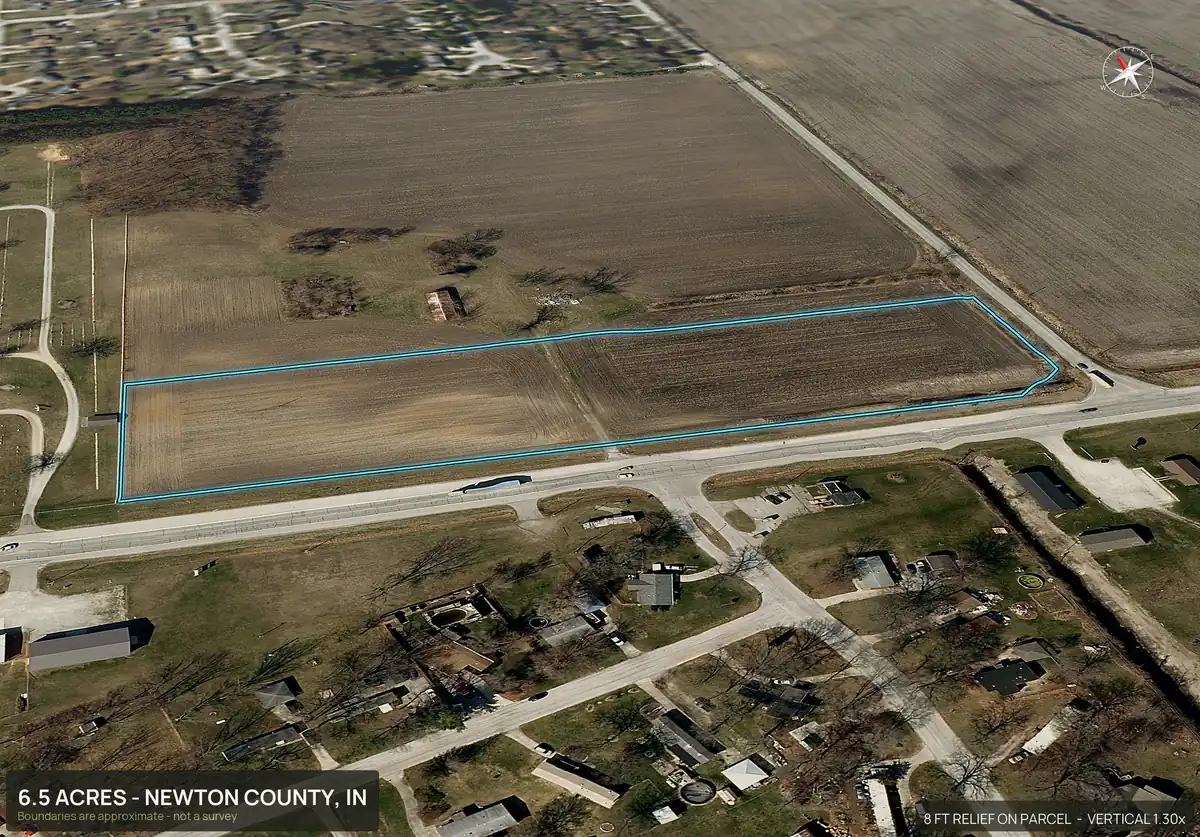
A plat is flat lines. It does not show slope, trees, water or the road in front of the lot. Put the lot lines on an aerial and the questions answer themselves: which lot has the long road frontage, which one sits on the slope, where the low ground is.
DirtFlight does that. Upload a surveyor's plat PDF or draw the lots, and every lot gets its own pack with the boundary, 3D views, acres and road frontage, plus the parent tract. The lot lines are approximate and are not a survey.
Watch for
Mistakes people make.
- Treating a plat as a survey of today. A plat is a snapshot from when it was recorded. Fences, roads and lot lines can have changed.
- Skipping the notes. Setbacks, drainage and septic restrictions are often in the notes.
- Ignoring easements. A strip that looks like open ground may belong to a utility.
- Assuming road access. Check whether the lot touches a public road or relies on an easement.
- Skipping the recording stamp. An unrecorded plat is not the official division.
This is general information, not legal advice. Plat rules and formats vary by state and county. Have a licensed surveyor or attorney confirm anything you rely on.
Straight answers
Questions people ask about this.
What is a plat map?
A scaled drawing, made by a licensed surveyor, that shows how a tract is divided into lots, with lot numbers, dimensions, easements and roads. Once the county approves and records it, it is the official division.
How do I read the bearings and distances on a plat?
Each boundary line has a length, usually in feet, and a bearing such as N 45 degrees E, which is a compass direction measured from north or south. Curves use a radius and an arc length.
What is the difference between a plat and a survey?
A survey measures one parcel on the ground. A plat shows how a larger tract was divided into lots and is recorded as a public document. A plat is based on a survey.
Where can I find the plat for a property?
Usually at the county recorder or register of deeds, and often online through the county's records website. The deed or tax record gives the lot and block.
What does an easement on a plat mean?
A strip of the lot reserved for a purpose such as utilities, drainage or access. It can limit where you build or fence.
Can DirtFlight read my plat?
You can upload a surveyor's plat PDF or draw the lots, and DirtFlight renders a pack for each lot with the lines drawn on the aerial. It supports up to 12 lots, and the lines are approximate, not a survey.
Free for a limited time.
Make an account, enter an APN, and the pack renders in about ten minutes. After launch, Dirt is $29 a parcel, Paydirt is $79, PayDirt Pro is $199 a month for 20 Paydirt packs, and Pro+ is $299 for 45.
Start free