
DirtFlight / Land home packages
Land and home packages
Land home packages: know where the home fits before you sell it.
A land and home package only works if the lot can take the house. Dirt Flight screens buildable ground, septic soils, utilities and access from the APN in about ten minutes, then gives you the images to sell the package.
Short answer
A land home package sells a lot and a home, built or placed on it, as one deal. The risk sits in the lot: how much ground is buildable after steep slope, flood and wetlands, whether the soils can take a septic system, what power, water and sewer are near, and whether the road access is legal. A Dirt Flight Paydirt pack screens all of that from the APN in about ten minutes, measures buildable acres, shows road frontage and the nearest utilities, and adds the aerial, 3D views and listing page to sell the package. It does not place a house footprint, and it is not a survey. Confirm septic and permits with the county.
What decides whether a home fits a lot.
| Question | What the pack shows | Still needs |
|---|---|---|
| How much ground can take a house? | Buildable acres after removing slope over 25 percent, flood zone and mapped wetland, drawn on the aerial. Small slivers are dropped. | A site plan, setbacks from zoning, a surveyor |
| Can it take septic? | Soils per map unit with septic limitations. | A percolation or site evaluation by a licensed professional and the health department permit |
| Is there power, water and sewer? | Who serves the area and how far the nearest water and sewer service area is, the electric provider, nearby power lines, gas pipelines and broadband. | The provider's confirmation and connection cost. Service areas are partly modeled and mains are not shown |
| Is access legal and real? | Road frontage measured in feet, an access view and a context map of the roads around the lot. | Deed, recorded easements and the driveway permit |
| How rough is the ground? | Contour map, elevation range and 3D views from four sides. | A grading plan if the pad needs cutting |
| What is around it? | Context map of neighbors and roads, and distance to the nearest towns. | A site visit |
Another parcel
The same pack on a different parcel.
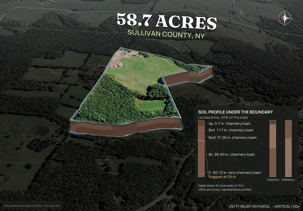
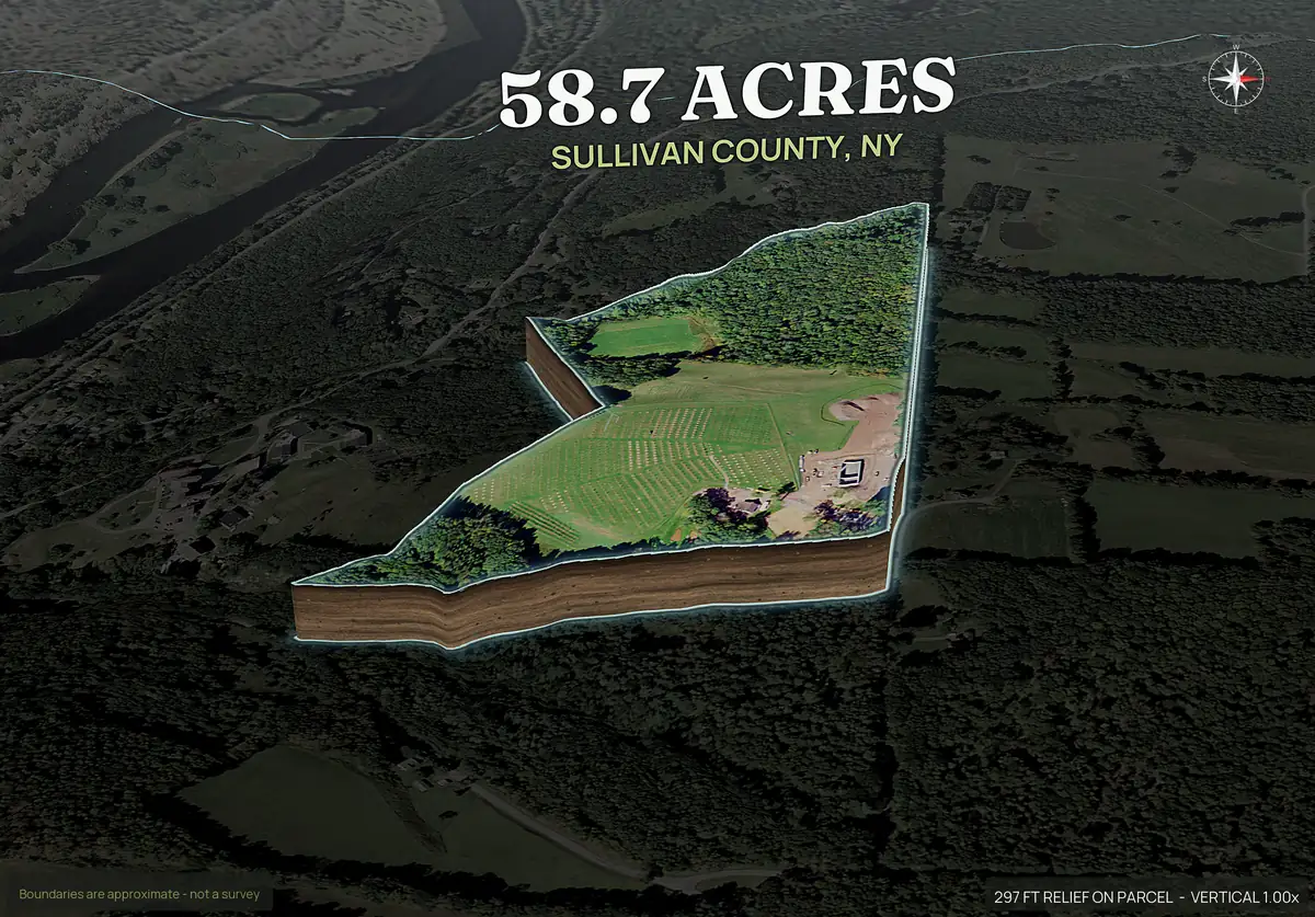
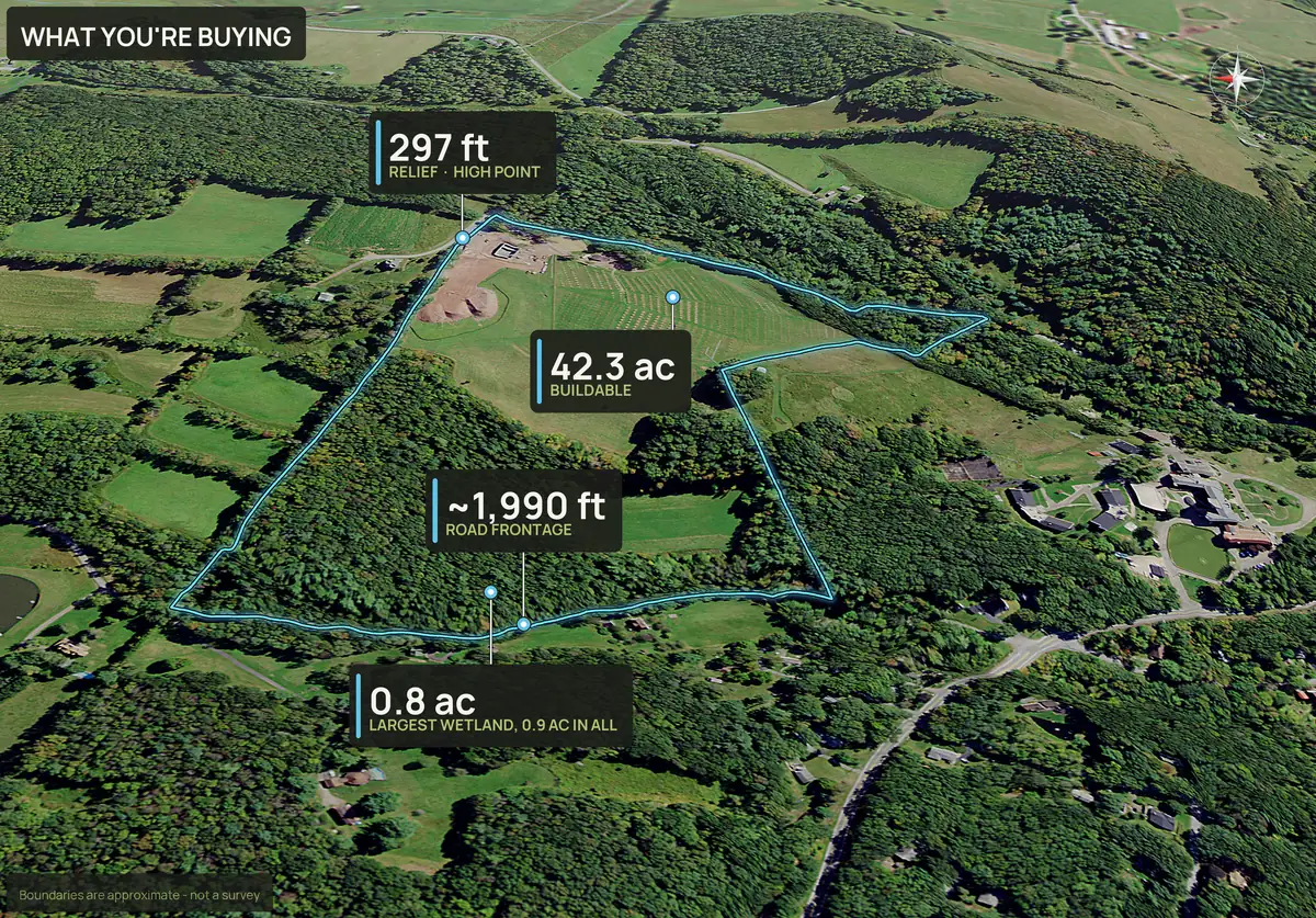
A 59 acre hobby farm in the Catskills: a hayfield and a wooded hillside. The pack shows the cut-away ground, the soil layers under it and the facts a home buyer asks for.
Buildable ground, shown on the lot.
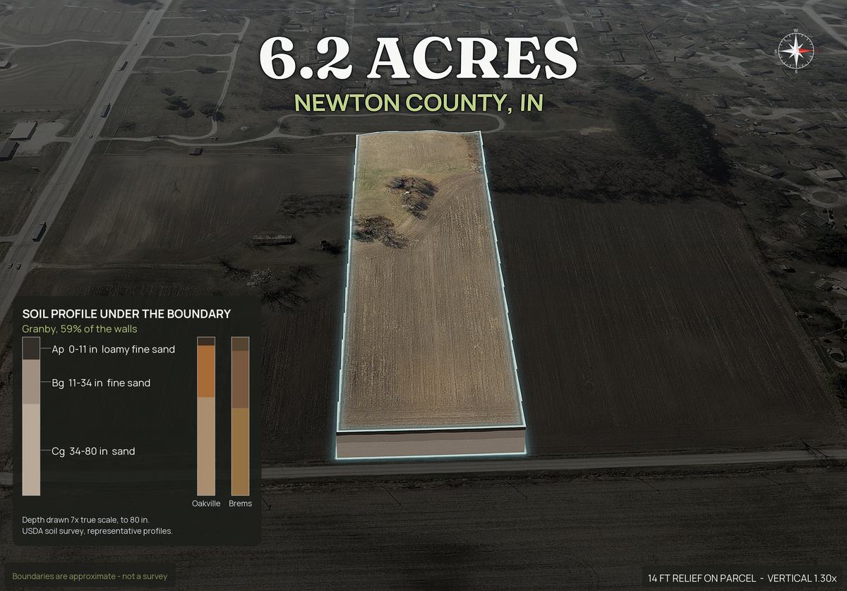
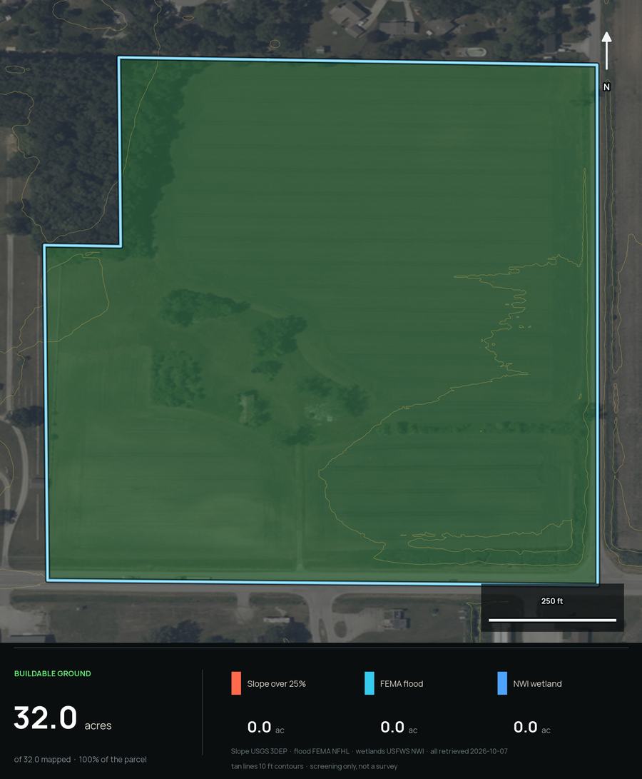
The buildable ground panel colors what is left after slope over 25 percent, flood and mapped wetland are taken out, and reports the acres. A parcel can look flat and still be mostly floodplain, so slope alone is not enough. This is the panel for a 32 acre tract in Newton County, Indiana, where none of those apply, so every acre counts as buildable ground. Buildable: ground outside mapped slope, flood and wetland areas. A screen, not a zoning, septic or permit approval.
It is a screen. It shows where a home can plausibly go, not where it will pass a permit. Dirt Flight does not place a house footprint or a build envelope.
Doing the diligence by hand, or from the APN.
| Check | By hand | Dirt Flight pack |
|---|---|---|
| Slope and buildable acres | Download elevation data, run a slope analysis, subtract flood and wetlands in mapping software | Buildable acres drawn on the aerial |
| Flood and wetlands | Look up the flood map and the wetlands map, estimate the acres overlapping the lot | Measured in acres inside the boundary |
| Soils and septic | Open the soil survey, find each map unit, read the limitation ratings | Each map unit with its septic rating and a soil profile view |
| Utilities | Call or search the water, sewer and power providers | Providers and nearest service areas, power lines, broadband |
| Road frontage | Measure from the county map | Feet of frontage and an access view |
| Time | An afternoon or more per lot | About ten minutes from the APN |
The pack is a screen that tells you which lots to take further. It does not replace the surveyor, the septic evaluation, the utility quote or the county's permit review.
Then sell the package.
- Pop-out 3D photo. A single picture of the lot lifted off the landscape, with the acres and county.
- Hero aerial and 3D views. The boundary is drawn on every view, so buyers see what the package includes.
- A listing page. A shareable page for the lot with a buyer inquiry form, and your logo on PayDirt Pro.
- A social kit. Captions, carousel images and reels for the lot.
- Several lots. If you are selling a row of home sites from one tract, Dirt Flight renders a pack for every lot and one page for the whole subdivision.
What it does not do.
- It does not place a house, a footprint or a build envelope, and does not know your floor plan.
- It is not a survey, a site plan, a percolation test or a permit. Confirm septic, setbacks and permits with the county.
- Utility maps show who serves an area and how far service is, not where a main runs, and parts are modeled.
- It does not show zoning, easements, covenants or title.
- Imagery is one to three years old for most parcels.
Straight answers
Questions people ask about this.
What is a land home package?
A deal that sells a lot and a home, built or placed on it, as one price. Investors and builders use them to sell lots that would otherwise sit.
How do I know if a lot can take a home?
Check buildable ground after slope, flood and wetlands, soils and septic suitability, access and utilities. Dirt Flight screens those from the APN. A surveyor, the health department and the county decide the rest. Buildable: ground outside mapped slope, flood and wetland areas. A screen, not a zoning, septic or permit approval.
Does Dirt Flight place a house on the lot?
No. It shows the buildable ground where a home can plausibly go. It does not place a footprint or a build envelope. Buildable: ground outside mapped slope, flood and wetland areas. A screen, not a zoning, septic or permit approval.
Can it tell me if the soil will pass a perc test?
No. It shows soil map units and their septic limitations. Only a licensed site evaluation and the local permit decide.
What does a Dirt Flight pack cost for a land home lot?
Free for a limited time. After launch, Paydirt is $79 a parcel, and PayDirt Pro is $199 a month for 20 packs.
Can I use it for a row of lots from one tract?
Yes. Upload the plat or draw the lots, and Dirt Flight renders a pack for every lot.
Free for a limited time.
Make an account, enter an APN, and the pack renders in about ten minutes. After launch, Dirt is $29 a parcel, Paydirt is $79, PayDirt Pro is $199 a month for 20 Paydirt packs, and Pro+ is $299 for 45.
Start free