
DirtFlight / Land listing photos checklist
Checklist
The land listing photos checklist.
Buyers of vacant land scroll for the boundary, the terrain, the road and the water. This checklist lists every shot a land listing needs, which ones a DirtFlight pack covers, and which ones you take yourself.
Short answer
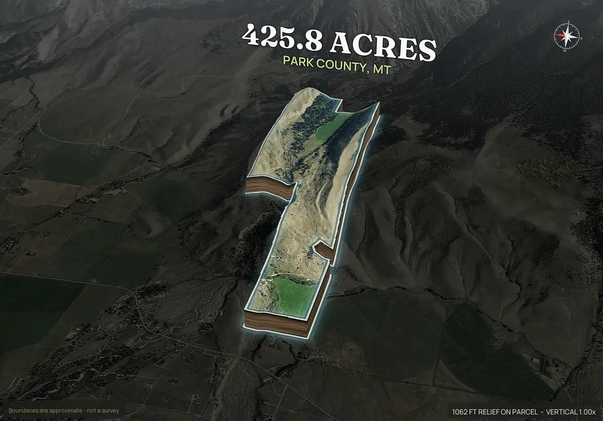
A vacant land listing needs a boundary aerial, wide and angled views of the terrain, a contour map, the road entrance, any water, and a few ground level photos of the land itself. Cover the first five with an aerial pack, and shoot the entrance, the view and any structures on your phone.
Shots
The checklist.
Work down the list. The last column says whether a rendered pack gives you the shot or you take it on site.
| # | Shot | Why buyers want it | Source |
|---|---|---|---|
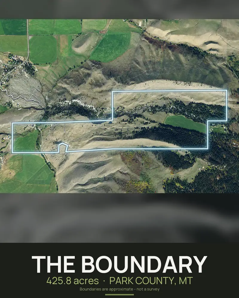
| 1 | Boundary aerial, top down | Shows exactly what is for sale | Pack |
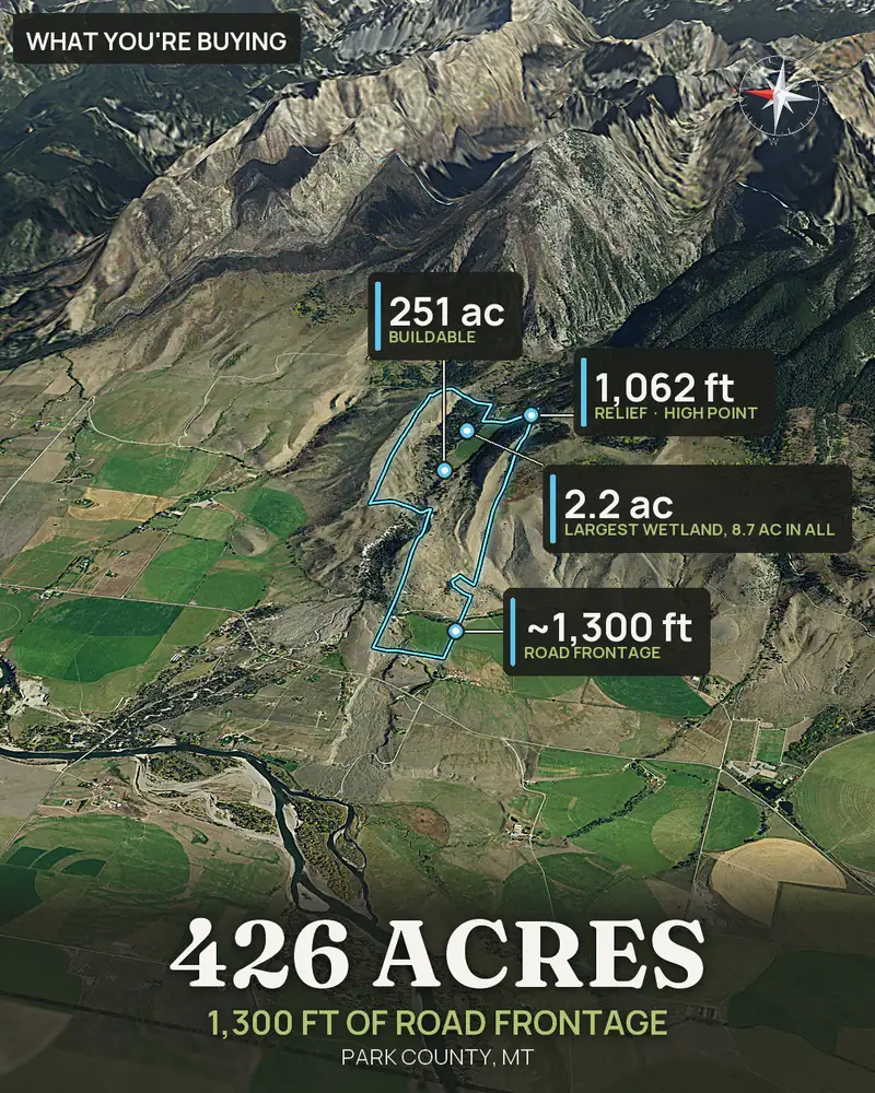
| 2 | Four angled 3D views | Shows how the ground lies, from every side | Pack |
| 3 | Contour map | Answers how steep and which way it drains | Pack (Paydirt) |
| 4 | Road frontage and access view | Shows how you get in and how much frontage there is | Pack (Paydirt) |
| 5 | Context map | Shows neighbors, roads and what is nearby | Pack (Paydirt) |
| 6 | Orbit or flyover video | One look at the whole tract | Pack |
| 7 | Entrance or gate | The first thing a buyer sees on a visit | You, on site |
| 8 | The road in front | Shows pavement, gravel or dirt and its condition | You, on site |
| 9 | Best ground level view | Sells the feel of the place | You, on site |
| 10 | Water: creek, pond, spring | The most asked about feature | You, on site, and the water layers in a pack |
| 11 | Typical cover: timber, field, pasture | Shows what the land is | You, on site |
| 12 | Corners and markers | Shows where the lines run on the ground | You, on site |
| 13 | Any structure, well or utility | Value and condition | You, on site |
| 14 | Ground facts: flood, wetland, soils, buildable acres | Answers the first due diligence questions | Pack (Paydirt) |
On site
Shooting the ground level photos.
- Shoot in good light, early or late in the day, and avoid flat midday sun.
- Take the road and the gate first. That is what a buyer drives up to.
- Walk to the best view and shoot wide, with something in the foreground.
- Show water and the edge of the timber, not a close up of a stump.
- Keep the horizon level, and avoid people and plates.
- Shoot in the season you are listing in and say so in the caption. Buyers notice a green photo on a winter listing.
Captions
Captions that sell.
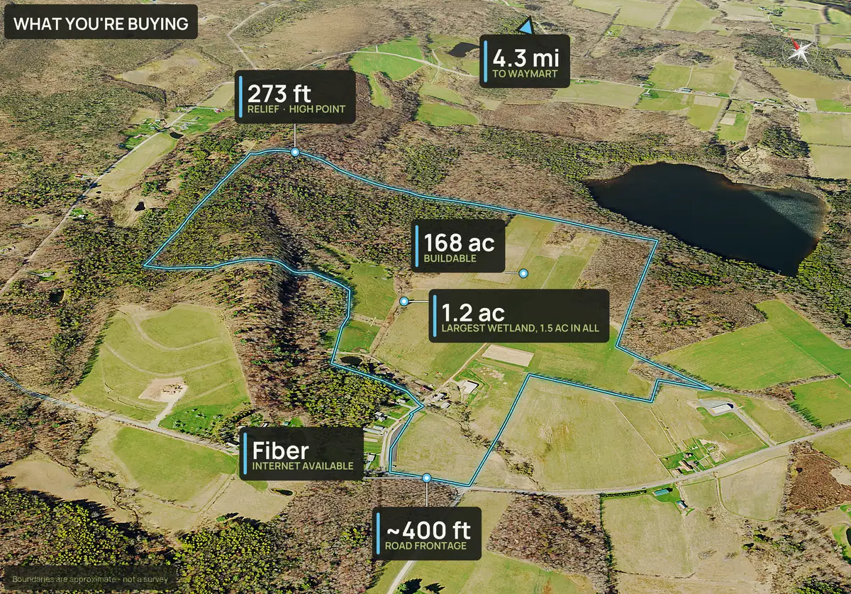
Start every caption with the acres and where it is, then say what the photo shows. For example: "83.9 acres in Minnesota. Aerial from the south with the boundary outlined." Add what a buyer cannot see, such as how far to the nearest town or the road type.
Say plainly when an image is a rendering and the boundary is approximate. A listing that overstates what the photos show loses the buyer at the first visit.
Ready to post
Getting it done the day you sign.
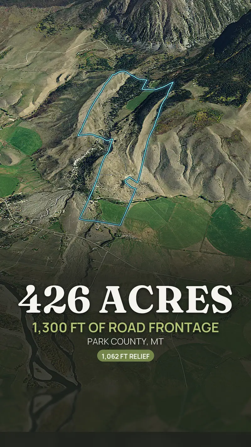
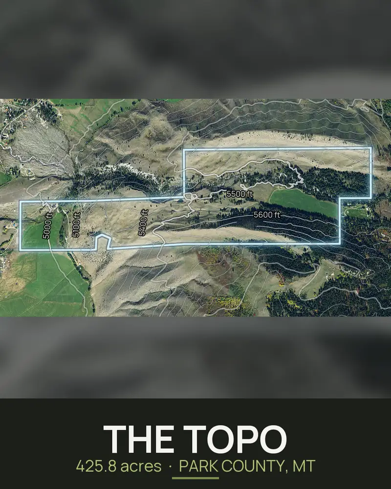
Run the parcel number and the pack renders in about ten minutes: the boundary aerial, the 3D views, the video and, with Paydirt, the topo, access and ground facts, plus a 9x16 story, a 4x5 feed post and a caption for social. A photo set that used to take a week is on the listing the same afternoon. See DirtFlight for land brokerages and how to list land for sale. Free for a limited time.
Straight answers
Questions people ask about this.
How many photos should a land listing have?
Enough to cover the boundary, the terrain, the road and entrance, any water, and a few ground level views. Fifteen to twenty images usually covers it. More is fine if each one shows something different.
What are the most important photos for a land listing?
The boundary aerial, the road entrance, and the view from the best spot on the land. Buyers use them to decide whether to visit.
Do I need a drone for land listing photos?
No. A rendered aerial pack gives you the boundary aerial, 3D views and video from the parcel number. A drone adds today's photographs and close detail where that helps sell it. See the comparison page.
Should I put the boundary on the photos?
Yes, as an approximate boundary, and say so. It shows buyers what is included. It is not a survey.
What should a land listing photo caption say?
Start with the acres and where it is, then what the picture shows, then anything a buyer cannot see in it. Say when an image is a rendering.
How soon can I have the photos?
A DirtFlight pack renders in about ten minutes from the parcel number. Ground level photos take as long as the site visit.
Free for a limited time.
Make an account, enter an APN, and the pack renders in about ten minutes. After launch, Dirt is $29 a parcel, Paydirt is $79, PayDirt Pro is $199 a month for 20 Paydirt packs, and Pro+ is $299 for 45.
Start free