DirtFlight / Drone photography vs DirtFlight
Compare
Drone photography vs DirtFlight for a land listing.
A drone gives you real photographs of the ground as it is today. DirtFlight gives you a finished, boundary marked pack from the parcel number in about ten minutes. Here is how they compare, and when to book the pilot anyway.
Short answer
A rural drone shoot for a land listing commonly costs $150 to $600 plus travel and takes five to nine days, but it shows the ground as it is today. DirtFlight renders a boundary marked aerial pack from the parcel number in about ten minutes, from $29 a parcel, and it is free for a limited time.
Side by side.
Typical figures for a rural vacant land listing. Drone prices vary by pilot, distance and what is delivered, so treat the drone column as a range to ask about, not a quote.
| Hire a drone pilot | DirtFlight | |
|---|---|---|
| Typical cost | About $150 to $600 for the edited aerial photos, plus travel that grows with the drive | Dirt $29 a parcel, Paydirt $79 a parcel, or PayDirt Pro $199 a month for 20 Paydirt packs. Free for a limited time |
| Time to deliver | Commonly five to nine days, because it waits on the pilot's schedule and the weather | About ten minutes from the parcel number |
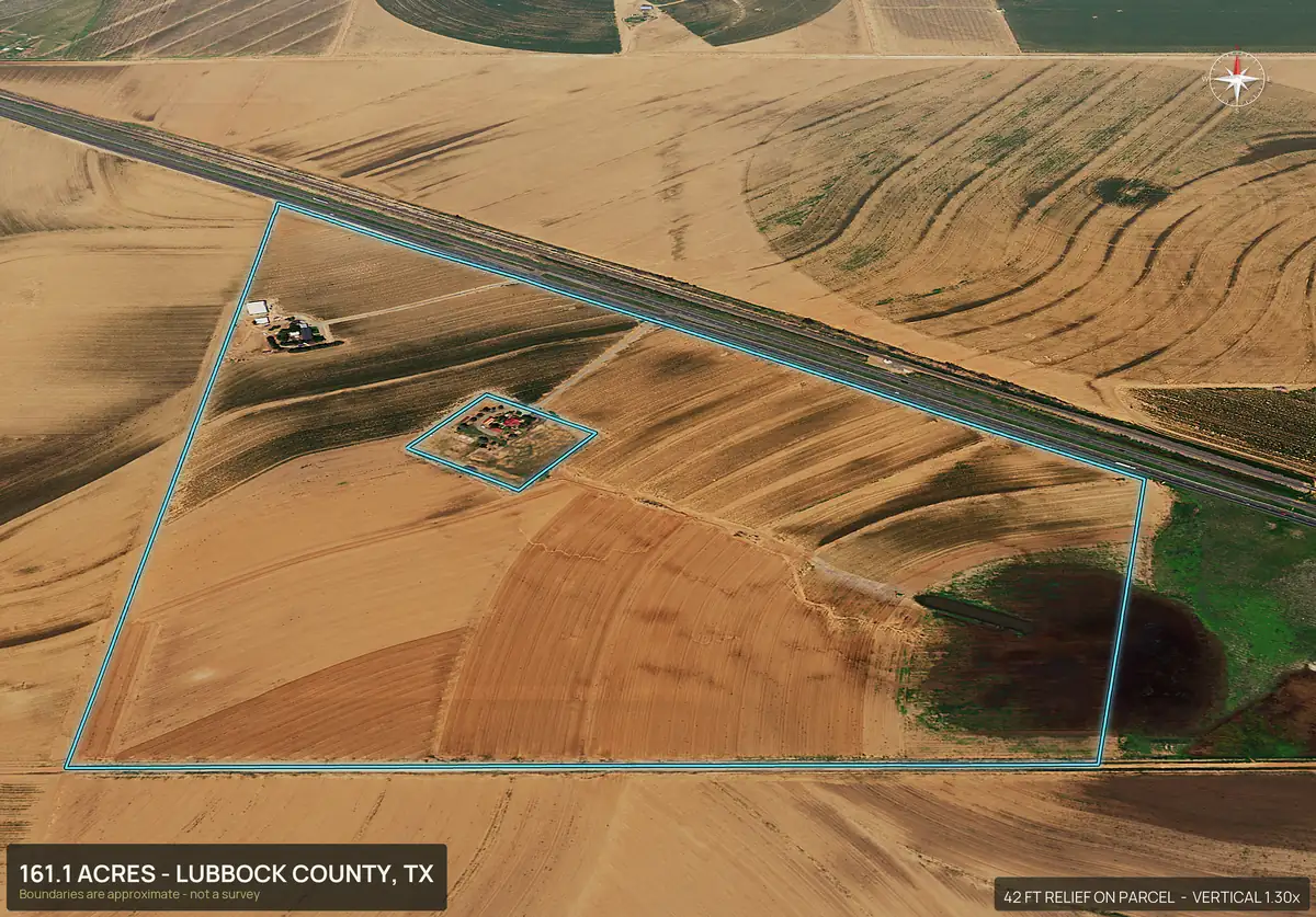
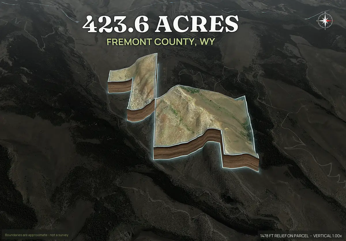
| What you get | Photographs and video of the ground as it is today | A rendered pack: boundary outlined aerial, four 3D views, orbit video, and with Paydirt a contour map, road frontage, flood, wetland, soils and septic facts, a social kit and a listing page |
| Boundary on the image | Only if someone draws it on afterward | On every view. Approximate, not a survey |
| How current | Today | One to three years old for most parcels, the most recent aerial available for that county |
| Close detail | Yes: buildings, ponds, fences, damage, trees | No. It is not a photograph of the ground today |
| Weather and scheduling | A wet or windy week pushes the shoot | None. Nothing is flown |
| Permissions | A commercial pilot needs an FAA remote pilot certificate and may need airspace approval | None needed, because nothing flies |
| Many parcels | A shoot per parcel, with travel each time | Enter each parcel number and download each pack |
Honest limits
When a drone is still better.
- You need the ground as it is now. A fresh clearing, a new road, a flooded field or a recent build will not appear in imagery that is one to three years old.
- The listing sells on close detail. A hunting cabin, a barn, a pond dam, a gate or a view from a ridge needs real photographs.
- It is a high value hero shot. A ranch or an estate earns a custom video that a rendered orbit does not replace.
- The imagery is too old for the listing. If the aerial is stale for what you are selling, a pilot is the better route.
- You need evidence of condition. Roofs, damage and fence lines call for a person with a camera.
Where it fits
When DirtFlight is the better first move.
- You have a stack of listings and a drone shoot on each one does not pay.
- The listing is going live today and cannot wait a week.
- You want the boundary, contours, flood and wetland acres, soils and road frontage on the pictures, which a drone does not give you.
- You are screening a parcel before you buy and do not want to pay for a shoot on ground you may pass on.
- You are splitting a tract into lots and need a pack for every lot.
Use both on the listings that earn it.
Many land agents render a pack for every listing the day it is signed, then book a pilot only for the hero shot on the listings worth it. The pack gives every listing the boundary, the terrain and the ground facts a buyer asks for. The drone adds today's photographs on top.
The cost of that mix is small. Three Paydirt parcels at $79 cost $237, less than two drone shoots at $150 each. From the third parcel in a month, PayDirt Pro at $199 a month for 20 packs costs less than buying Paydirt packs one at a time.
The math
What it costs over a month.
Using the low end of a drone shoot at $150, with PayDirt Pro at $199 a month for up to 20 packs.
| Parcels a month | Paydirt at $79 each | PayDirt Pro (up to 20) | Drone shoot at $150 each |
|---|---|---|---|
| 1 | $79 | $199 | $150 |
| 2 | $158 | $199 | $300 |
| 3 | $237 | $199 | $450 |
| 5 | $395 | $199 | $750 |
| 10 | $790 | $199 | $1,500 |
Prices apply after launch; every pack is free for a limited time. Drone figures are typical ranges, not quotes. See what land aerial photography costs for the full breakdown.
Straight answers
Questions people ask about this.
Is DirtFlight a replacement for a drone pilot?
No. A drone photographs the ground as it is today. DirtFlight renders the parcel and draws the boundary on every view. It is faster and cheaper per parcel, and many listings use both.
How much does a drone shoot for a land listing cost?
A rural shoot commonly runs about $150 to $600 for the edited aerial photos, plus travel that grows with the drive. A DirtFlight pack is $29 for Dirt or $79 for Paydirt, flat per parcel, or $199 a month for 20 Paydirt packs. It is free for a limited time.
How long does each take?
A drone shoot commonly takes five to nine days because it waits on scheduling and weather. A DirtFlight pack renders in about ten minutes from the parcel number.
Is DirtFlight imagery current?
Not to the day. For most parcels it is one to three years old, the most recent aerial available for that county, and the pack says which. A drone shows the ground today.
Do I need FAA approval to use DirtFlight?
No. Nothing is flown, so there is no pilot certificate, waiver or airspace approval to arrange. A commercial drone shoot generally needs a certified remote pilot.
Can I use both on one listing?
Yes. Render a pack the day the listing is signed so it goes live with the boundary and terrain, then add drone photographs where close detail will help sell the property.
Free for a limited time.
Make an account, enter an APN, and the pack renders in about ten minutes. After launch, Dirt is $29 a parcel, Paydirt is $79, PayDirt Pro is $199 a month for 20 Paydirt packs, and Pro+ is $299 for 45.
Start free