
DirtFlight / Topo map of a property
Topo map of a property
How to get a topo map of your property.
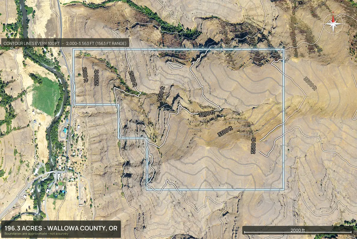
A topo map shows the shape of the ground with contour lines. Enter your parcel number and DirtFlight draws the contours inside your boundary in about ten minutes.
Short answer
A topographic map of your property is a map of its shape drawn with contour lines, each line joining points of equal elevation. The fastest way to get one with your boundary on it is to enter the parcel number in DirtFlight, which renders a contour map with elevation stats in about ten minutes. The free USGS National Map shows contours for the whole country but not your property line, and only a licensed surveyor can produce a legal topographic survey. DirtFlight boundaries are approximate and are not a survey.
Four ways to get a topo map, and when each one fits.
Free tools are fine for a quick look at the contours. DirtFlight is for when you are selling or deciding: it draws your boundary, reports the relief, adds 3D and buildability, and hands you images ready to market. Buildable: ground outside mapped slope, flood and wetland areas. A screen, not a zoning, septic or permit approval.
| Option | Boundary drawn | Cost | Time | Good for |
|---|---|---|---|---|
| DirtFlight contour map | Yes, on every view | Free for a limited time, then $79 a parcel on Paydirt | About ten minutes | Selling or deciding: boundary drawn, relief stats, 3D, buildability, marketing-ready images |
| USGS National Map (usgs.gov) | No | Free | Minutes, you find the spot | A quick look at the contours of an area |
| County mapping website | Parcel lines yes, contours sometimes | Usually free | Minutes | Checking lines and ownership |
| Licensed land surveyor | Yes, surveyed | Typically hundreds to thousands of dollars | Days to weeks | Legal boundaries, construction, disputes |
When free tools are enough
- You want a quick look at the contours of an area.
- You do not need your boundary on the map.
- It is for your own curiosity, a hike or a first impression.
- Nothing rides on the answer.
When you need Dirt Flight
- You are selling the parcel and need images that market it.
- You are deciding whether to buy, and want relief, slope and buildability on the actual boundary.
- You need 3D, flood and wetland acres, and a page you can send to a buyer.
- You want it in about ten minutes, not a lookup per layer.
Boundary, relief, 3D and buildability on one parcel.
This is the part a free map does not do. A contour map is one layer; a buyer or a buyer's agent wants the answer to a question.
- Boundary drawn. The outline sits on every view, so the contours are your land and not the area around it.
- Relief stats. Lowest point, highest point and range for the tract.
- 3D. Four cardinal views and an orbit video, so the lines read as ground.
- Buildability. Acres under 25 percent slope, plus flood and wetland, measured inside the boundary.
- Marketing-ready. Full resolution images, a social kit and a listing page, so the same pack can go on a listing.
Relief examples
See the relief, not only the lines.
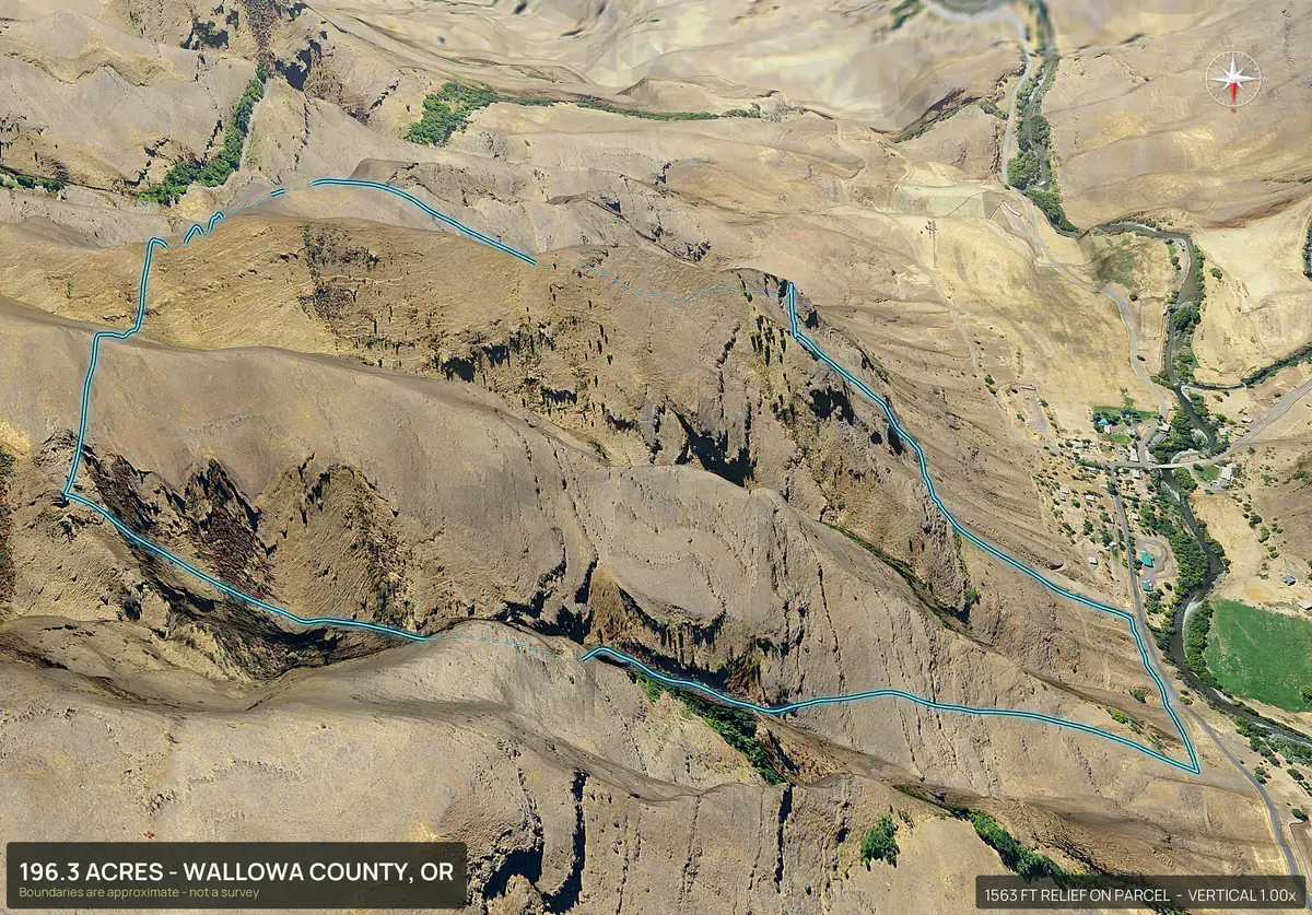
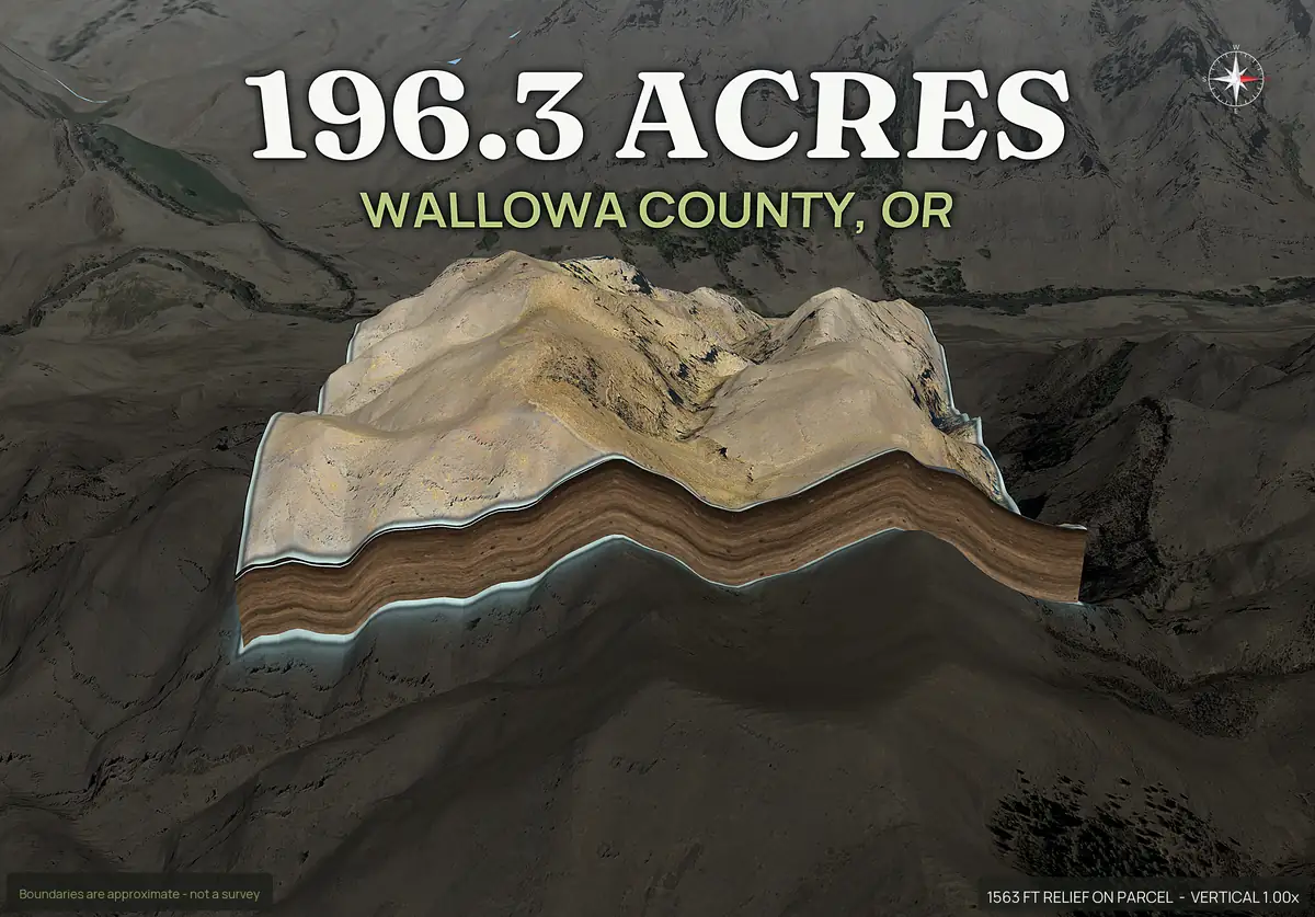
Dramatic ground is where a contour map earns its keep. This parcel drops 1,563 feet inside its boundary. The same pack turns the lines into 3D views and a pop-out you can read at a glance.
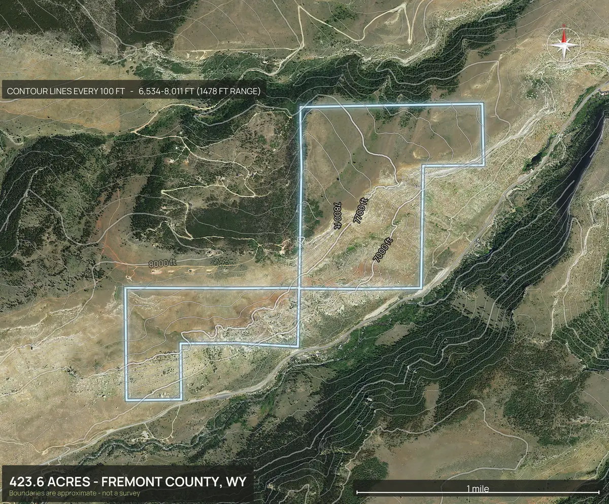
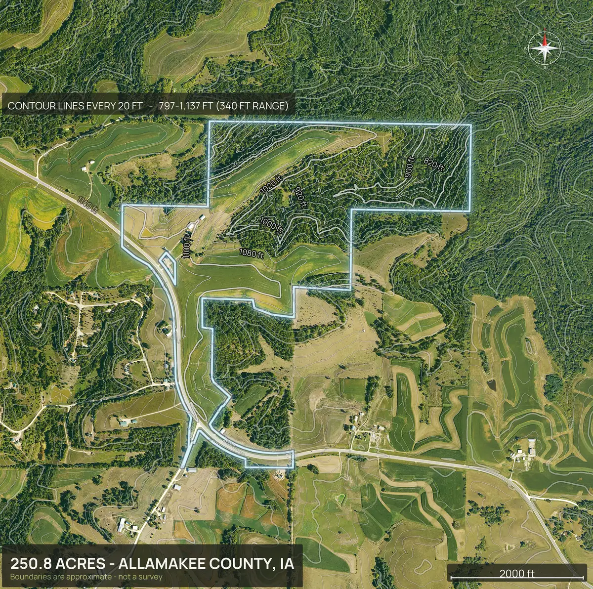
What is on the DirtFlight topo.
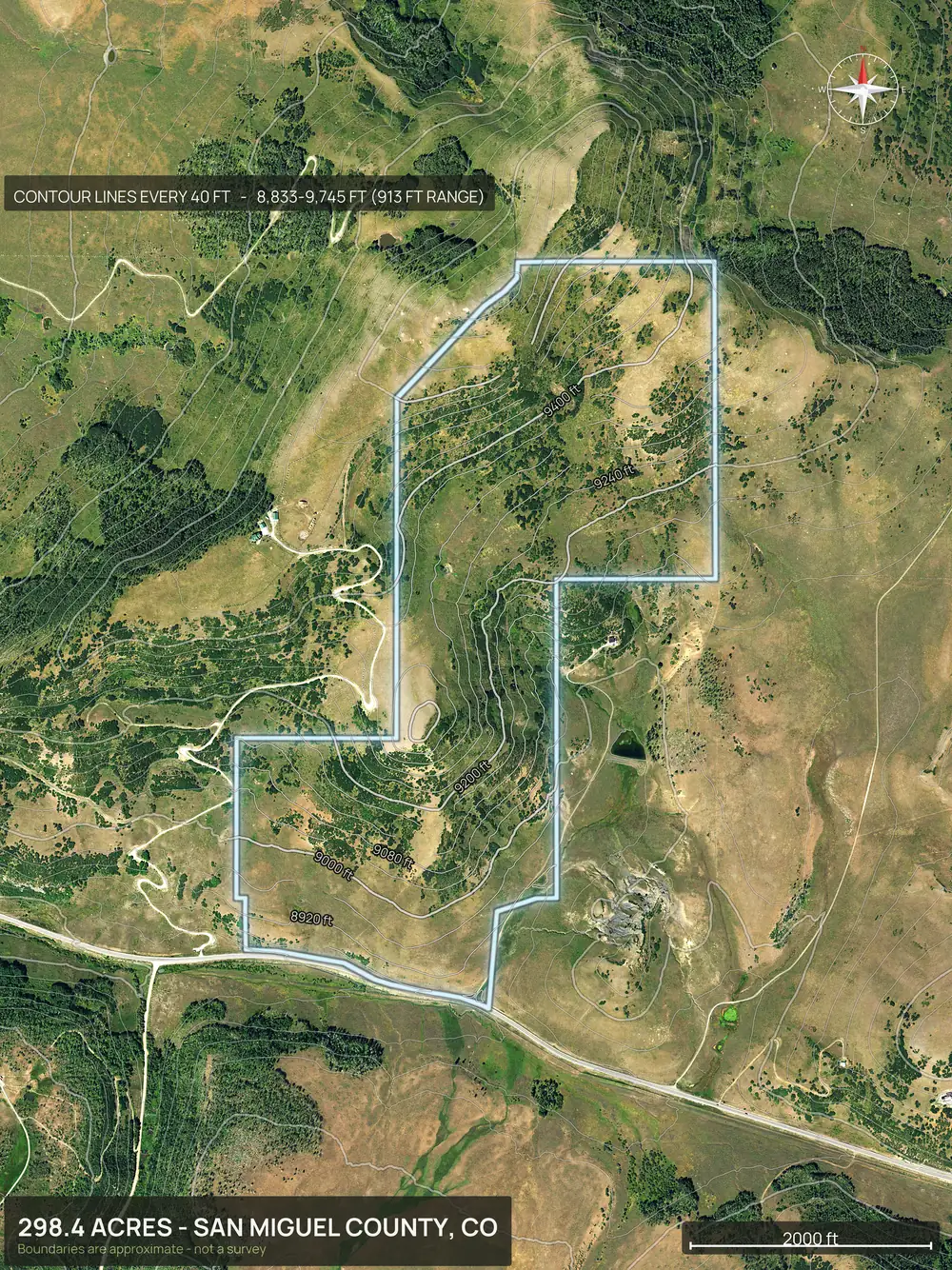
The contour map is drawn inside the parcel boundary and comes with elevation stats for the tract, such as lowest and highest points. It sits beside four 3D views and an orbit video, so the contours make sense against the real ground. On Paydirt it also feeds buildability by slope, which reports acres flat enough to build on. Buildable: ground outside mapped slope, flood and wetland areas. A screen, not a zoning, septic or permit approval.
The contour map is part of Paydirt. It is free for a limited time and $79 a parcel after launch, or $199 a month for PayDirt Pro (20 packs).
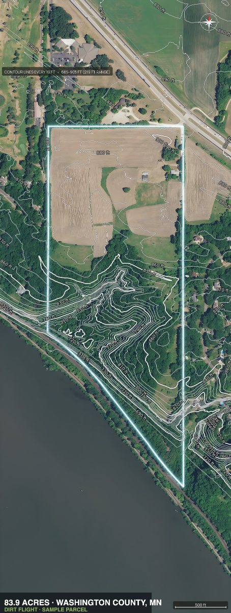
How to read a contour map.
- Each line is one elevation. Walk along a line and you stay level.
- Close lines mean steep. Wide spacing means flat or gentle.
- Lines that form V shapes point uphill along a creek or draw, and the water runs the other way.
- Closed circles are hills or depressions. Read the elevation numbers to tell which.
- Count the interval. The difference between neighboring lines tells you how much the ground rises across a gap.
What it is not.
A DirtFlight topo is a marketing and screening map. It is not a survey. The boundary is approximate, and the contours are good for seeing the lay of the land and not for grading, drainage design or construction. Hire a licensed surveyor for those.
Topo and aerial packs in every state.
Popular topo and aerial states
Every state
Every state has a page, and DirtFlight works in every county in the country. Type the parcel number, or draw the boundary on the map or upload a file. See the coverage page.
- Alabama
- Alaska
- Arizona
- Arkansas
- California
- Colorado
- Connecticut
- Delaware
- Florida
- Georgia
- Hawaii
- Idaho
- Illinois
- Indiana
- Iowa
- Kansas
- Kentucky
- Louisiana
- Maine
- Maryland
- Massachusetts
- Michigan
- Minnesota
- Mississippi
- Missouri
- Montana
- Nebraska
- Nevada
- New Hampshire
- New Jersey
- New Mexico
- New York
- North Carolina
- North Dakota
- Ohio
- Oklahoma
- Oregon
- Pennsylvania
- Rhode Island
- South Carolina
- South Dakota
- Tennessee
- Texas
- Utah
- Vermont
- Virginia
- Washington
- West Virginia
- Wisconsin
- Wyoming
Straight answers
Questions people ask about this.
How do I get a topographic map of my property?
Enter the parcel number in DirtFlight and it renders a contour map with elevation stats and your boundary in about ten minutes. You can also use the free USGS National Map, which has no property line.
When is a free topo map enough?
When you only want a quick look at the contours of an area, such as a hike or a first impression of the terrain. The free USGS National Map does that well. Use DirtFlight when you are selling or deciding on a specific parcel and need the boundary drawn, relief stats, 3D, buildability and images ready to market. Buildable: ground outside mapped slope, flood and wetland areas. A screen, not a zoning, septic or permit approval.
Is a topo map the same as a survey?
No. A topographic survey is done on the ground by a licensed surveyor. A DirtFlight topo is a screening map with an approximate boundary.
Can I get a topo map without knowing my APN?
The app takes a state, county and APN, or a street address in many places. The APN is on your tax bill and in the county's property search.
What do the contour lines mean?
Each line connects points of equal elevation. Close lines are steep ground and wide spacing is flat ground.
Does it show the elevation of my land?
Yes. The pack includes elevation stats for the tract, such as the low and high points.
How much does it cost?
Free for a limited time. After launch the contour map comes with Paydirt at $79 a parcel, or $199 a month for PayDirt Pro (20 packs).
Free for a limited time.
Make an account, enter an APN, and the pack renders in about ten minutes. After launch, Dirt is $29 a parcel, Paydirt is $79, PayDirt Pro is $199 a month for 20 Paydirt packs, and Pro+ is $299 for 45.
Start free