
DirtFlight / Hunting and recreational land
Hunting and recreational land
Show hunting and recreational land the way buyers read it.
Relief, cover, water and access are the pitch. A DirtFlight pack puts all four on one parcel with the boundary drawn, in about ten minutes from the APN.
Short answer
Buyers of hunting and recreational land look for terrain, cover, water and access. A DirtFlight pack shows the parcel boundary on an aerial, four 3D views and an orbit video, plus a contour map with elevation stats, streams and ponds with perennial told apart from intermittent, wetland and flood acres, a land health infrared view and road frontage. PayDirt Pro adds LiDAR canopy and bare-earth views where LiDAR exists. It does not show game, sign, stands or trails, and it does not recommend food plots. Boundaries are approximate and are not a survey.
What recreational buyers ask, and what the pack shows.
| The buyer asks | What the pack shows | What it does not do |
|---|---|---|
| How rough is the ground? | Contour map with elevation stats, 3D views from four sides and an orbit video. | It is not a trail map and does not rate difficulty. |
| Where is the cover? | The aerial and an infrared land health view. PayDirt Pro adds a LiDAR canopy surface where LiDAR is available. | It does not identify tree species or stand age. |
| Where is the water? | Streams and ponds with perennial told apart from intermittent, plus wetland and flood zone in acres. | It does not say whether a stream holds fish or runs in every season. |
| Can I get in? | Road frontage hero, an access view and a context map showing the roads around the parcel. | It does not show easements or legal access. Confirm those in the deed. |
| Where could I camp or build? | Buildability by slope in acres, flood zone, and soils and septic limitations per soil map unit. | It is not a perc test or a building permit. |
| Who are the neighbors? | The context map shows surrounding parcels and roads. | It does not show hunting leases or ownership. |
Real parcels
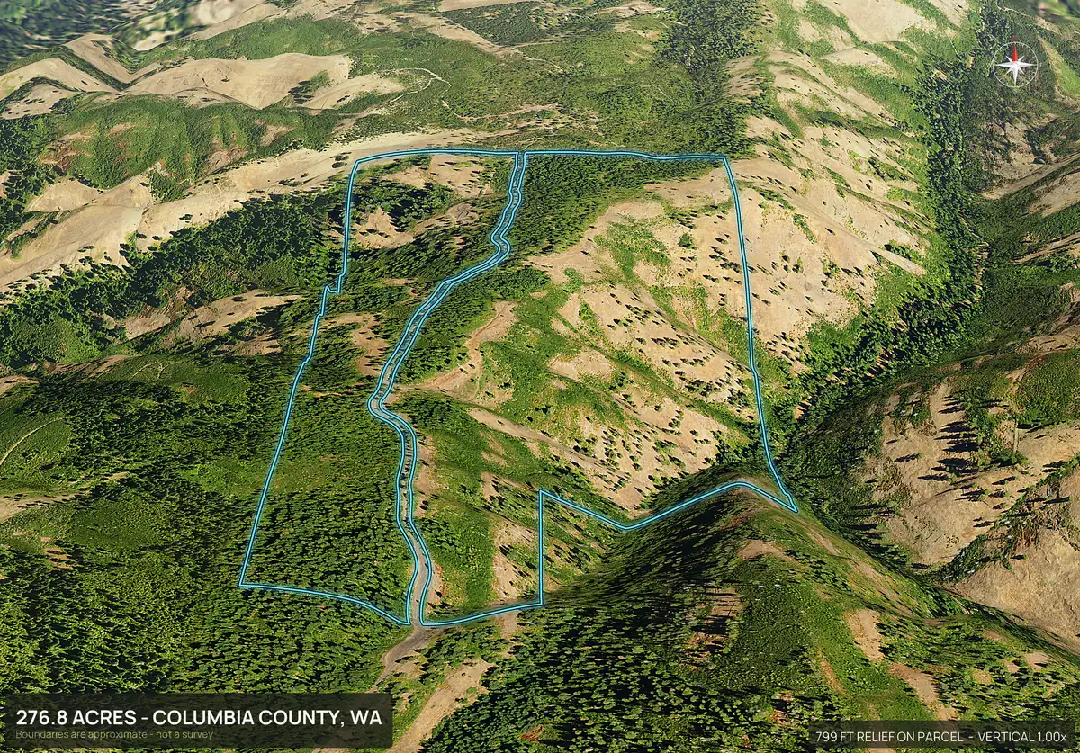
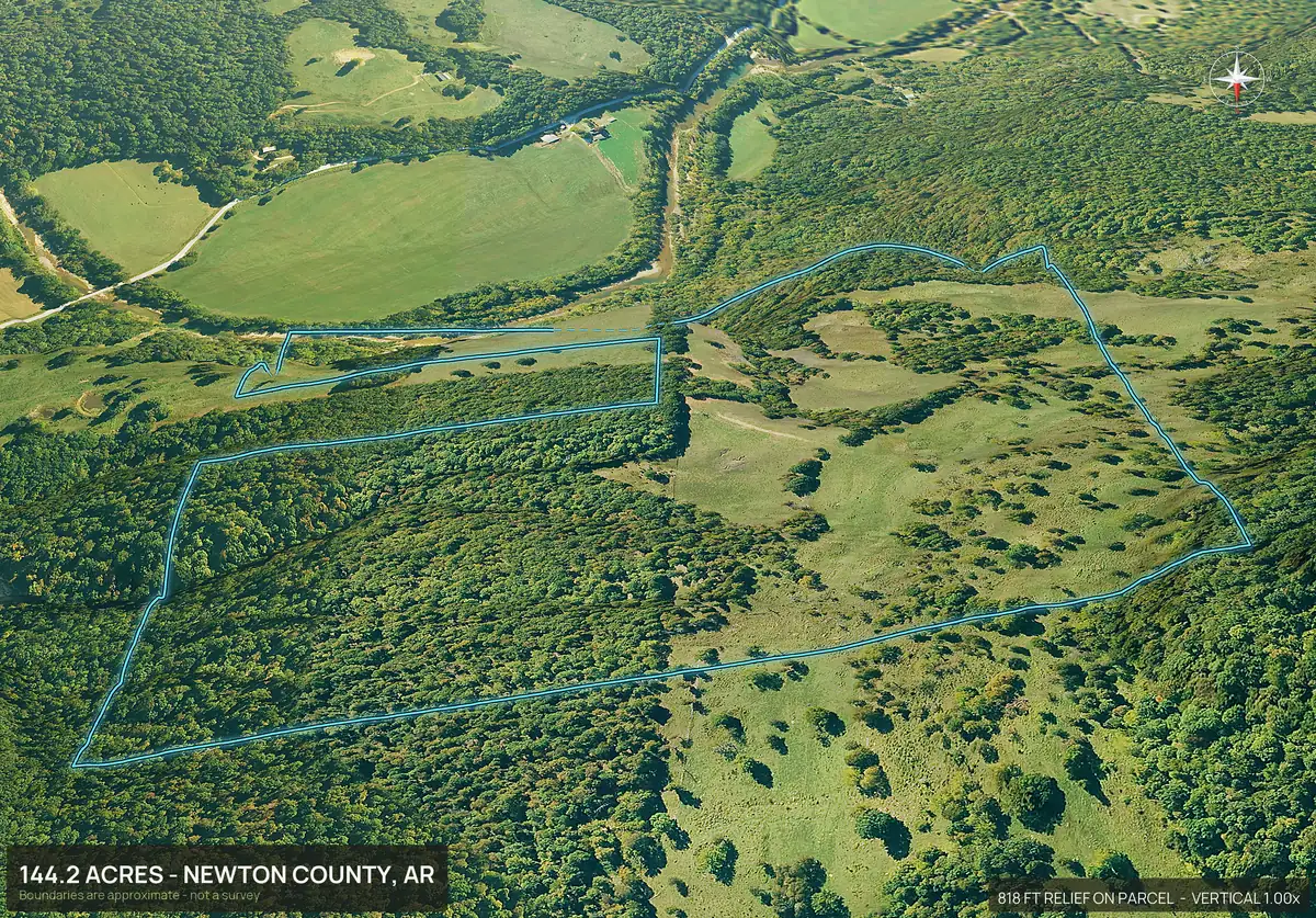
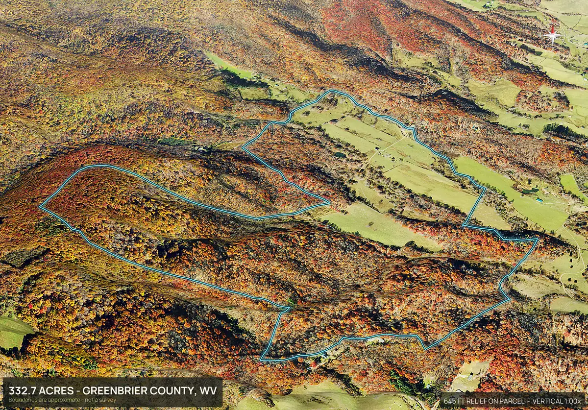
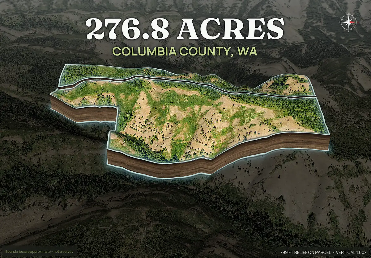
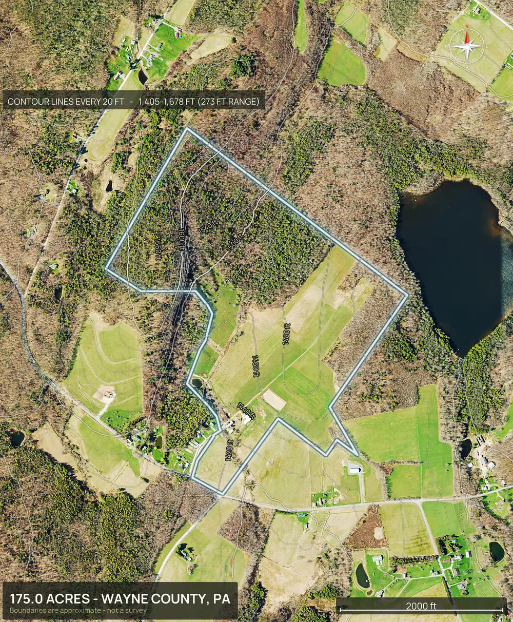
Ridges, draws, timber and openings, on the actual boundary.
Three real parcels in three different kinds of hunting country, each rendered from its parcel number.
Terrain for ATV, UTV and trail use.
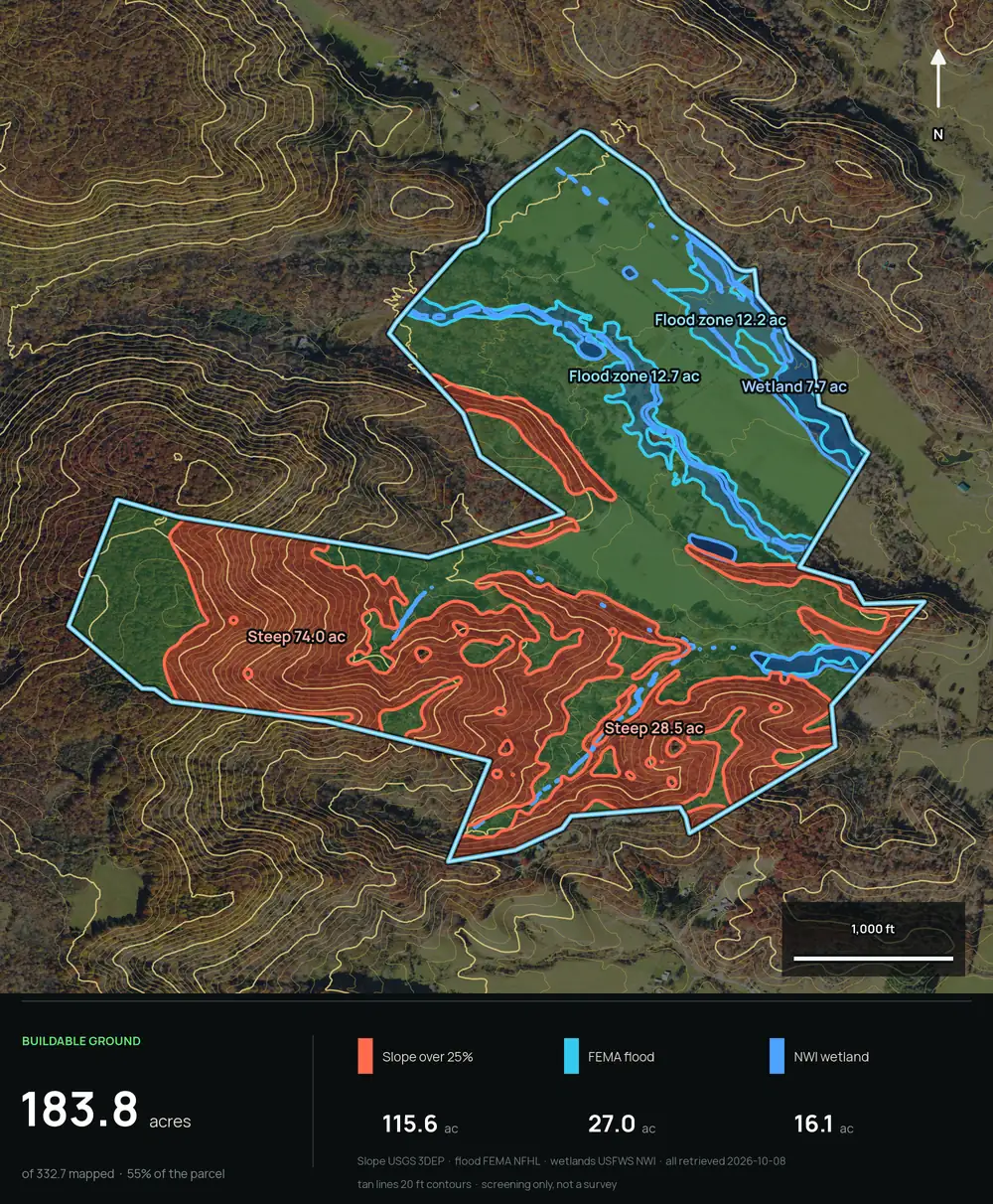
Contours show where the ground is gentle and where it is steep, and the 3D views show how a ridge or a draw sits on the whole tract. Buildability by slope reports acres of flatter ground, which is where most campsites, cabins and landings go. Tight contour lines mean steep, wide spacing means flat. The pack does not map existing trails, so walk the ground before you promise a route. Buildable: ground outside mapped slope, flood and wetland areas. A screen, not a zoning, septic or permit approval.
How steep it really is.
Buildability by slope paints the ground over 25 percent in red, with flood and wetland in blue, and reports the acres left. For a hunter that is the quick read on where the steep side hills are and where a camp, a landing or a stand access could sit. The contour lines under it show the draws and benches. Buildable: ground outside mapped slope, flood and wetland areas. A screen, not a zoning, septic or permit approval.
Food plots and cover, said carefully.
The pack gives you ingredients, not recommendations: soils per soil map unit, open ground versus canopy on the aerial and the infrared view, and slope. A buyer can use those to think about where a plot might go. DirtFlight does not tell a buyer what will grow or what game will use, and a listing should not claim it either.
PayDirt Pro feature
Canopy and ground under the trees.
PayDirt ProOn PayDirt Pro, where LiDAR exists, two more views show what the aerial cannot: how tall the timber is, and the ground with the trees taken away. The openings, benches, old roads and draws show up as clearly as the ridges. These are PayDirt Pro features, and the views appear only where LiDAR coverage exists.
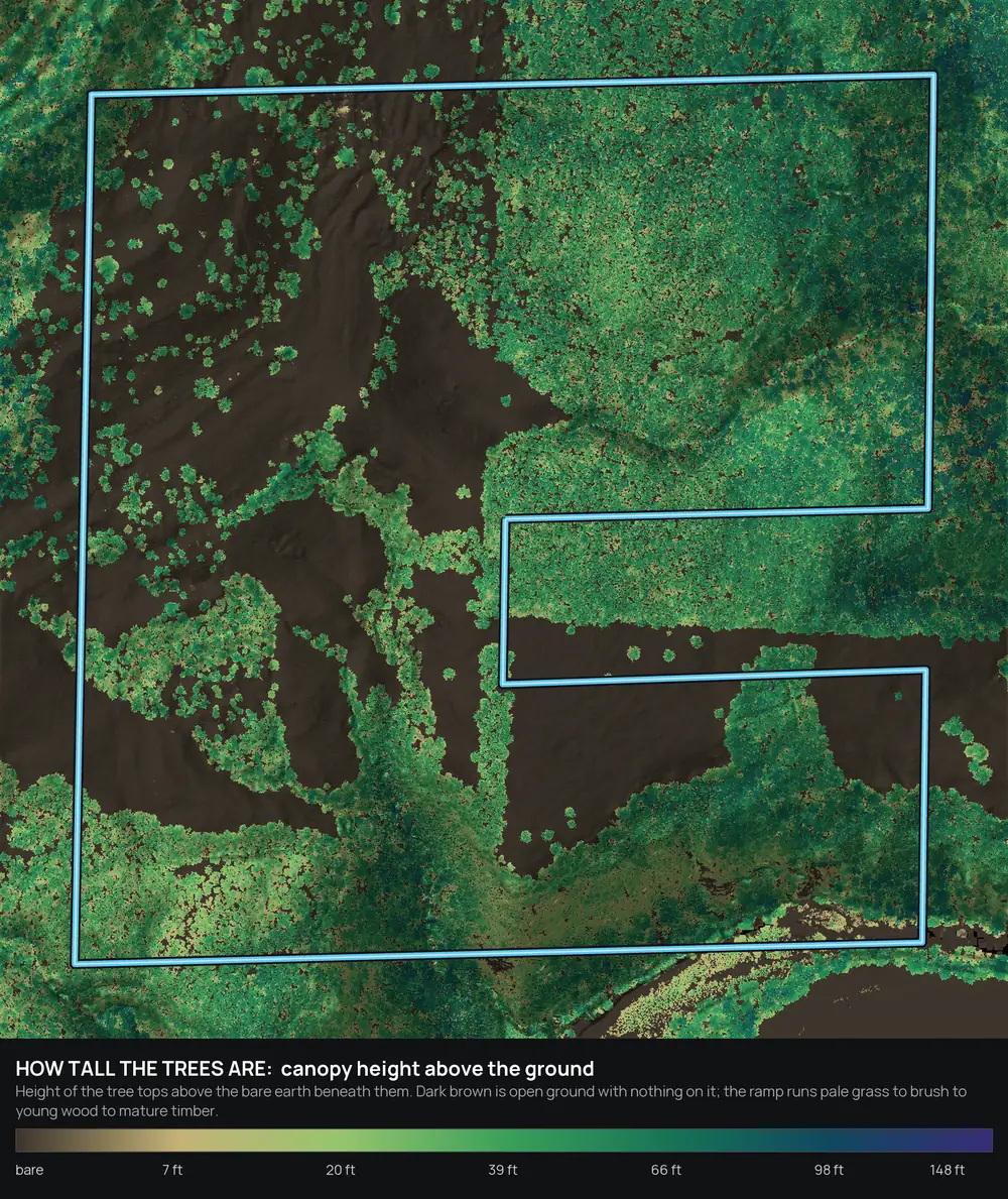
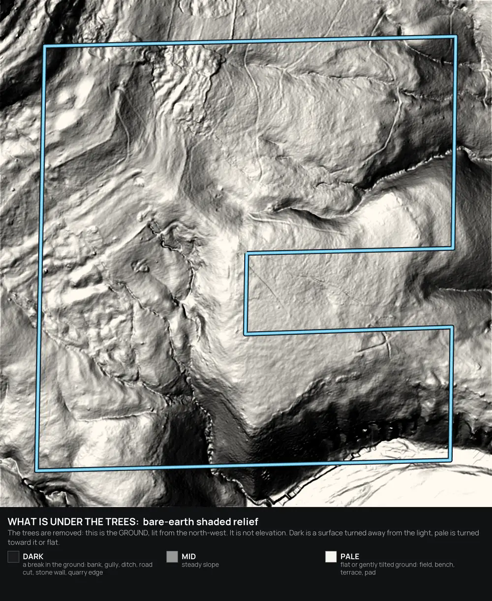
Cover and ground shape only. It does not show game, sign or what a plot will grow.
Water, wetlands and flood.
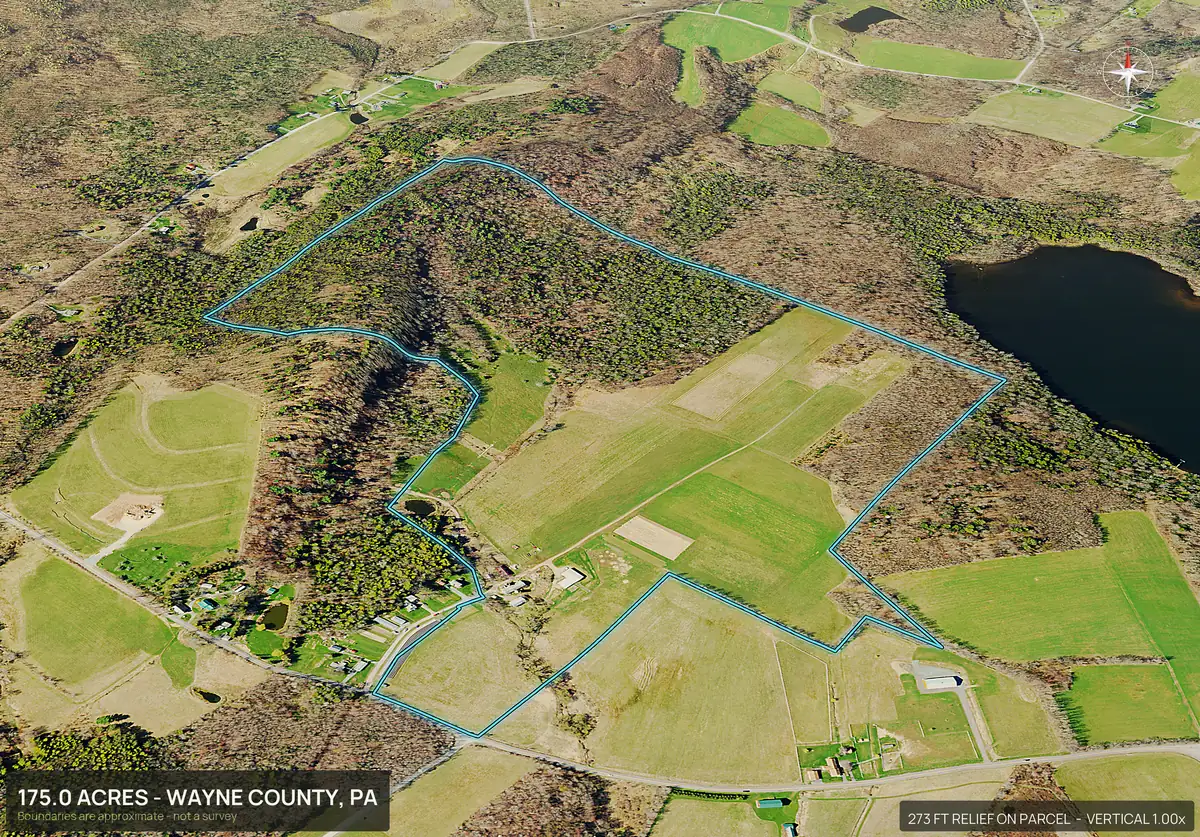
Streams and ponds are drawn with perennial and intermittent told apart. Wetland and flood zone are measured in acres inside the boundary. For a recreational buyer that answers whether a creek crossing, a pond or a low wet bottom comes with the tract, and for a seller it heads off the question before the first call.
Ponds, creeks and bottoms in view.
Hunting land in every state.
Popular hunting and recreation states
Every state
Every state has a page, and DirtFlight works in every county in the country. Type the parcel number, or draw the boundary on the map or upload a file. See the coverage page.
- Alabama
- Alaska
- Arizona
- Arkansas
- California
- Colorado
- Connecticut
- Delaware
- Florida
- Georgia
- Hawaii
- Idaho
- Illinois
- Indiana
- Iowa
- Kansas
- Kentucky
- Louisiana
- Maine
- Maryland
- Massachusetts
- Michigan
- Minnesota
- Mississippi
- Missouri
- Montana
- Nebraska
- Nevada
- New Hampshire
- New Jersey
- New Mexico
- New York
- North Carolina
- North Dakota
- Ohio
- Oklahoma
- Oregon
- Pennsylvania
- Rhode Island
- South Carolina
- South Dakota
- Tennessee
- Texas
- Utah
- Vermont
- Virginia
- Washington
- West Virginia
- Wisconsin
- Wyoming
Straight answers
Questions people ask about this.
Can I see the terrain of a hunting property before I visit?
Yes. The contour map with elevation stats, four 3D views and an orbit video show relief and the lay of the land from the APN, in about ten minutes.
Does DirtFlight show deer, bedding areas or food plot sites?
No. It shows terrain, cover, water, access and soils. It does not show game or sign.
Can it show streams and ponds on a property?
Yes, on Paydirt. Streams and ponds are drawn with perennial told apart from intermittent, and wetland and flood zone are measured in acres.
Does it work for ATV and UTV trail use?
Contours, slope and the 3D views show how steep the ground is. It does not map existing trails.
Is the canopy data available everywhere?
The LiDAR canopy and bare-earth views, part of PayDirt Pro and up, appear only where LiDAR coverage exists. The aerial and infrared views are available wherever the pack renders.
Are the boundary lines surveyed?
No. Boundaries are approximate and are not a survey.
Free for a limited time.
Make an account, enter an APN, and the pack renders in about ten minutes. After launch, Dirt is $29 a parcel, Paydirt is $79, PayDirt Pro is $199 a month for 20 Paydirt packs, and Pro+ is $299 for 45.
Start free