DirtFlight / About
About
About DirtFlight.
DirtFlight turns a parcel number into a finished aerial pack for land in about ten minutes, with the boundary drawn on every view. It was founded by Sam Rauchwarter.
Short answer
DirtFlight is an aerial imagery service for land. Enter a parcel number and it renders a finished pack in about ten minutes: a boundary marked aerial, 3D views, an orbit video, a contour map and ground facts. Nothing is flown. It was founded by Sam Rauchwarter and is run by Dirt Flight LLC in Minnesota.
The product
What DirtFlight does.
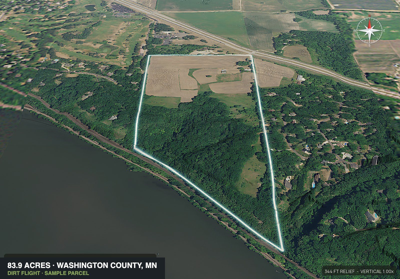
Land listings often go live with a few phone photos, or none, because a drone shoot costs money and a week. DirtFlight renders the pack instead. A seller, agent or investor enters the parcel number and gets the boundary outlined on an aerial, four 3D views, an 18 second orbit video, and with Paydirt a contour map, road frontage, flood, wetland, soils and septic facts, a social kit and a hosted listing page. See the sample listing page.
Nothing is flown. Every view is rendered, which is why it takes minutes and needs no pilot, permit or airspace approval.
Audience
Who it is for.
Land agents and brokerages
A finished pack on the day a listing is signed. See DirtFlight for land brokerages.
Land investors
Screen a parcel before you buy, with slope, flood, wetland and road frontage on the boundary. See the due diligence checklist.
Landowners
A better look at your own ground and a link to send a buyer. See how to list land for sale.
Subdividers
A pack for every lot from a plat or a drawn split. See subdivide land photos.
Who is behind it
Founder.
Sam Rauchwarter is the founder of DirtFlight and a land investor. DirtFlight is built around the first questions a land buyer asks about a parcel: what it looks like, where the boundary runs, how the ground lies and what it can be used for.
Honest limits
What it does not do.
- It is rendered, not photographed. For most parcels the imagery is one to three years old.
- Boundaries are approximate and are not a survey. They do not belong in legal descriptions or boundary disputes.
- It does not replace a drone for close detail, a surveyor, a title search or a site visit.
- A parcel that will not come up from its number is said so before anything is charged. See the coverage page and the page for any state.
Contact
Company and contact.
DirtFlight is a product of Dirt Flight LLC, a Minnesota company. Write to support@dirtflight.com. Follow along on Instagram or Facebook. The terms, privacy policy and refund policy are public.
Plans start at $29 a parcel and are free for a limited time. See what land aerial photography costs.
Straight answers
Questions people ask about this.
What is DirtFlight?
An aerial imagery service for land. Enter a parcel number and it renders a boundary marked aerial pack in about ten minutes, with 3D views, an orbit video, a contour map and ground facts. Nothing is flown.
Who runs DirtFlight?
DirtFlight was founded by Sam Rauchwarter, a land investor, and is run by Dirt Flight LLC, a Minnesota company.
Is DirtFlight a drone company?
No. It does not hire or dispatch pilots. Every view is rendered.
How do I bring a parcel in?
Type the state, county and parcel number, or draw the boundary on the map, or upload a KML, KMZ, GeoJSON or zipped shapefile. The pack comes back the same either way. Boundaries are approximate and are not a survey.
How do I contact DirtFlight?
Write to support@dirtflight.com or send a message on Instagram at @dirtflight.
Free for a limited time.
Make an account, enter an APN, and the pack renders in about ten minutes. After launch, Dirt is $29 a parcel, Paydirt is $79, PayDirt Pro is $199 a month for 20 Paydirt packs, and Pro+ is $299 for 45.
Start free