
DirtFlight / Subdivide land photos
Subdivide
A full aerial pack for every lot in your subdivision.
Upload the surveyor's plat PDF, or draw the lots on the map. Dirt Flight splits the parcel, renders a pack for every lot and the whole tract, and gives you one download. No drone pilot per lot.
Short answer
Dirt Flight can split a finished parcel pack into lots and render a full pack for each lot. Upload a surveyor's recorded plat as a PDF, including a CAD printed plat with no text layer, which is read by text recognition, or upload a KML, GeoJSON or zipped shapefile of the lots, or draw the corners on the parcel's aerial. Every lot gets its own boundary aerial, 3D views, topo, ground facts and listing text, you get an overview map of the lots, one shareable lot table, and one download with the parent and every lot. Up to 12 lots per run. Boundaries are approximate and not a survey.
See it happen
From the surveyor's plat to a pack for every lot.
Scroll through a real five lot subdivision in Newton County, Indiana. It starts as a plat PDF and ends as five lots, each with its own aerial pack.
- Reads drawn CAD plats tooEven a plat printed from CAD with no text layer.
- Precise lot lines and surveyor acreageThe lines and the acres come off the plat itself.
- Fitted to your parcelThe plat is placed on the parcel's own aerial.
- One click renders every lotA full pack for each lot, plus the whole tract.
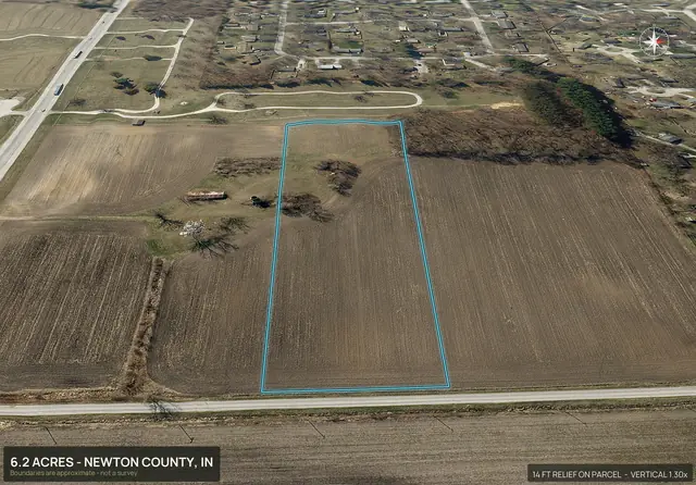
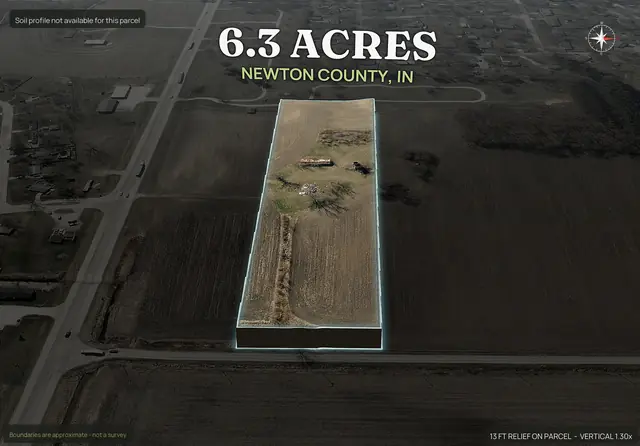
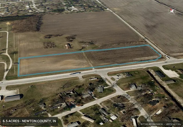
Step 1 of 5
Start with the surveyor's plat.
A recorded plat is the drawing of every lot line, with the surveyor's acreage printed on each lot. It is where most subdivisions start, and it is a flat sheet that no buyer can picture.
Step 2 of 5
Upload the plat PDF.
Dirt Flight reads the line work off the page, drawn CAD plats too, and fits it to your parcel. The lot lines are the surveyor's and snap onto the aerial.
Step 3 of 5
The parcel splits into its lots.
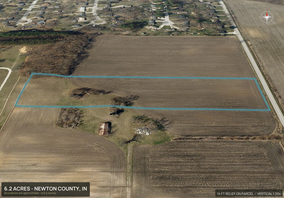
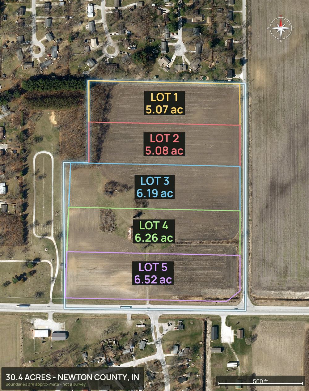
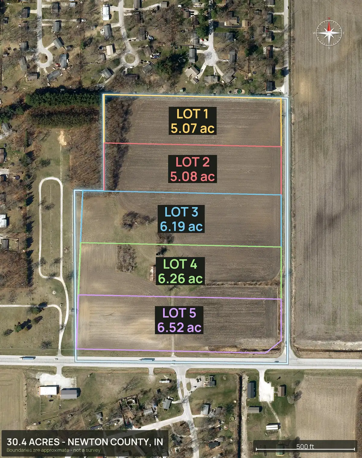
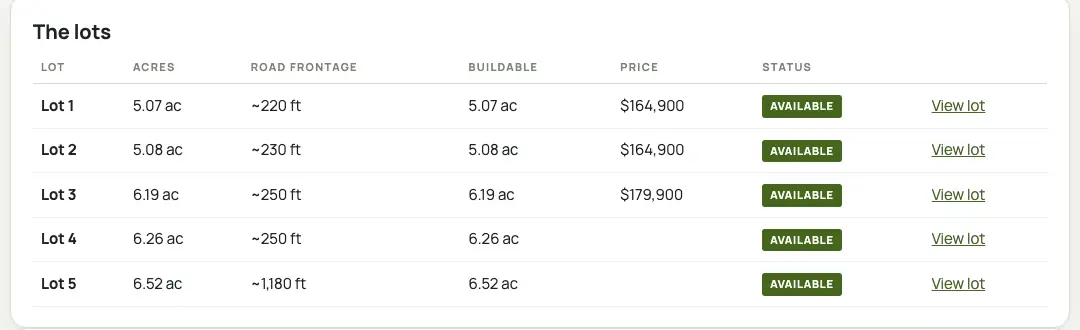
Five lots, each with its number and the exact acres from the plat: 5.07, 5.08, 6.19, 6.26 and 6.52.
Step 4 of 5
Every lot gets its own pack.
Boundary aerial, 3D views, a road view and a pop-out for each lot, with ground facts, listing text and a social kit. Here is one picture from each lot's own pack.
Step 5 of 5
One plat in. A pack for every lot out.
Precise lot lines and surveyor acreage, fitted to your parcel, then one click renders every lot.
Upload a plat, get every lot's pack See the real subdivision page
Step 1 of 5
Start with the surveyor's plat.
A recorded plat is the drawing of every lot line, with the surveyor's acreage on each lot.
PRIMARY PLATNEWTON COUNTY, INDIANAPlat lines redrawn for this page. Not the surveyor's sheet.The plat's lot lines, redrawn for this page. Not the surveyor's sheet. Step 2 of 5
Upload the plat PDF.
Dirt Flight reads the line work off the page, drawn CAD plats too, and fits it to your parcel.
The plat lines fitted onto your parcel. Step 3 of 5
The parcel splits into its lots.
Five lots, each with its number and the exact acres from the plat.
The five lots, with the surveyor's acres. Step 4 of 5
Every lot gets its own pack.
Boundary aerial, 3D views, a road view and a pop-out for each lot, with ground facts and listing text.
Lot 1 Pop-out Lot 2 3D view Lot 3 Road view Lot 4 Pop-out Lot 5 Road view One picture from each lot's own pack. Step 5 of 5
One plat in. A pack for every lot out.
Precise lot lines and surveyor acreage, fitted to your parcel, then one click renders every lot.
Upload a plat, get every lot's pack See the real subdivision page
A marketing rendering of a real subdivision, not a survey. Lot lines are placed on the parcel and are approximate. The acres shown are the surveyor's, as printed on the plat; the pack images round them to one decimal.
From one plat to a pack for every lot.
- Start from a finished parcel pack.Run the parent parcel by APN first. Then press Subdivide on that pack in My parcels.
- Bring in the lots.Upload the recorded plat PDF (up to 30 MB and 8 pages), upload a KML, GeoJSON or zipped shapefile of the lots, or click the corners of each lot on the parcel's own aerial.
- Check and adjust.Every lot appears on one screen with its acres. Drag any corner, rename lots, and see the warnings. Nothing renders until you press the button.
- Render.Dirt Flight renders a full pack for each lot, one after another in the render queue, from two up to 12 lots at a time.
- Share and download.Send one link for the whole subdivision, or download the parent and every lot in one zip.
What the lot map looks like.
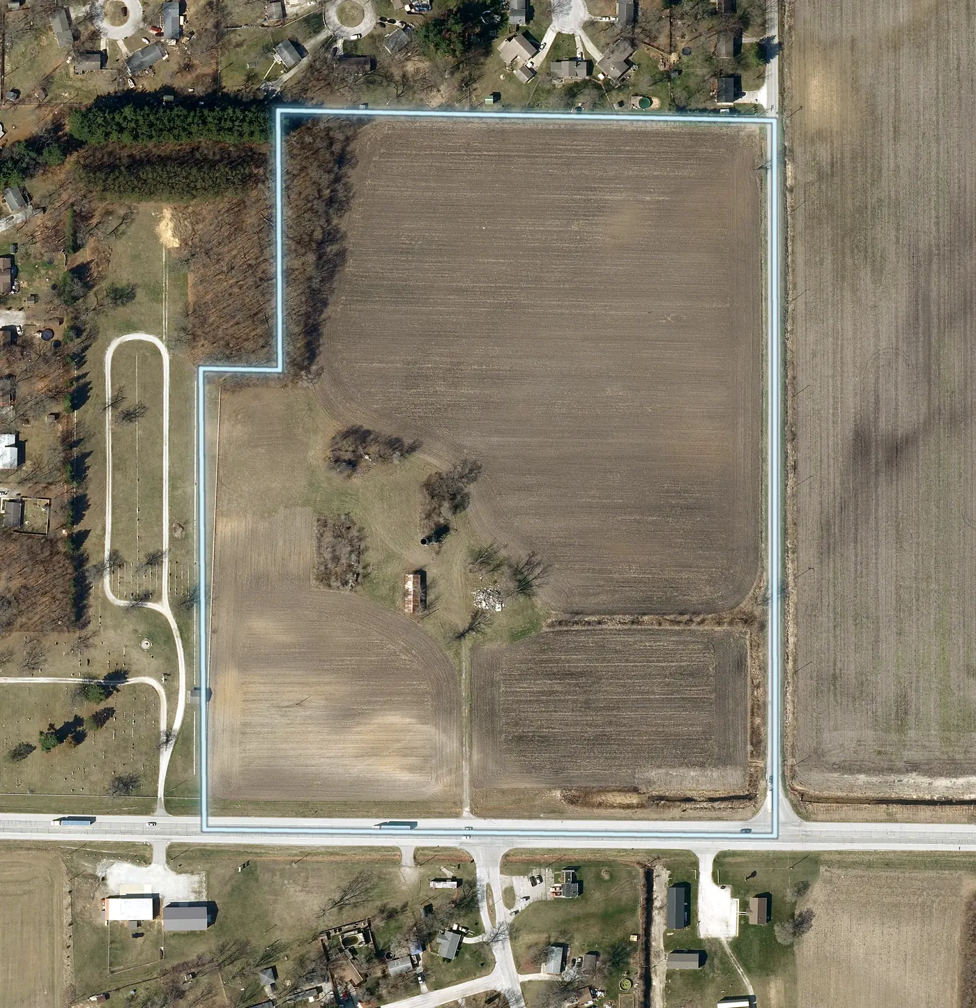
The overview draws every lot on the parent's aerial with its number and acres, so a buyer sees the whole offering in one picture. This is a real five lot subdivision in Newton County, Indiana, read from a recorded plat. The lot acreages are the surveyor's, taken from the plat.
Each lot is then rendered on its own, with its own boundary aerial, 3D views, topo, road frontage and ground facts. The lot also gets a view that shows where it sits among its sibling lots.
Before and after
Parent tract, then five lots.
Before and after, on the same ground. On the left the parent parcel is one 30.4 acre tract. On the right the surveyor's lot lines turn it into five lots, each with its own number and acres, ready to list one by one.
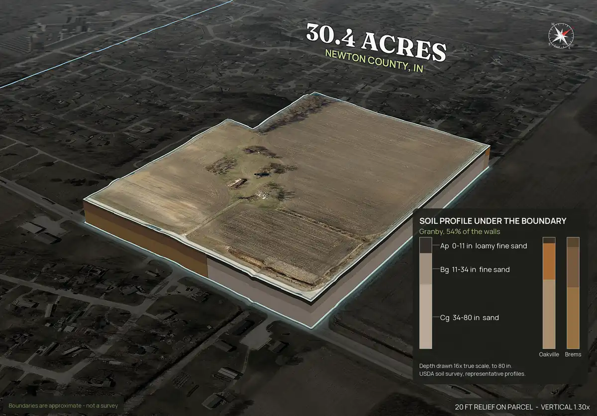
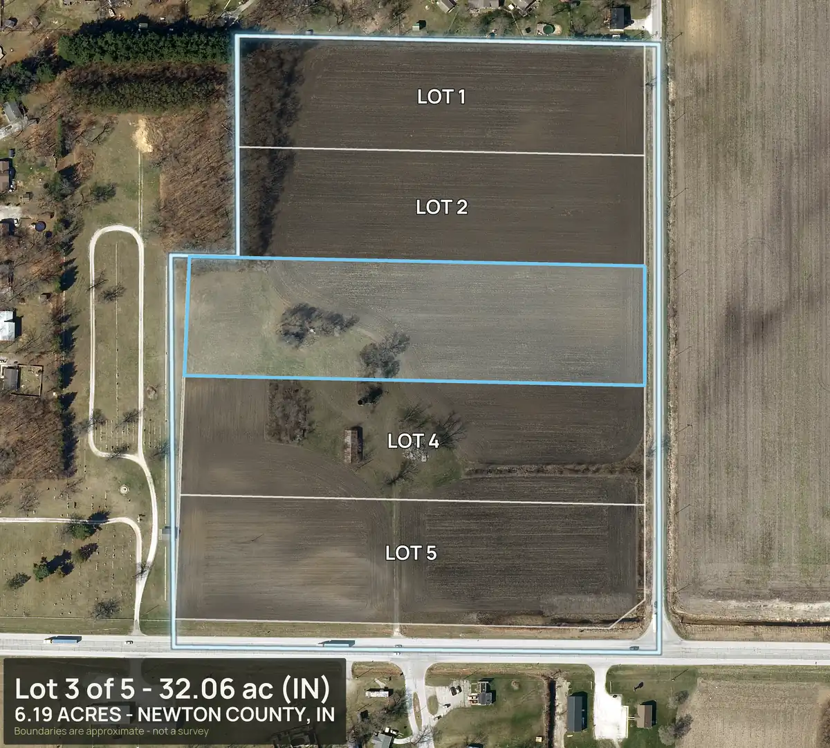
Every lot also gets a view that shows where it sits among its siblings, so a buyer of one lot sees the neighbors.
Rendered, not photographed. Lot lines come from the recorded plat; they are approximate and not a survey.
Plat PDFs, even the ones with no text.
Dirt Flight reads the line work of a plat PDF, finds the closed lot shapes, takes the scale from the printed scale or the dimension labels, and places the lots on your parcel. Many surveyors send a CAD print where every letter is an outline and the PDF has no text layer. Dirt Flight renders those pages and reads them with text recognition, so lot labels and acreages still come through. If the plat has no lot labels, the closed pieces are numbered Lot 1, Lot 2 and so on from west to east.
Checks keep you honest. If the plat's outline overlaps the parcel's mapped boundary by less than 70 percent, Dirt Flight refuses it as not this parcel's plat, and below 88 percent it warns you that the fit is loose. A lot taken from a plat keeps the plat's own lines and cites the surveyor's acreage. A lot you drag or draw is measured from the drawing and labeled as not a survey.
What every lot gets.
A full pack at the parent's tier
Each lot is a full pack at the same package as the parent. In the sample, that is Paydirt: boundary aerial, four 3D views, orbit video, topo, buildability by slope, flood and wetland, soils and septic notes, utilities and road frontage. Buildable: ground outside mapped slope, flood and wetland areas. A screen, not a zoning, septic or permit approval.
Its own ground facts
Acreage, road frontage measured for that lot, buildable acres and nearby towns, so no lot borrows the parent's numbers.
Listing text and a social kit
Listing text for the lot with its acres, frontage and distance to town, plus captions, carousel images and reels sized for social posts.
A lot in context view
One image of the lot outlined among its sibling lots, so a buyer can place it.
A shareable lot page
Each lot can have its own share link that carries a buyer inquiry form.
Parent tract too
The whole tract keeps its own full pack, so the offering also works as one parcel.
Lot gallery
Every lot at a glance.
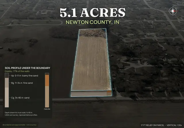
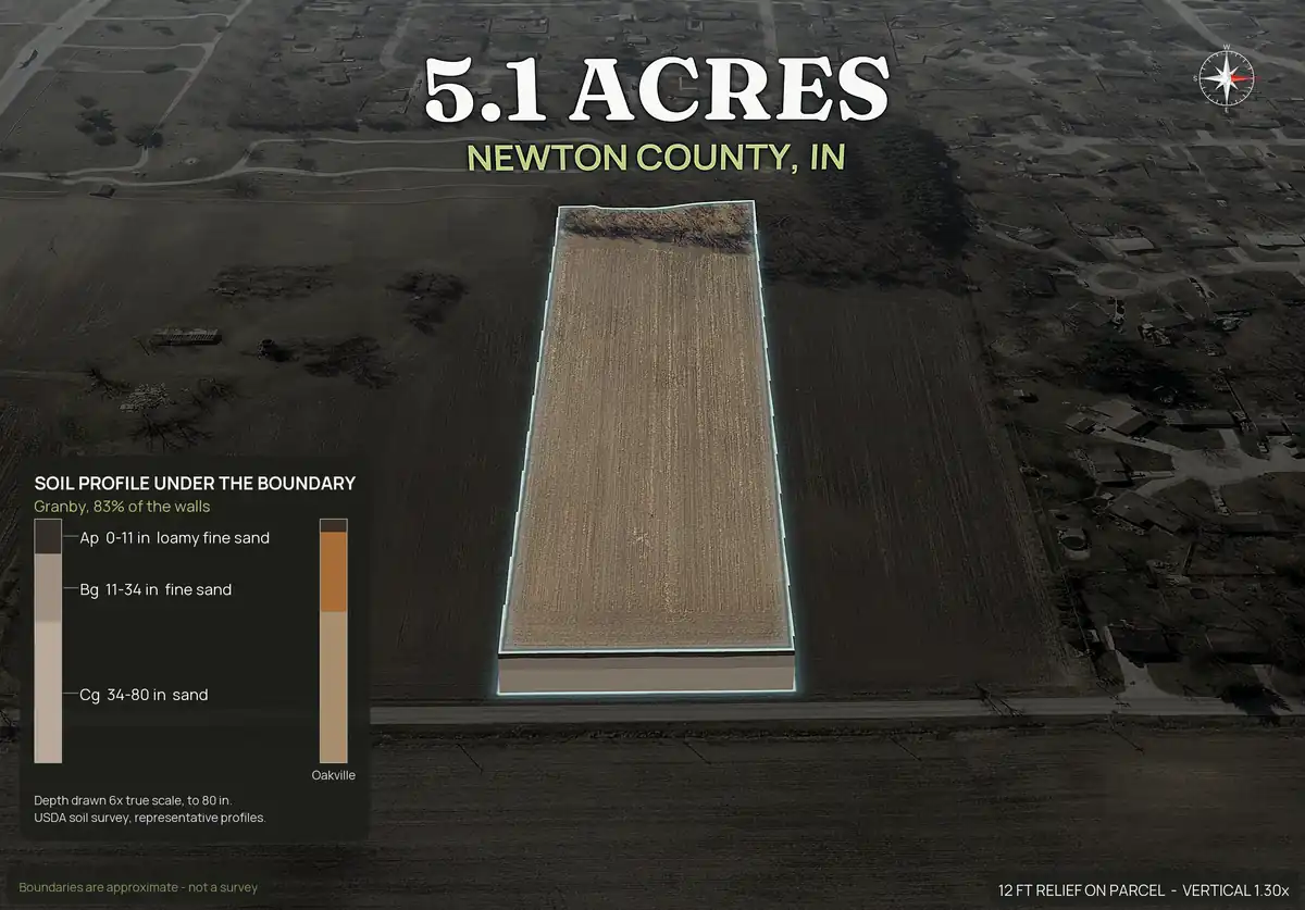
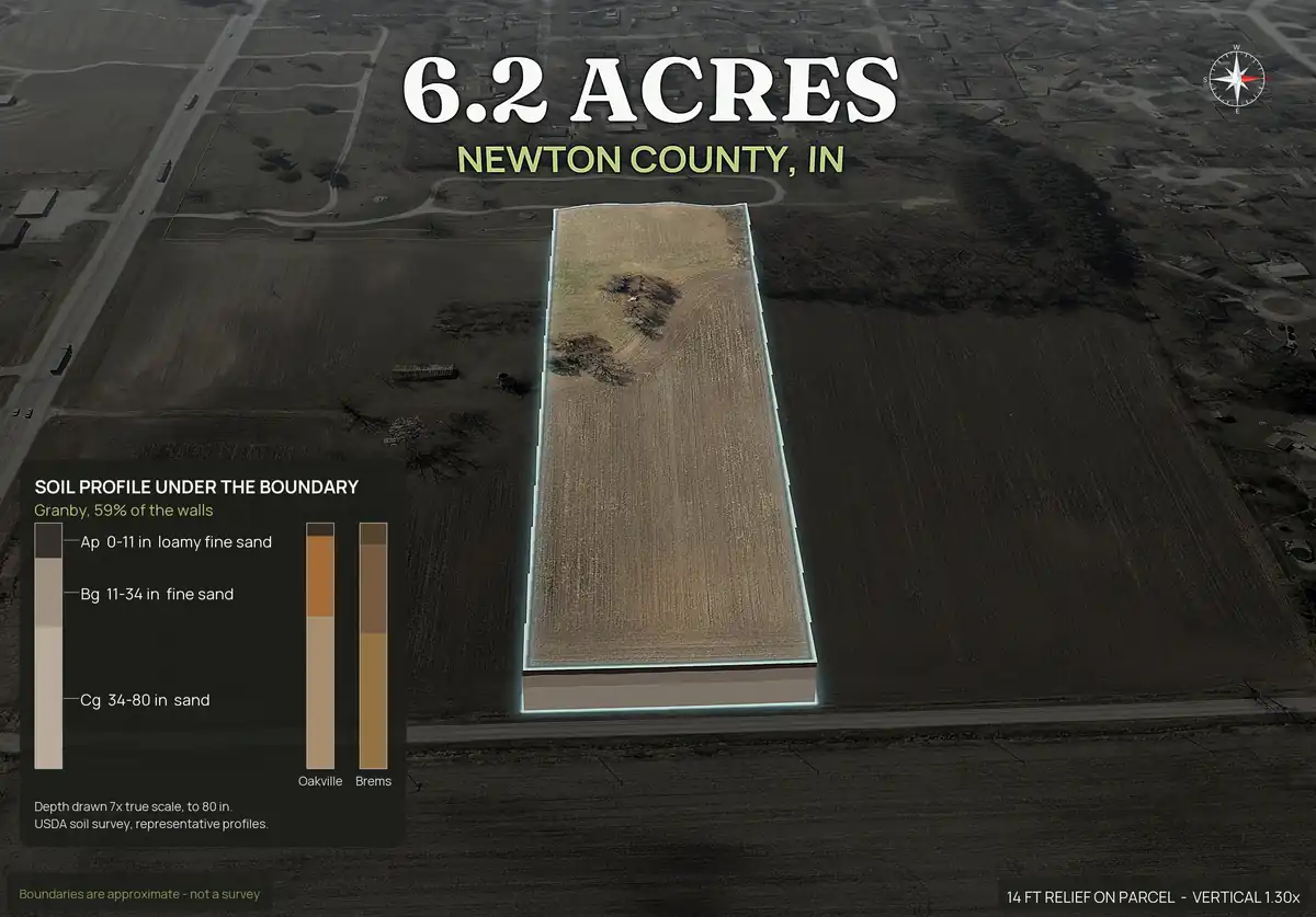
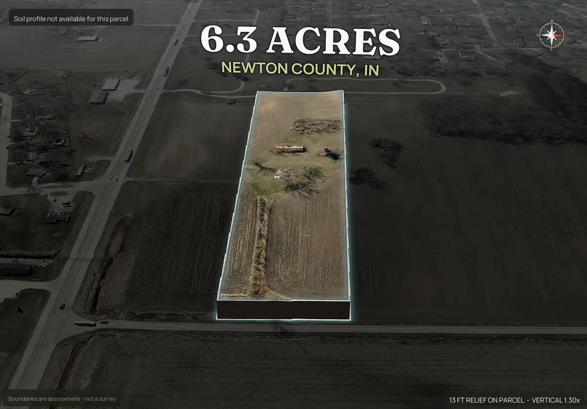
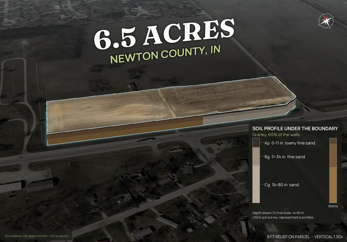
One pop-out for each of the five lots, with the soil layers under the boundary cut away. Acres and road frontage are measured for each lot, not borrowed from the parent.
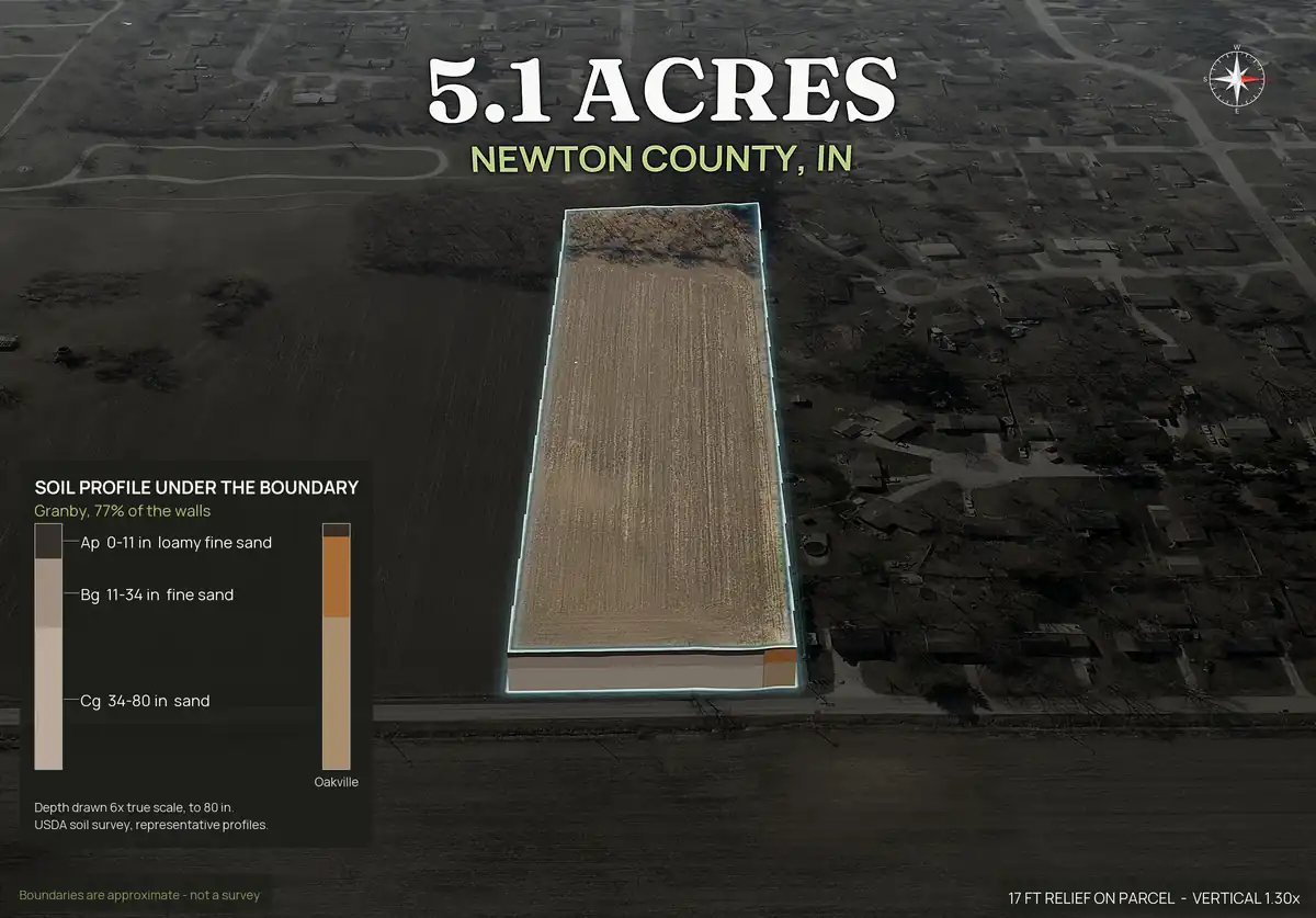
Real lot images.
Lot by lot
A full image set for each lot.
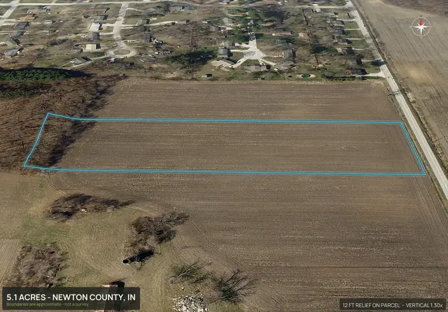
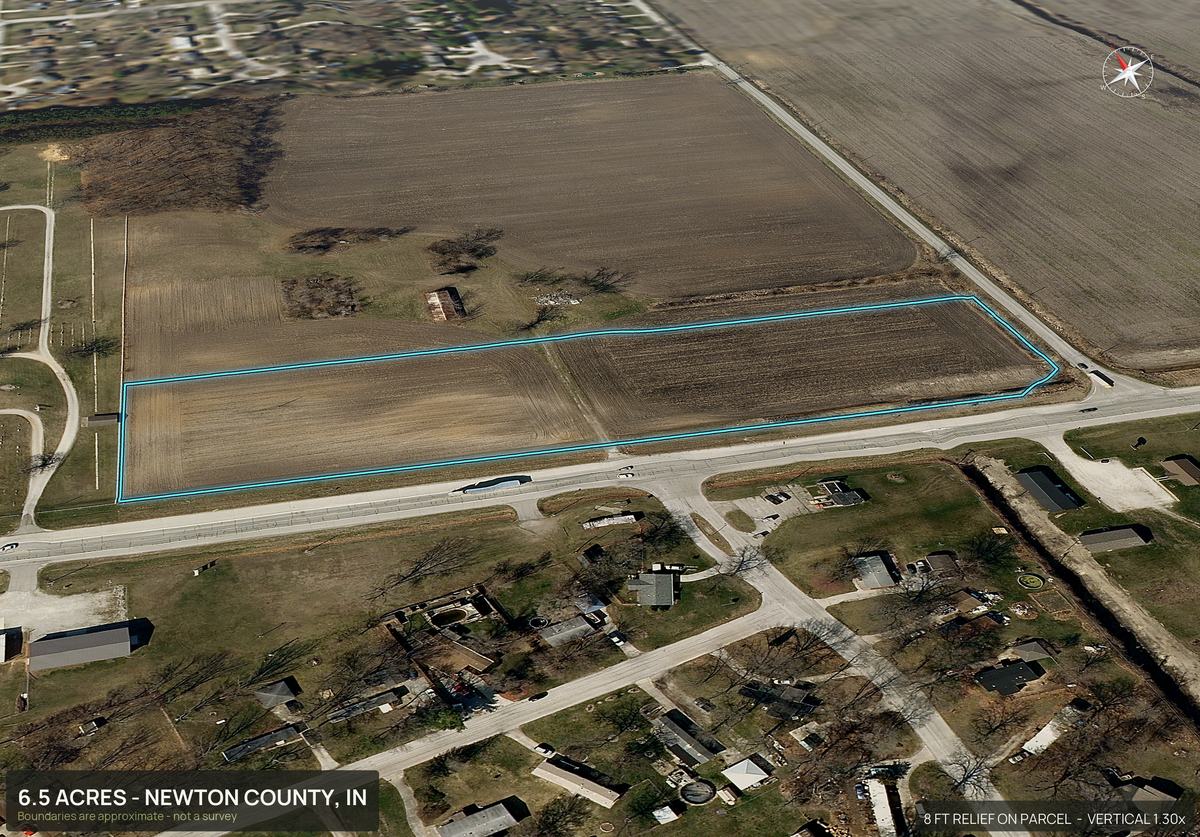
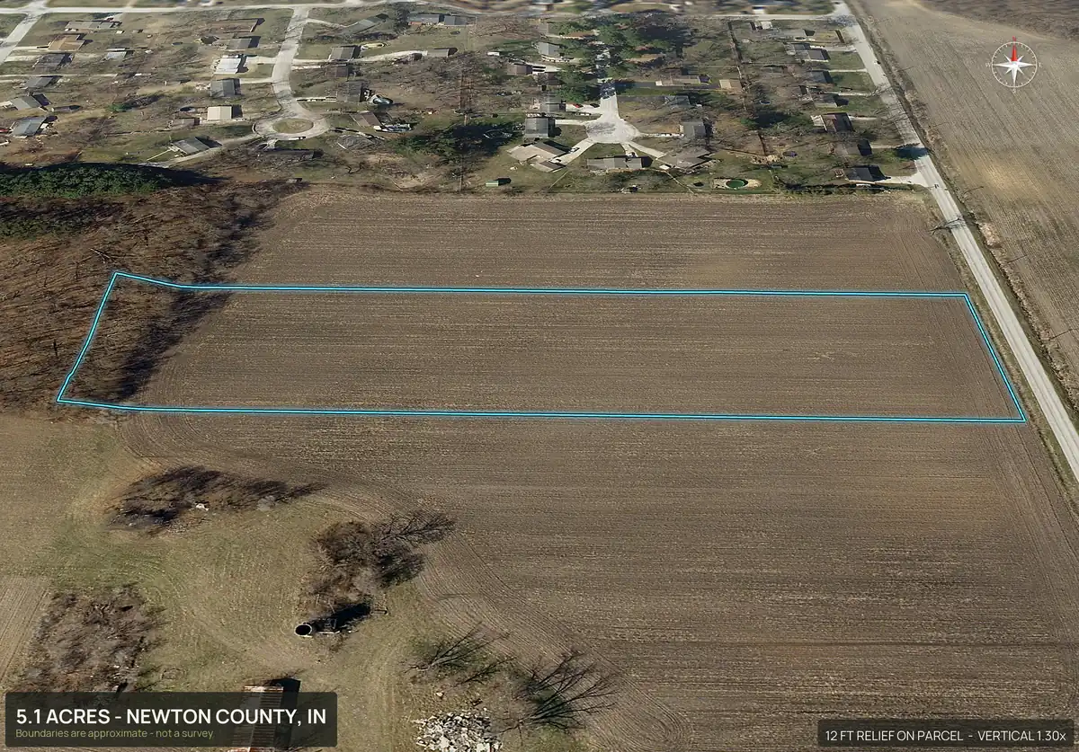
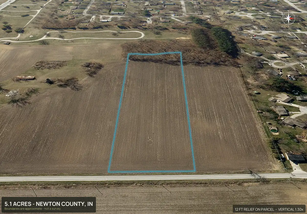
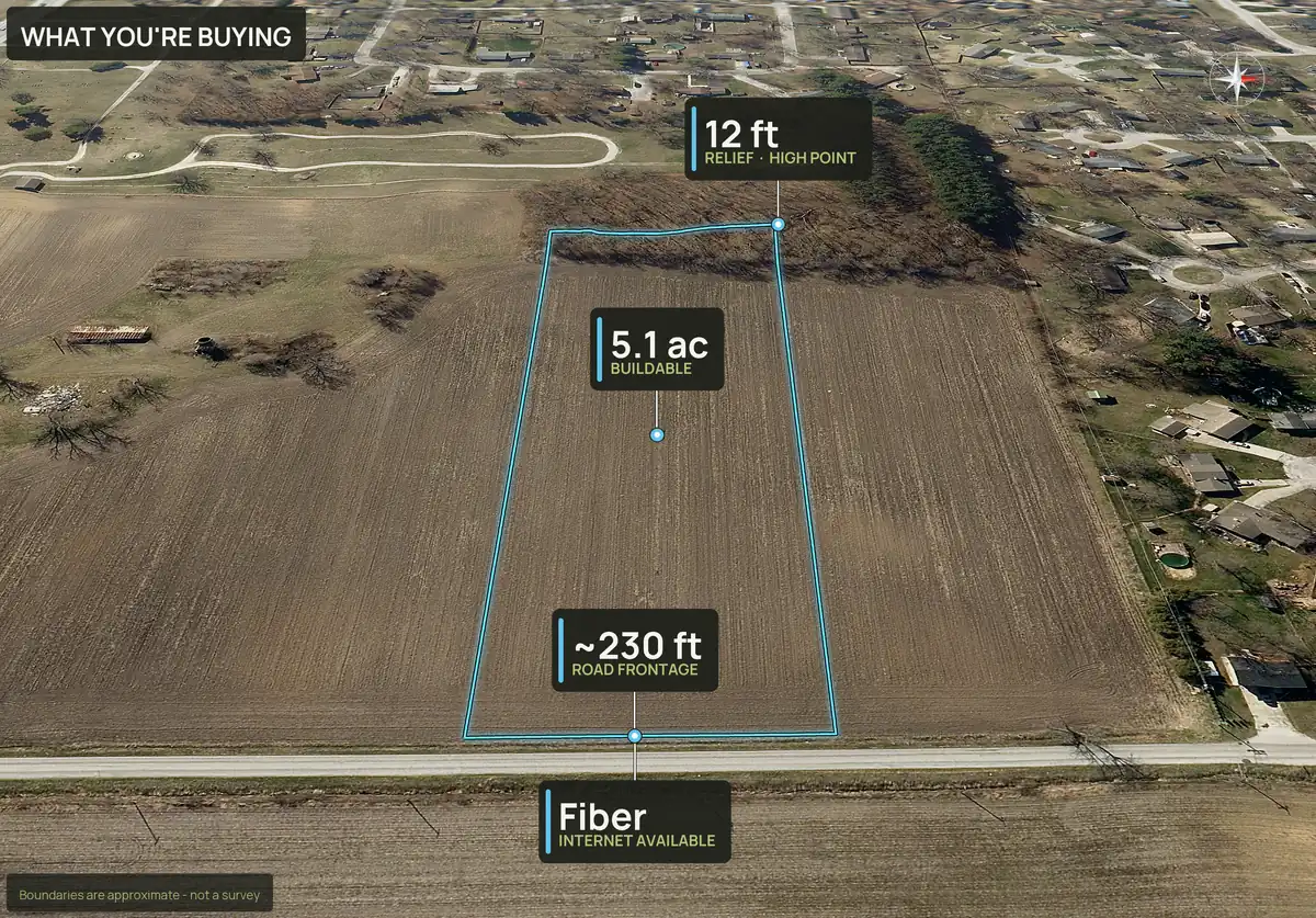
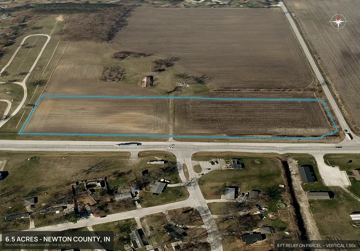
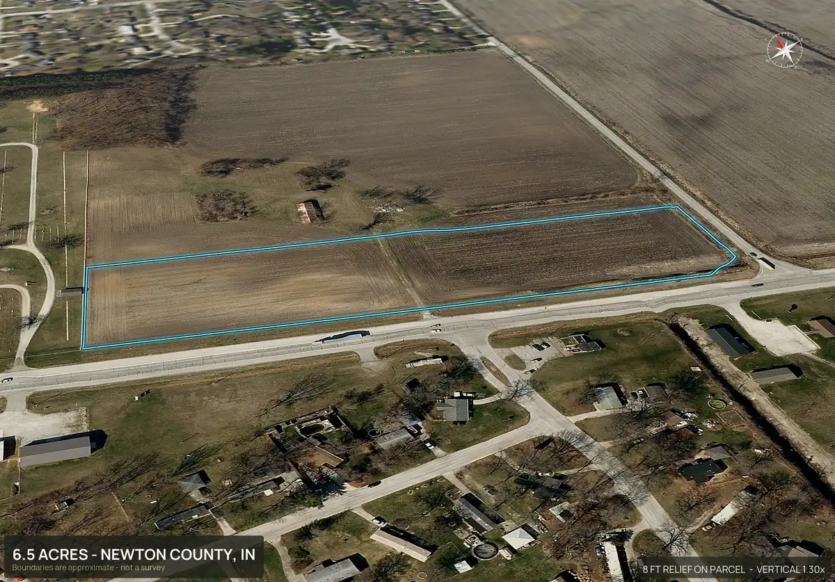
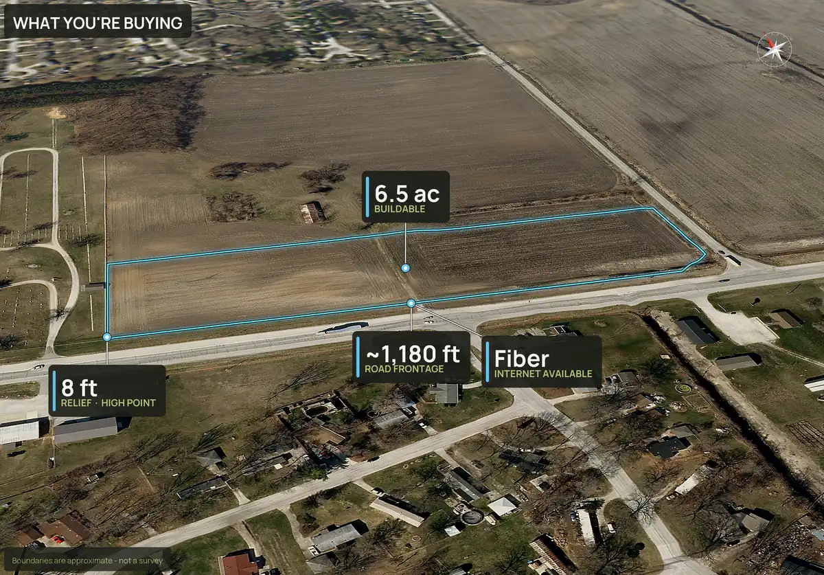
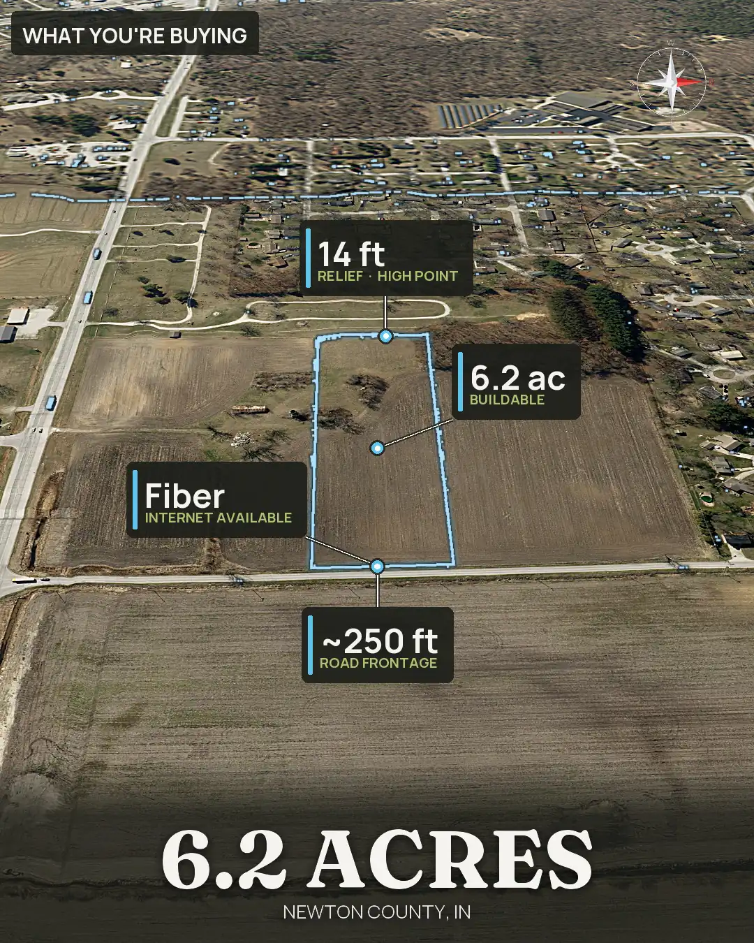
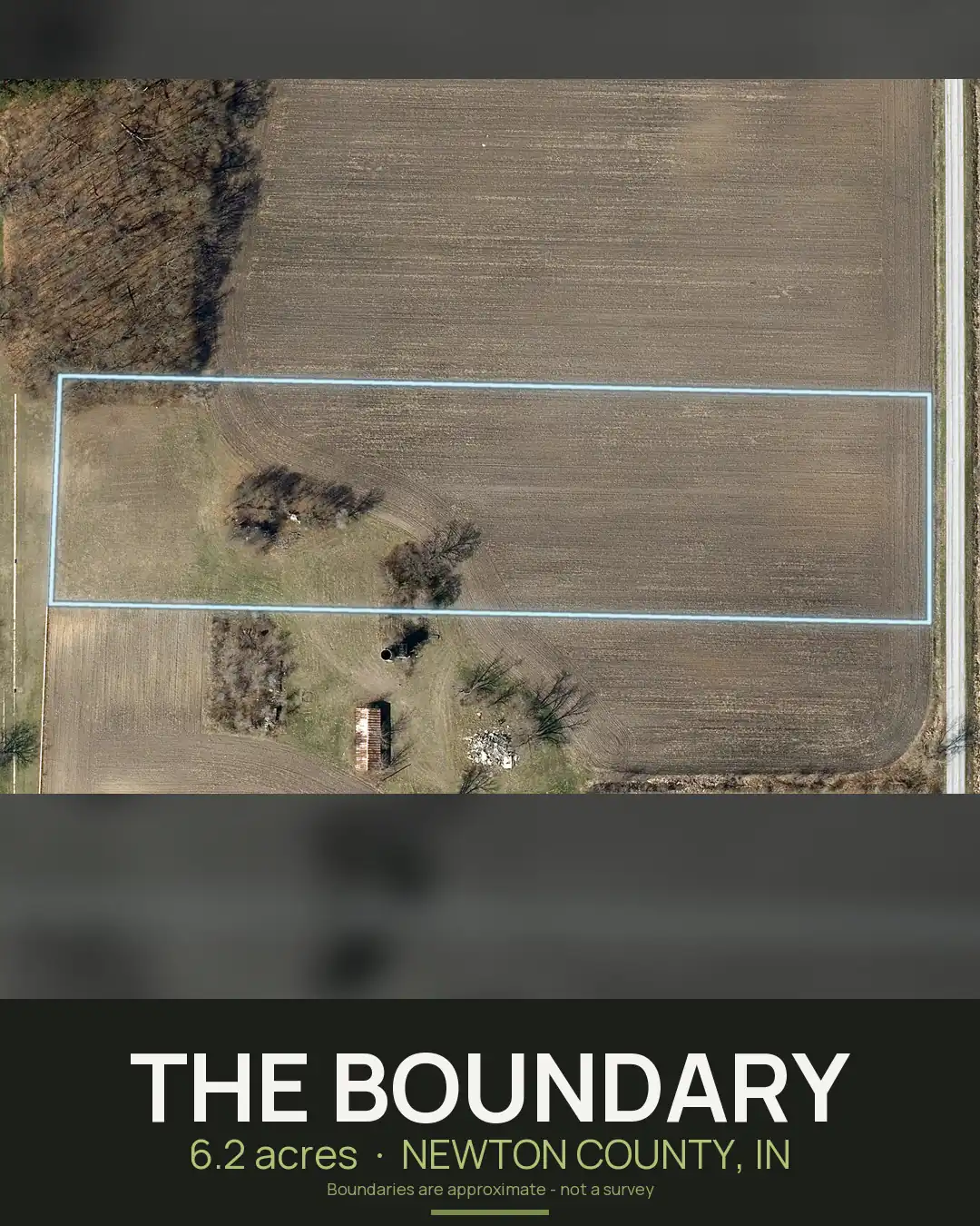
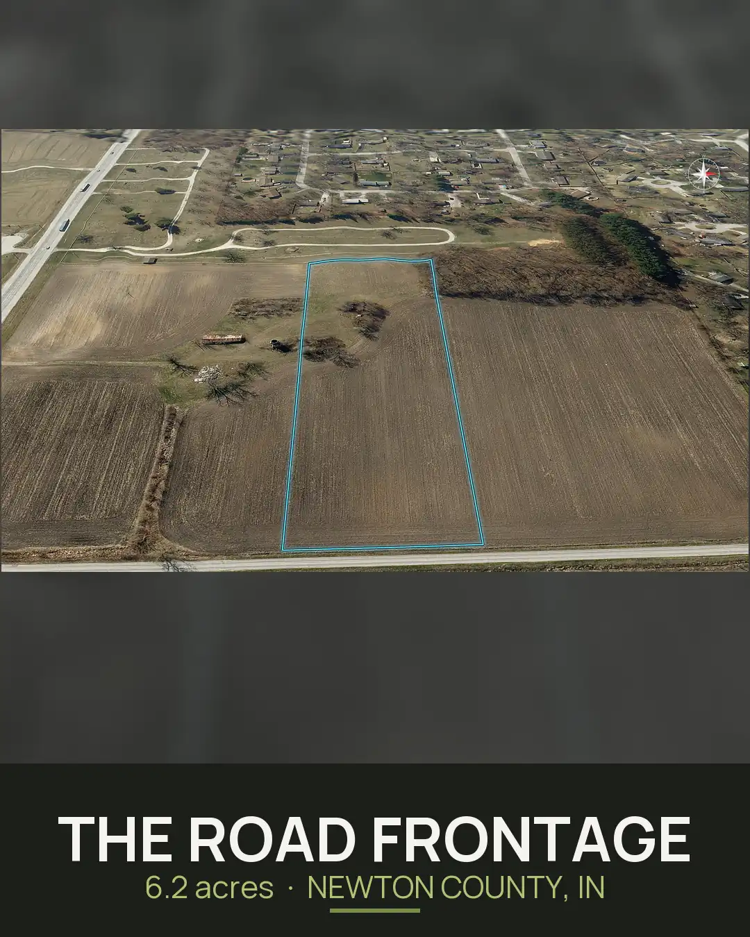
Each lot has its own pack. Here are three more views from every one: a 3D view, the road frontage and the What You're Buying panel. Lot 5 sits at the road corner and has the most frontage.
Lot 1 · 5.07 acres · about 220 ft of road frontage
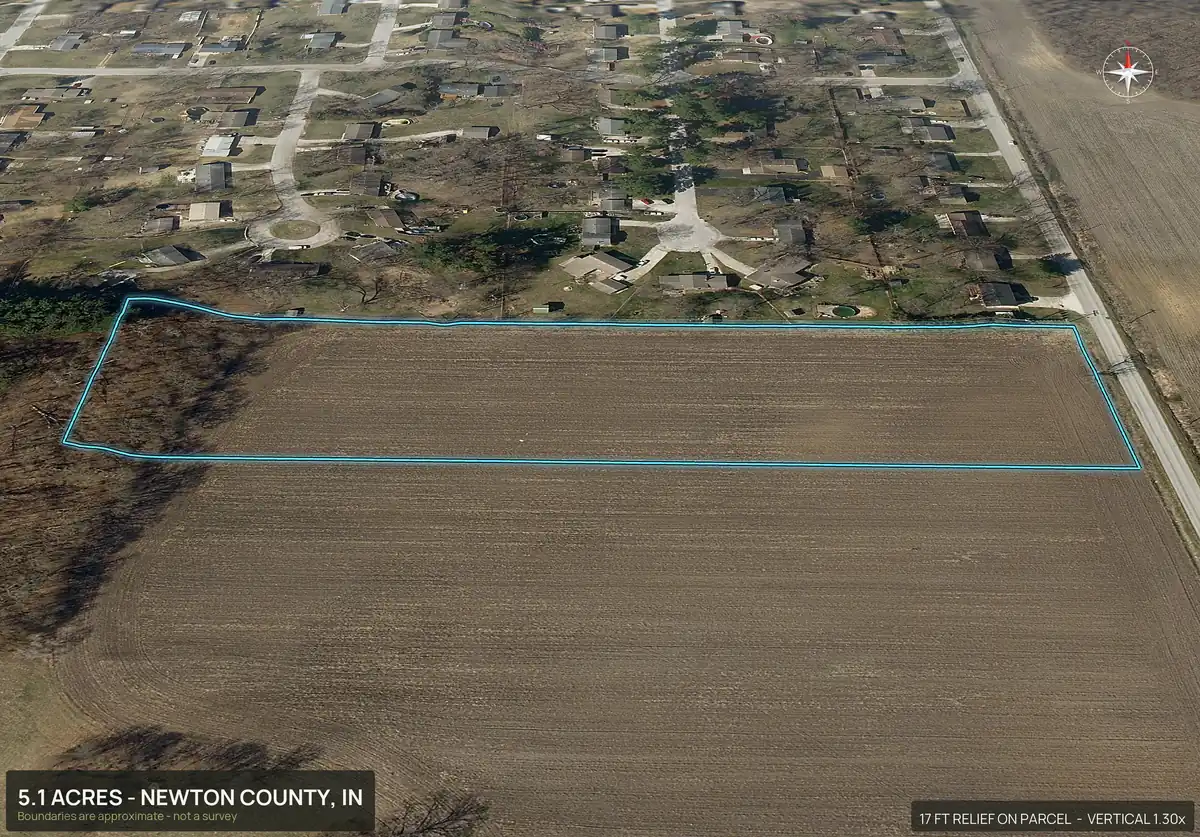
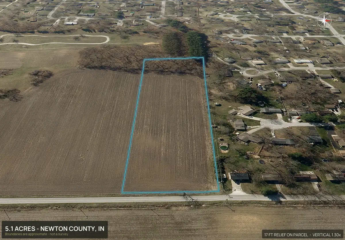
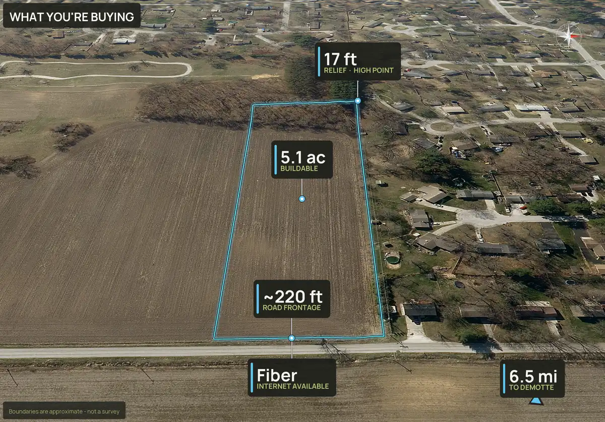
Lot 2 · 5.08 acres · about 230 ft of road frontage
Lot 3 · 6.19 acres · about 250 ft of road frontage
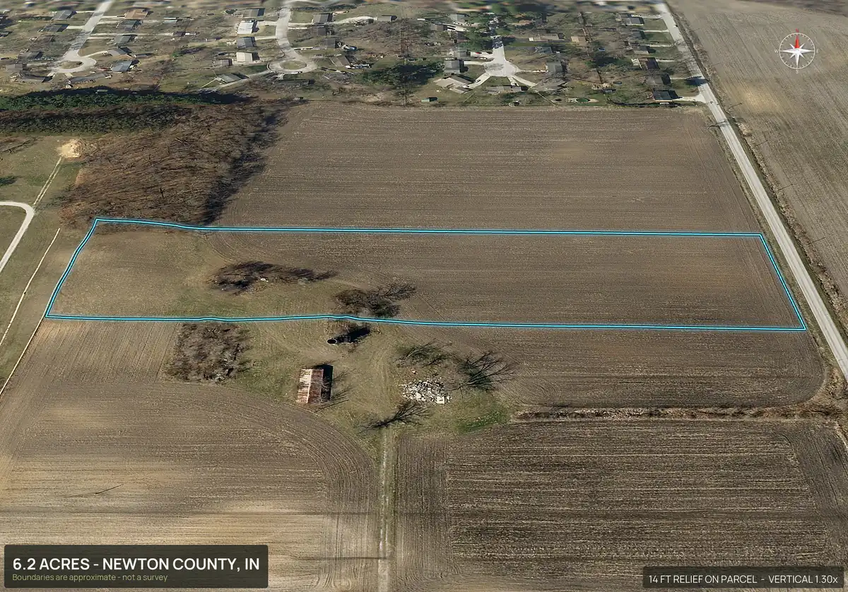
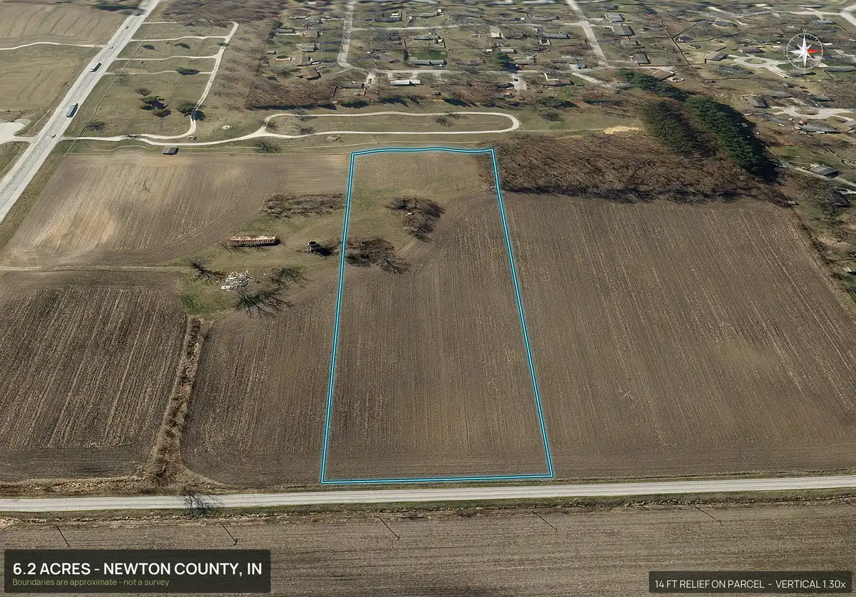
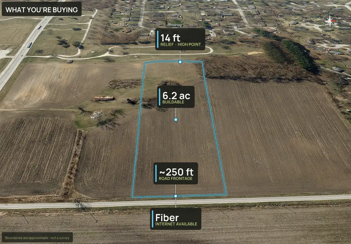
Lot 4 · 6.26 acres · about 250 ft of road frontage
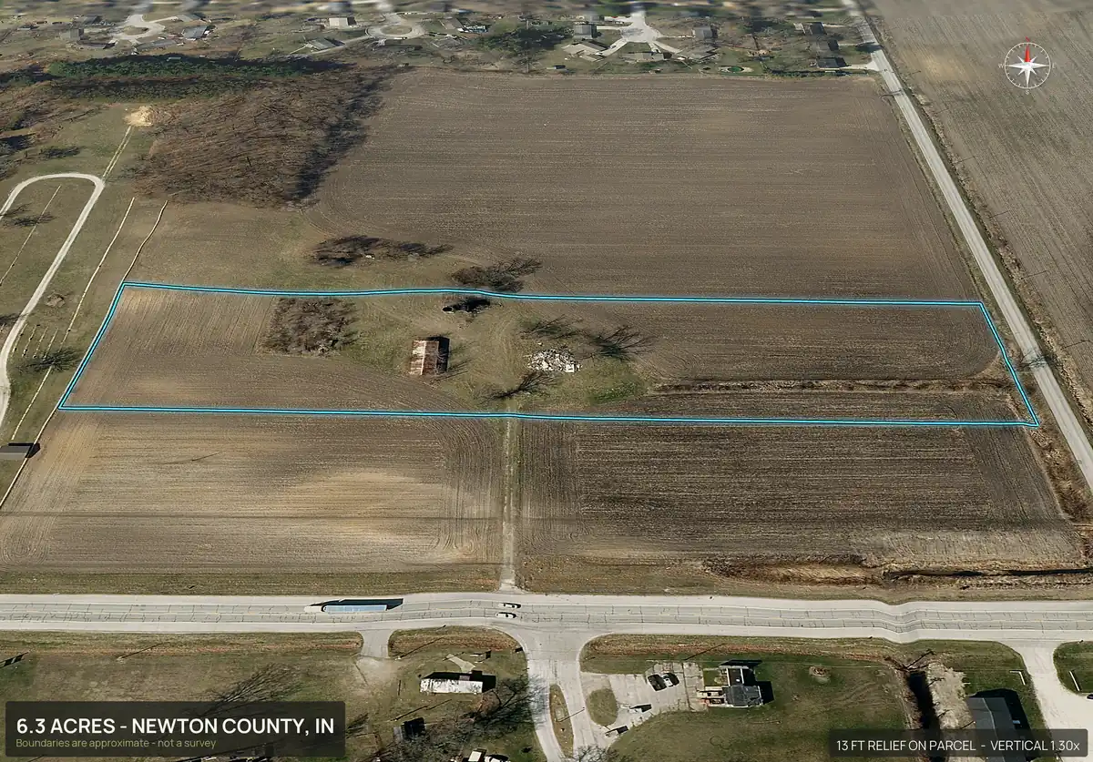
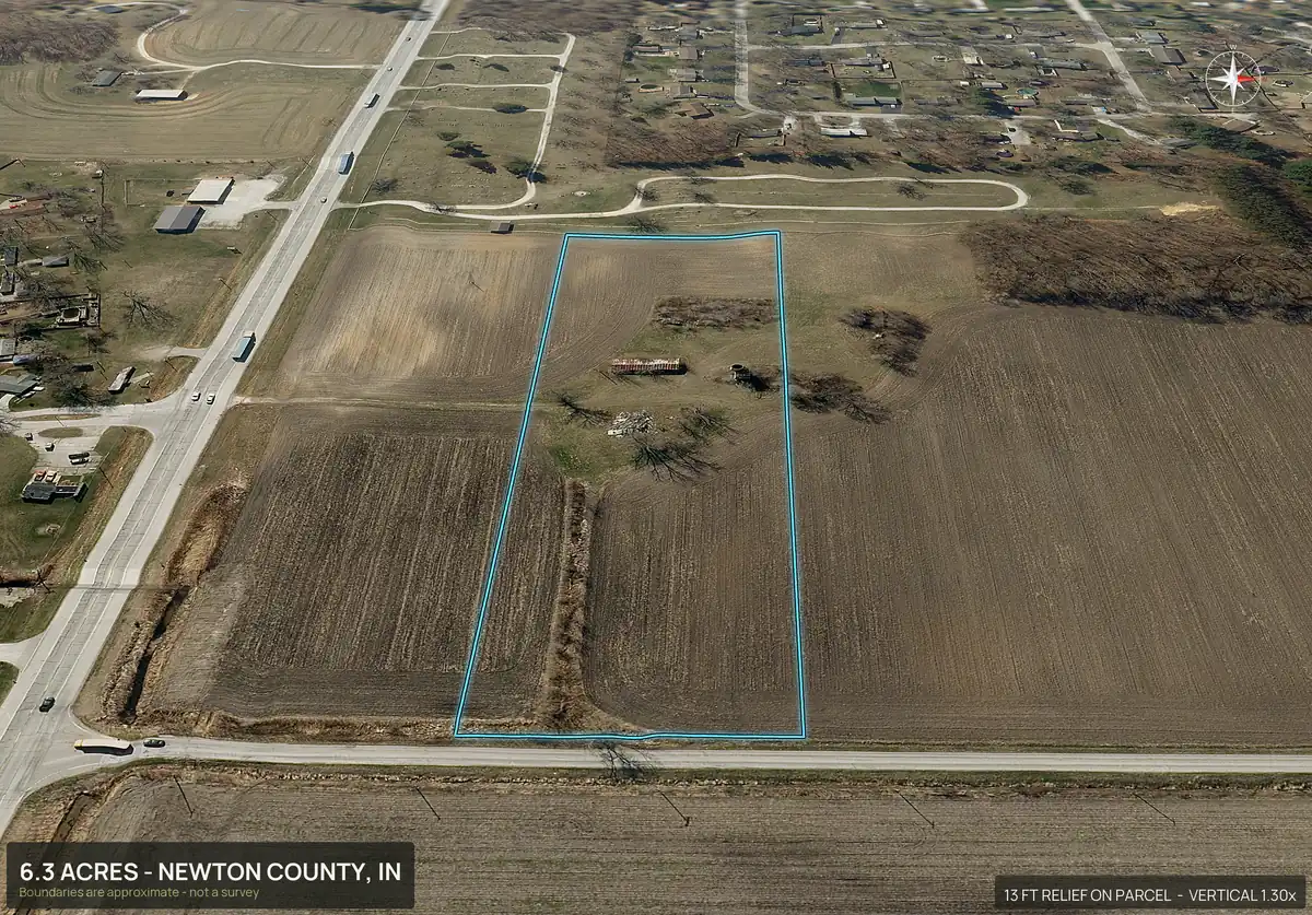
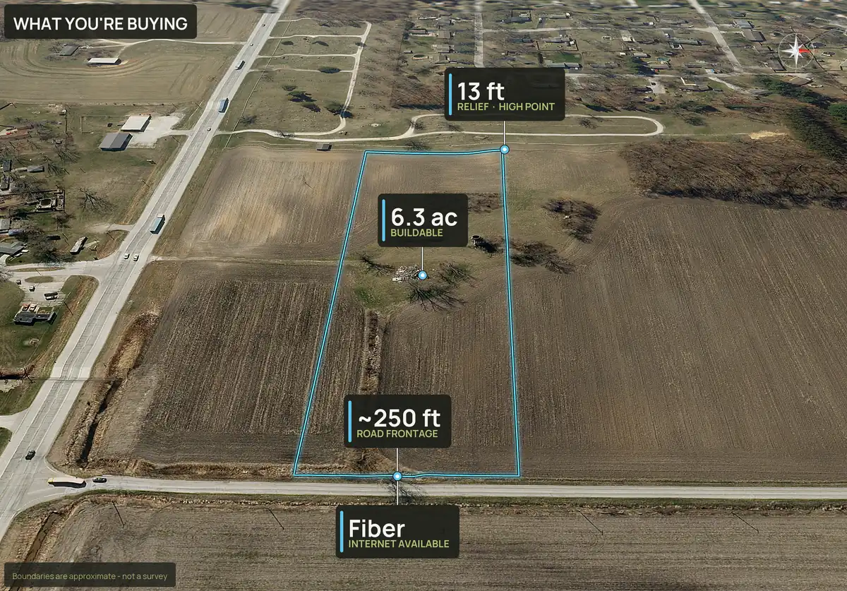
Lot 5 · 6.52 acres · about 1,180 ft of road frontage
Rendered, not photographed. Lot lines come from the recorded plat; they are approximate and not a survey.
One link and one download for the whole subdivision.
- One share page. A single link shows the lot map and a table of every lot with acres, road frontage, buildable acres, your price and an available, pending or sold status that you set. Each row links to that lot's pack.
- One zip. The parent pack and every lot in its own folder, plus the lot map and a read-me. You can add each pack's site physicals.
- Your brand. Your company name, phone and website show on the share page, and on PayDirt Pro your logo goes on the images.
Listing and social
The listing page, the lot table and the social kit.
Each lot has a shareable listing page with its photos, the video, the property details and a buyer inquiry form. The subdivision share page lists every lot with acres, road frontage, buildable acres, your price and an available, pending or sold status. Buildable: ground outside mapped slope, flood and wetland areas. A screen, not a zoning, septic or permit approval.
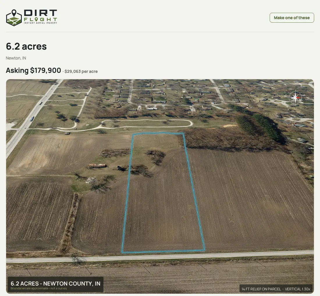
The social kit for a lot
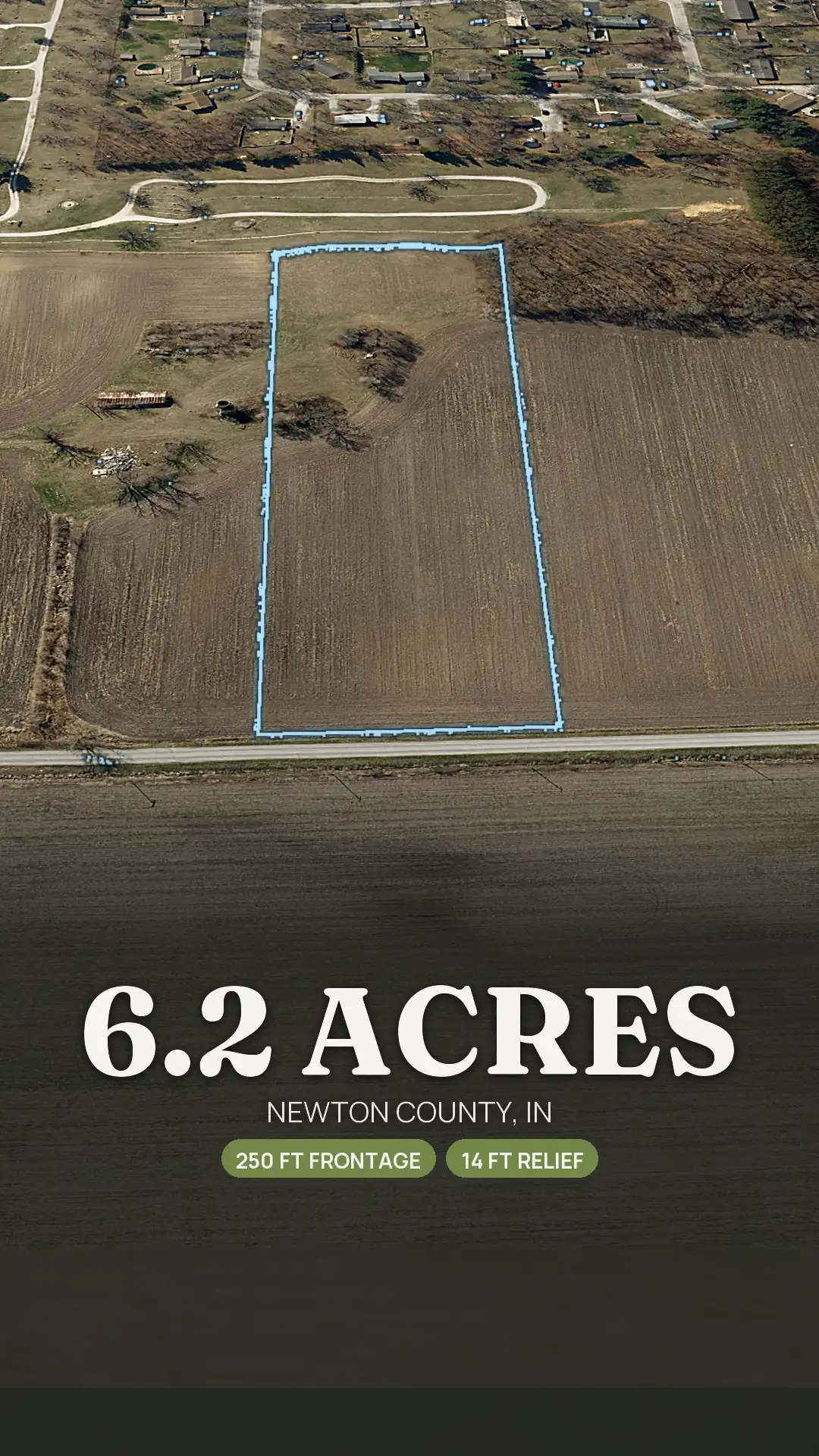
Every lot comes with a cover, a carousel and reels sized for Instagram and Facebook. A few of the Lot 3 stills:
The one download
One zip holds the whole subdivision, laid out so you can hand any folder to an agent, a buyer or a county:
- The parent folder. The full pack for the whole tract.
- One folder per lot. Lot 1 through Lot 5, each with its aerial, 3D views, topo, pop-out, What You're Buying panel, orbit video, listing text and social kit.
- The lot map and a read-me. The overview image and a short guide to what is where.
Rendered, not photographed. Lot lines come from the recorded plat; they are approximate and not a survey.
Fast, against a drone pilot per lot.
A rural drone shoot commonly runs $150 to $600 per site and typically takes five to nine days. For a five lot split that is five shoots, or one long one, and each lot still needs its boundary drawn. A Dirt Flight pack is $79 on Paydirt, or PayDirt Pro is $199 a month for 20 packs. The whole tract and each lot each count as a pack, and the lots render one after another, so a bigger subdivision takes longer than a single parcel. Every pack is free for a limited time while we launch.
A drone gives you real photographs of the ground today. Dirt Flight renders the lots from recent aerial imagery, so many sellers use both.
Another subdivision
A two lot split, too.
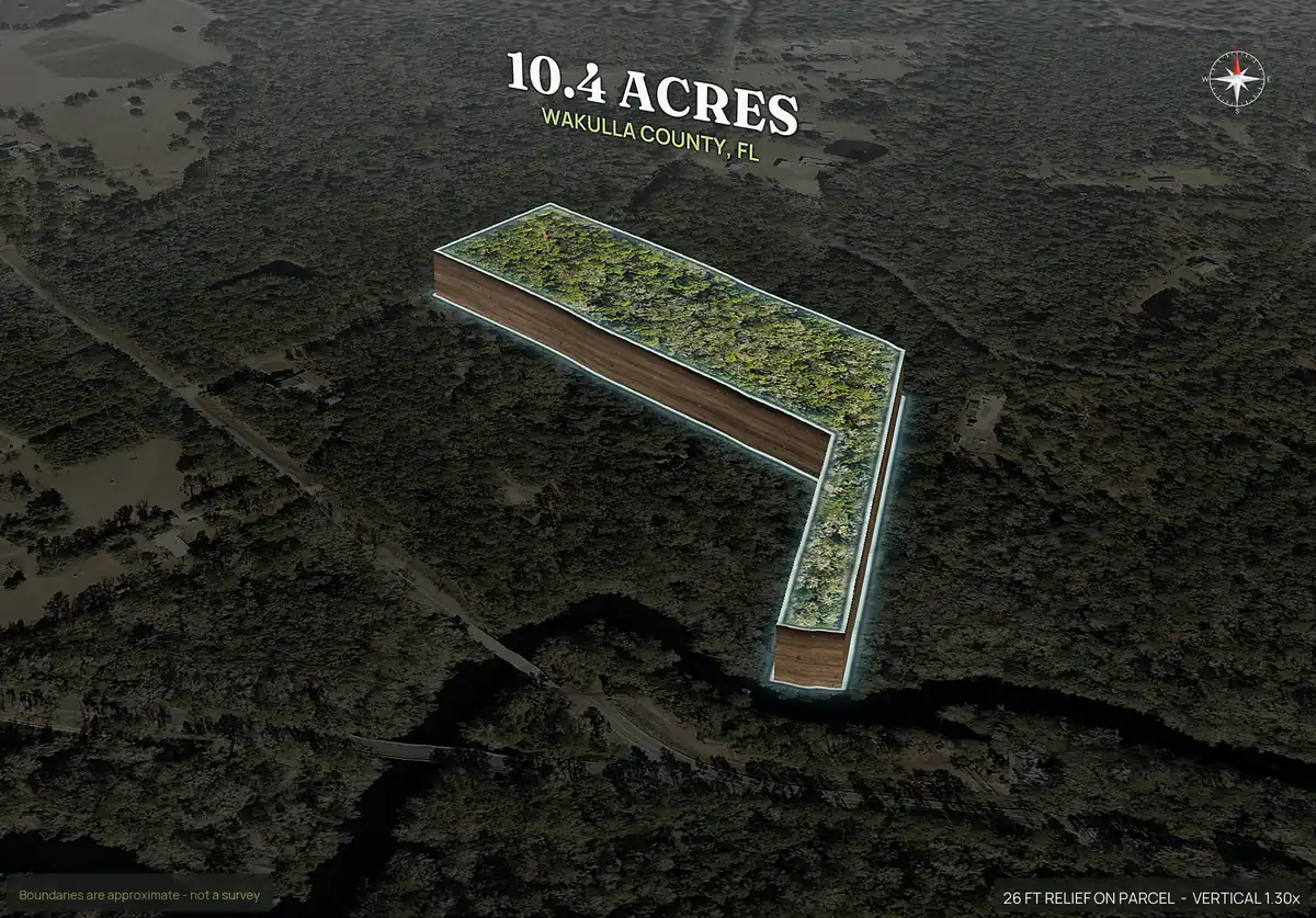
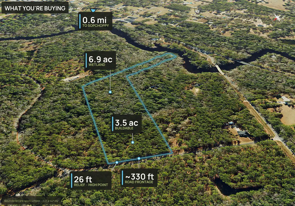
It works for a simple split as well. This is a 20 acre tract in Wakulla County, Florida, divided into two lots of about 10.4 acres each, with a pop-out and a What You're Buying panel for each.
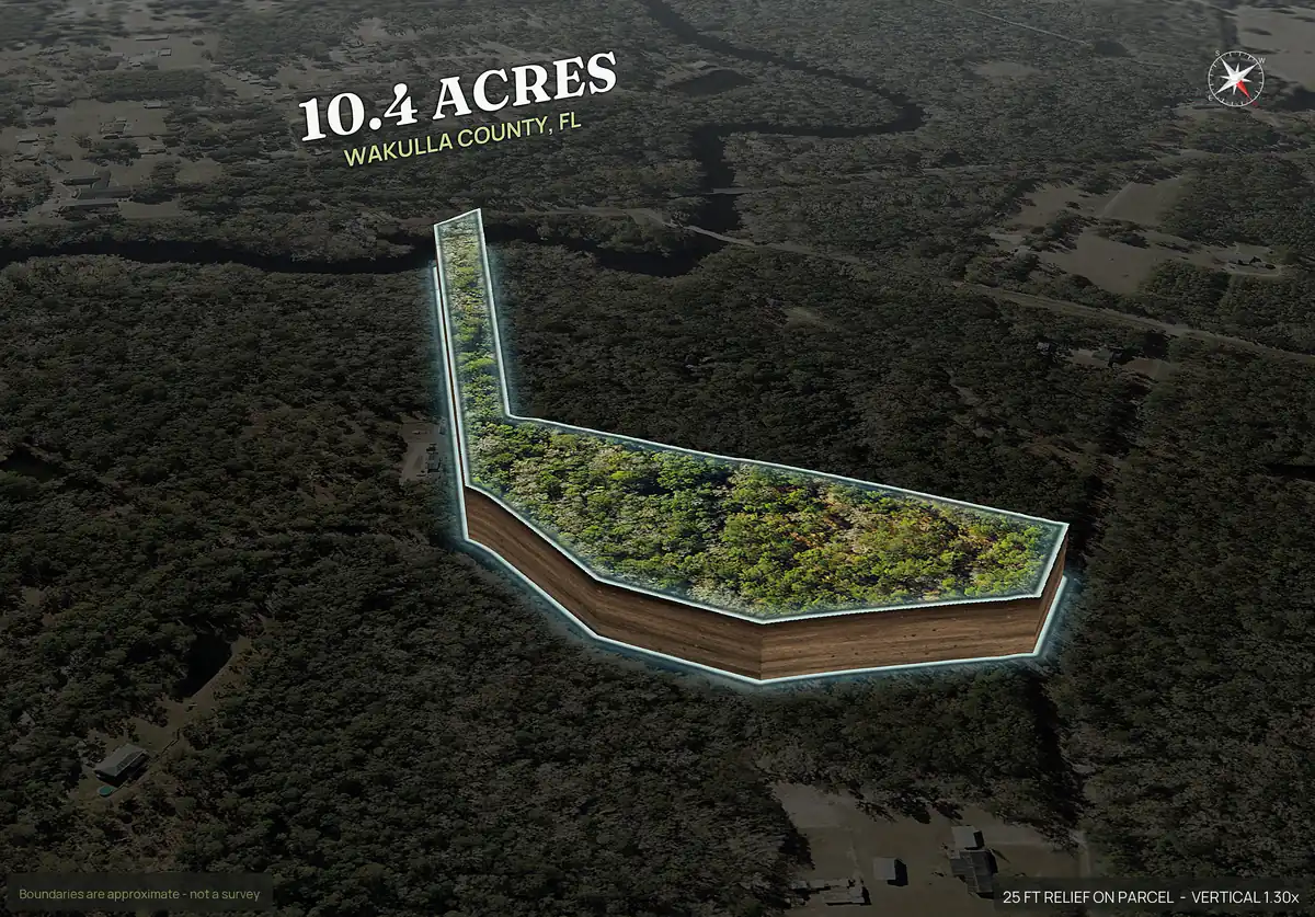
Rendered, not photographed. Lot lines come from the recorded plat; they are approximate and not a survey.
Adjoining parcels
Adjoining parcels: the whole tract and each lot.
Selling several adjoining parcels is a different job from cutting a new subdivision, and the same account handles both. Enter the parcel numbers once and the adjoining parcels render as one tract. Tick the whole tract, each parcel as its own lot, or both, and each choice comes back as its own listing pack, so there is one pack for every way you might sell.
A buyer who wants the whole holding gets the whole tract, and a buyer who only wants one piece gets that lot, both listed on the same day. The whole tract plus up to 5 lots sits inside one Subdivide / Multi-parcel pack, and a tract that needs new lines can then be split into lots as described above. Boundaries are approximate and are not a survey.
Subdivide / Multi-parcel pack pricing.
Subdivide / Multi-parcel pack: $149 for the whole tract plus up to 5 lots. 6 or more: contact us for a quote. Free for a limited time, like every pack.
What it does not do.
- It is not a survey, and it does not make a subdivision legal. County approval and recording are the owner's job. Read how to subdivide land for the steps.
- Boundaries are approximate and follow the plat you upload, and a lot you draw yourself is not a survey.
- Lots from a plat are placed on your parcel, so the leftover ground, usually road right-of-way, will not add up to the parcel.
- It does not test septic or confirm utilities. Soils and utility service are only screened, so confirm with the health department and providers.
- Up to 12 lots per run and a 30 MB plat of up to 8 pages. A plat with too much line work to read is refused with a message.
Straight answers
Questions people ask about this.
Can I upload a plat PDF to Dirt Flight?
Yes. Upload the recorded plat as a PDF up to 30 MB and 8 pages. A CAD printed plat with no text layer is read by text recognition.
How many lots can I render at once?
Up to 12 lots in one run. The Subdivide / Multi-parcel pack price covers the whole tract plus 5 lots, and 6 or more lots are quoted, so contact us before you render more than 5.
What does each lot get?
A full pack at the same package as the parent, with its own boundary aerial, 3D views, topo, ground facts, listing text and share page. On Paydirt that includes buildability, soils, utilities and road frontage. Buildable: ground outside mapped slope, flood and wetland areas. A screen, not a zoning, septic or permit approval.
Can I draw the lots instead of uploading a plat?
Yes. Click the corners of each lot on the parcel's aerial, or upload a KML, GeoJSON or zipped shapefile. Every corner can be dragged.
Is the lot boundary a survey?
No. Boundaries are approximate. A lot from a plat keeps the plat's lines and acreage, and a lot you draw is measured from the drawing. Neither replaces a survey.
How much does a subdivision pack cost?
Subdivide / Multi-parcel pack: $149 for the whole tract plus up to 5 lots. 6 or more: contact us for a quote. It is free for a limited time, like every pack. On PayDirt Pro, the whole tract and each lot each count as one of the month's packs.
Does Dirt Flight handle county approval?
No. County approval and recording are the owner's job. Dirt Flight makes the marketing and screening packs once you have the lots.
Can I market adjoining parcels together and separately?
Yes. Enter the parcel numbers once, tick the whole tract, each parcel as its own lot, or both, and each choice comes back as its own listing pack. The whole tract plus up to 5 lots is covered by one Subdivide / Multi-parcel pack, and the tract can then be split into lots you draw or upload.
Free for a limited time.
Make an account, enter an APN, and the pack renders in about ten minutes. After launch, Dirt is $29 a parcel, Paydirt is $79, PayDirt Pro is $199 a month for 20 Paydirt packs, and Pro+ is $299 for 45.
Start free