DirtFlight / For land brokerages
For land brokerages and agents
Aerial packs for every land listing your brokerage takes.
Enter the APN and get the boundary aerial, 3D views, orbit video, topo, ground facts and a shareable listing page in about ten minutes. PayDirt Pro, $199 a month for 20 Paydirt packs, adds your logo and embeds. PayDirt Pro+ is $299 for 45, and Enterprise covers teams.
Short answer
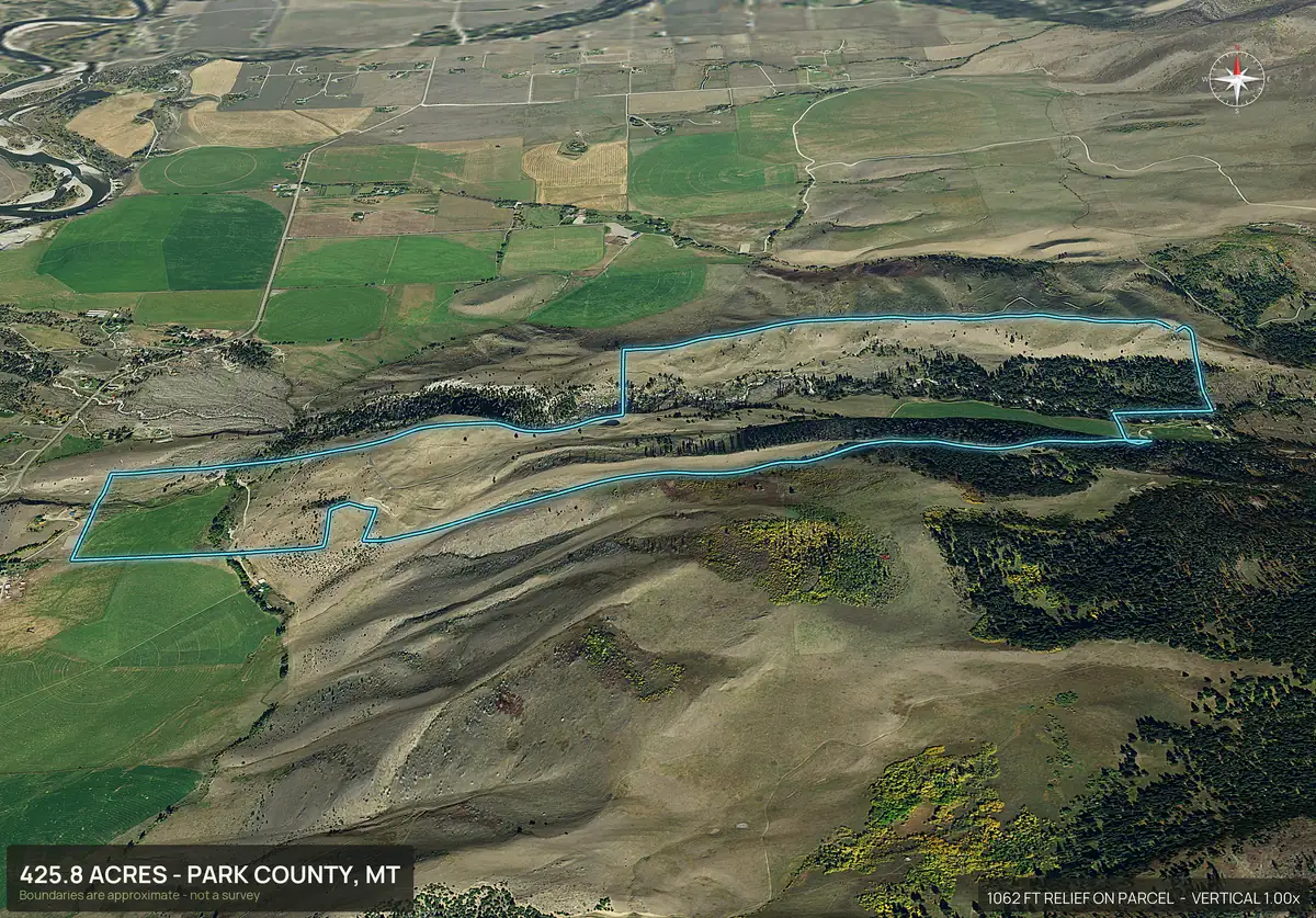
DirtFlight is an aerial marketing pack for land listings. A land agent enters the parcel number and gets, in about ten minutes, a boundary outlined aerial, four 3D views, an orbit video, a contour map, road frontage, flood, wetland, soils and septic facts, a social kit and a hosted listing page. PayDirt Pro is $199 a month for 20 Paydirt packs, adds the agent's logo and embeds on the agent's own site, and pays for itself at the third parcel in a month. PayDirt Pro+ is $299 a month for 45 packs, and Enterprise is custom for teams and higher volume. It is free for a limited time. Nothing is flown, so boundaries are approximate and are not a survey.
The product
What a listing looks like with a DirtFlight pack.
Most vacant land listings go live with a handful of phone photos, or none, because a drone shoot costs money and a week. A DirtFlight pack gives the listing the things a land buyer scrolls for first.
- The boundary on every view. The outline sits on the aerial, the 3D views and the video, so a buyer sees what is included.
- Terrain. Four cardinal 3D views, an 18 second orbit and a contour map with elevation stats.
- Ground facts a buyer asks about. Buildability by slope, flood zone and wetland in acres, soils and septic limitations, streams and ponds, power lines with voltage and distance, and road frontage.
- Ready to post. A 9x16 story, a 4x5 feed post, a reel cover, a 15 second looping video and a caption.
- One link. A hosted listing page you text to a buyer, with your logo on it on PayDirt Pro.
Showcase
The same pack on very different land.
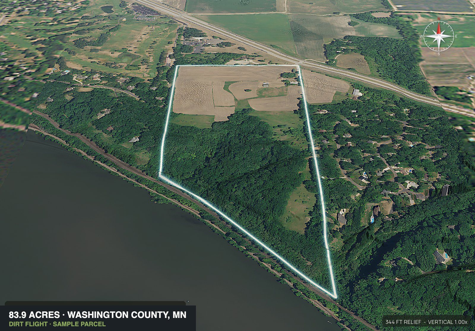
Every pack below was rendered from a parcel number. A mountain ranch, an irrigated cotton farm, a high country hay meadow and a hobby farm get the same set: the boundary on every view, 3D relief, a pop-out with the soil layers cut away, and a What You're Buying panel of facts for the listing.
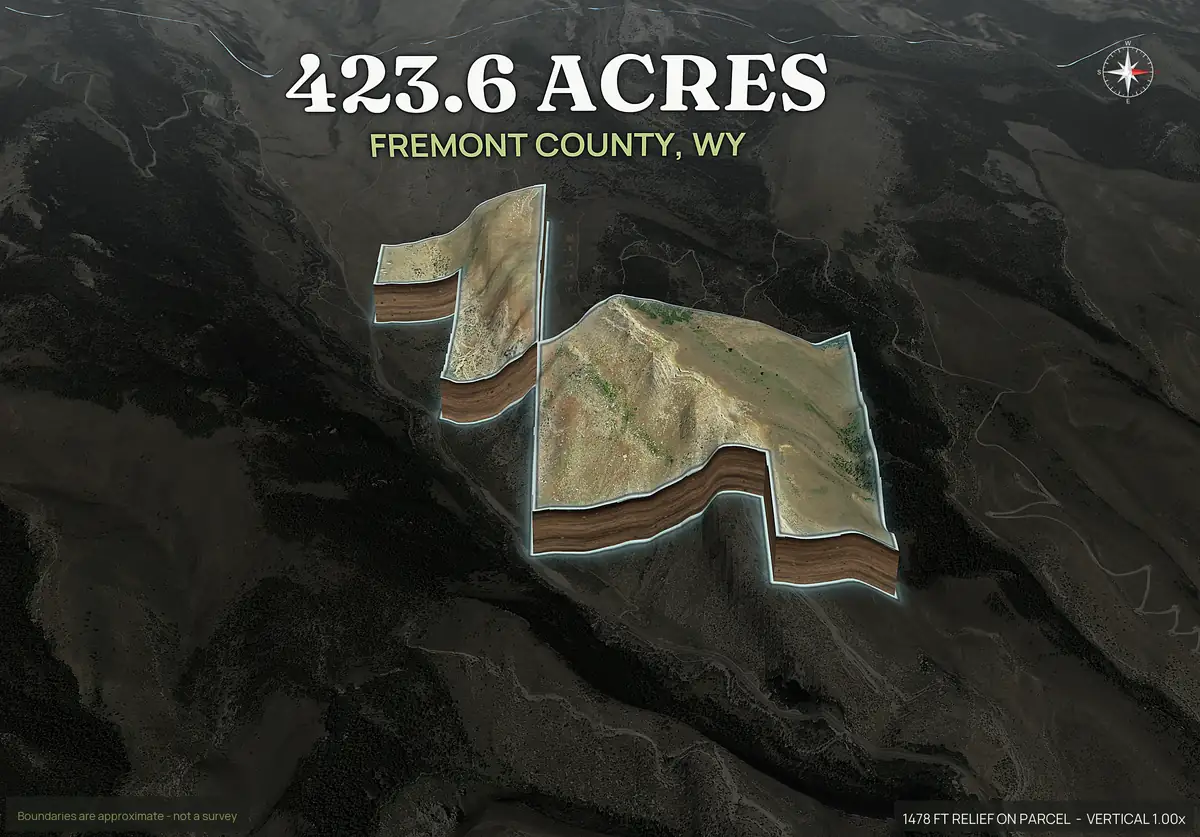
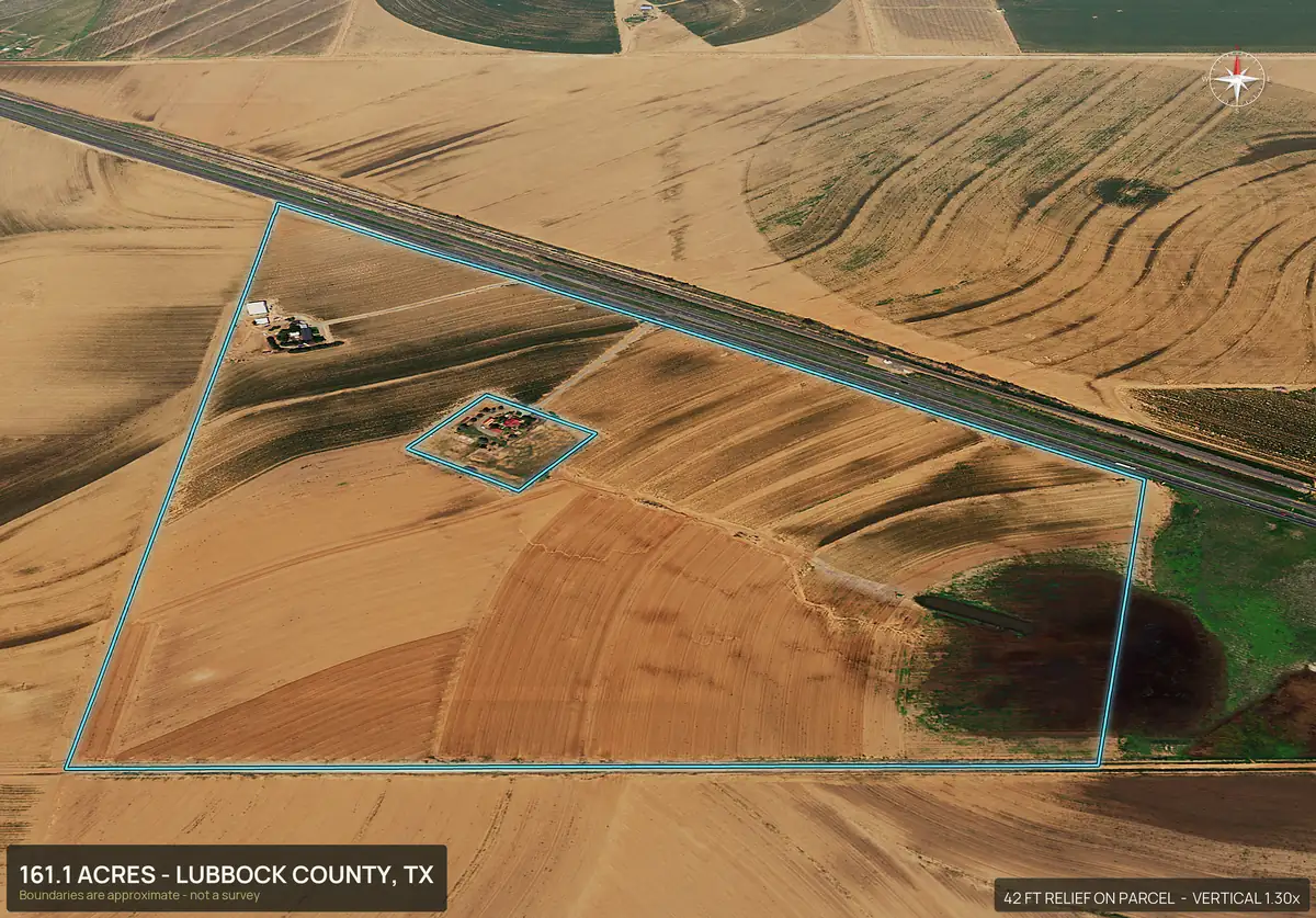
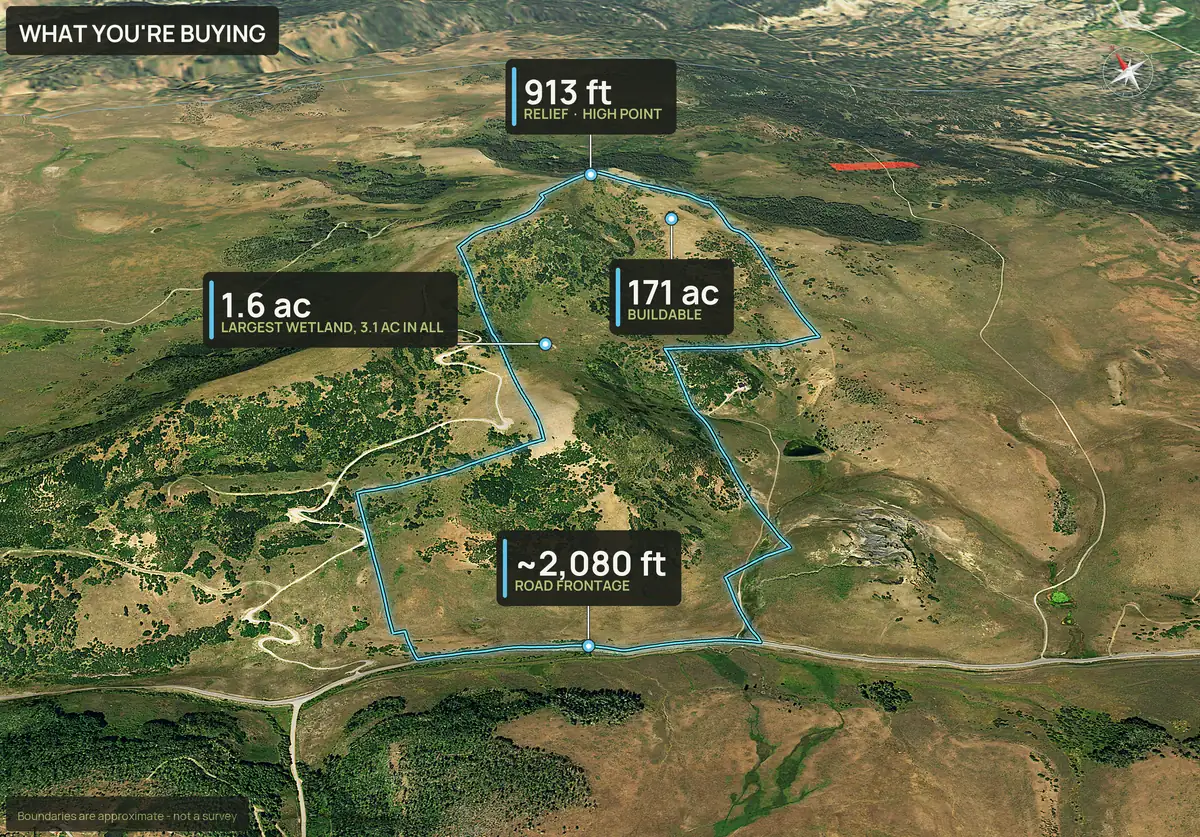
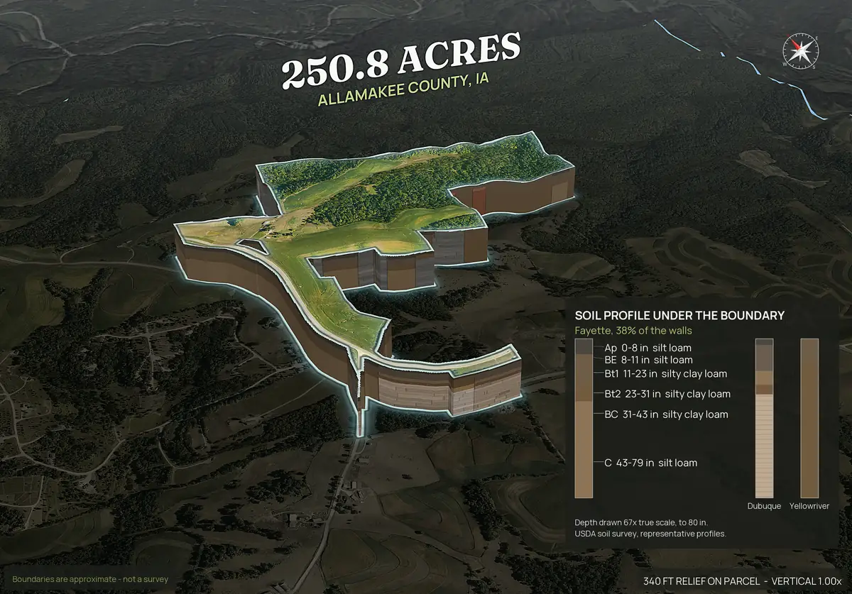
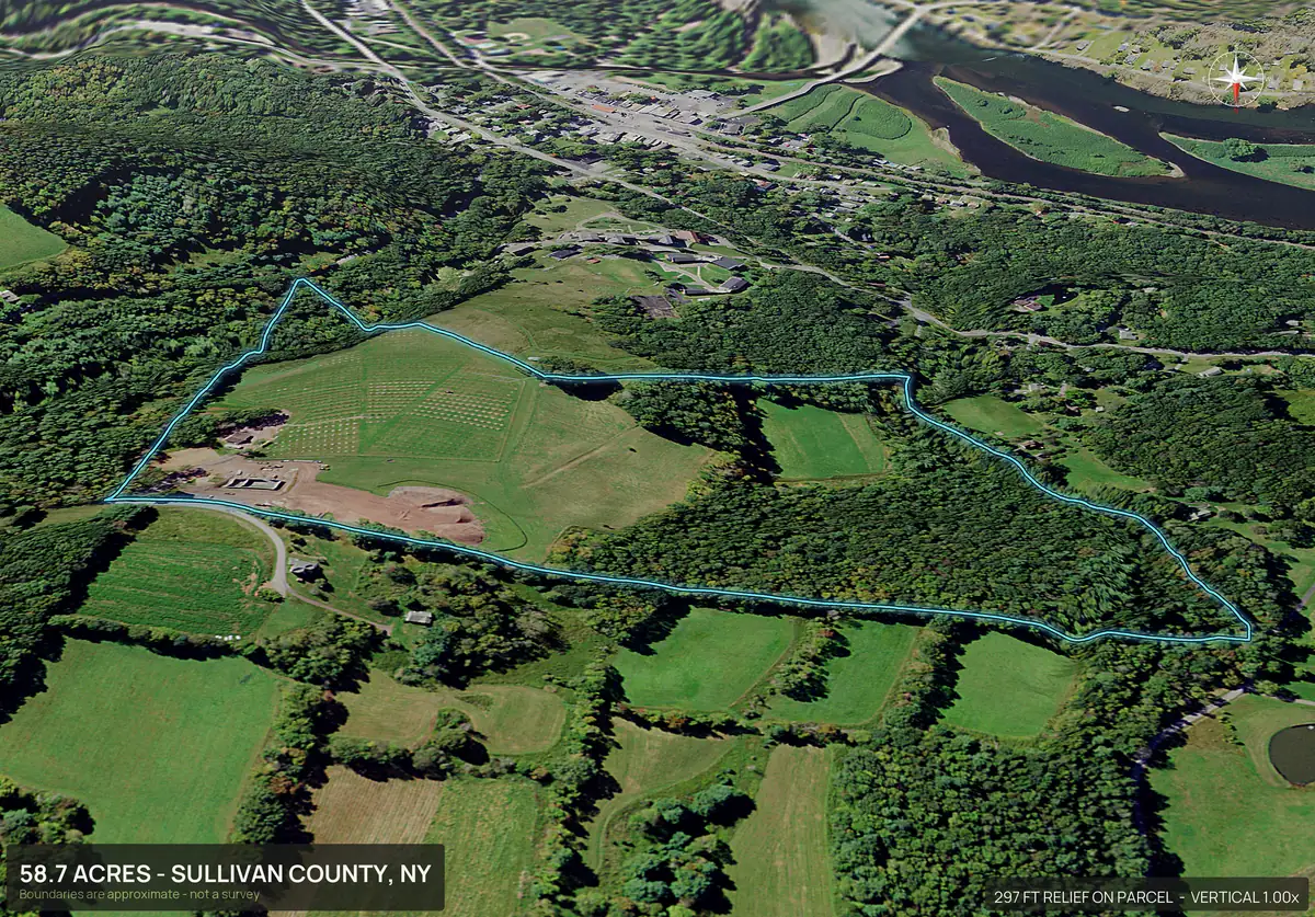
Rendered, not photographed. Each is a marketing rendering; boundaries are approximate and not a survey.
Where it fits in a land agent's week.
- Before the listing appointment.Run the APN and walk in with the aerial, the boundary and the topo already rendered. The seller sees the property the way a buyer will.
- The day the listing agreement is signed.The pack is ready in about ten minutes, not after a pilot's schedule opens. The listing goes live with real visuals on day one.
- On listing sites and the MLS.Every zip has full resolution files and a set sized for the MLS and listing sites. Paste the hosted page link into any virtual tour or video field a listing site offers.
- On social.The social kit is sized for Instagram and Facebook, so a new listing is a post the same afternoon.
- When a buyer calls.Text the listing page. It answers the first round of questions about access, water, slope and flood before anyone drives out.
ROI
The math against a drone shoot.
A rural drone shoot commonly runs $150 to $600 and typically takes five to nine days, weather permitting. A Paydirt pack is $79 a parcel, or PayDirt Pro is $199 a month for 20 packs. The table compares what a month costs at different listing volumes, using the low end of a drone shoot. A drone gives you real photographs of the ground today, and nothing renders that, so many agents run both and book the pilot only for the hero shot on a listing that earns it.
| Parcels a month | Paydirt at $79 each | PayDirt Pro (up to 20) | Drone shoot at $150 each |
|---|---|---|---|
| 1 | $79 | $199 | $150 |
| 2 | $158 | $199 | $300 |
| 3 | $237 | $199 | $450 |
| 5 | $395 | $199 | $750 |
| 10 | $790 | $199 | $1,500 |
Prices apply after launch; every pack is free for a limited time. Drone figures are typical rural quotes, not a DirtFlight price. PayDirt Pro is a hard cap of 20 packs a month with no roll-over; PayDirt Pro+ is 45 packs for $299. Fair use: your own listings and deals, not bulk resale.
Team use
Built for a team that lists land all year.
Your brand, not ours
On PayDirt Pro your logo goes on the imagery, the social kit and the shareable listing page, so what a buyer receives carries your brokerage. A single Paydirt pack is delivered unbranded.
Saved packs
Packs stay downloadable for 30 days. Rebuild anytime from your saved parcel ($9.95 Dirt, $19.95 Paydirt).
Two parcels, one tract
Enter APNs separated by commas and adjoining parcels merge into a single boundary, the way a buyer sees the ground.
Every county in the country
Type the APN, or draw the boundary on the map, or upload a KML, KMZ, GeoJSON or zipped shapefile, and the pack comes back the same. If a parcel will not come up from its number, you hear that before anything is charged.
No software to learn
It is not a mapping suite. You enter an APN and download the finished pack. Plenty of agents keep their mapping tool for research and use DirtFlight for the marketing.
Cancel any time
PayDirt Pro has no contract and no cancellation fee. The plan runs to the end of the month you paid for.
Each agent works from their own account today. Enterprise, with teams and seats, bulk import and higher volume, is custom: write to support@dirtflight.com.
Plans
Plans, from one parcel to a whole office.
Pay per parcel, subscribe as an agent, or put a team on an Enterprise arrangement. Anything marked coming soon is being built and is not part of the product today.
| Plan | Price | What it includes | Status |
|---|---|---|---|
| Dirt | $29 a parcel | Boundary outlined aerial, four 3D views, orbit video, hosted listing page, parcel info sheet and full resolution files. Delivered unbranded | Available |
| Paydirt | $79 a parcel | Everything in Dirt, plus road frontage hero, contour map, access and context maps, infrared view, social kit, pop-out photos, 3D explorer and measured buildability, flood, wetland, soils and septic, water and power layers. No custom branding, embeds or LiDAR views | Available |
| Subdivide / Multi-parcel pack | $149 for the whole tract plus up to 5 lots | A full Paydirt pack for the whole tract and one for each lot (up to 5), where a lot is an adjoining parcel you enter or a lot you draw or upload after the tract renders, each lot with its own listing page. Lots you draw or upload also get one sales page that shows every lot. 6 or more: contact us for a quote | Available |
| PayDirt Pro | $199 a month, 20 packs, $9.95 a pack | 20 Paydirt packs a month (hard cap, no roll-over), your logo on the imagery, the social kit and the listing page, embed code for your own site, LiDAR canopy and bare-earth views where LiDAR exists, and a due diligence flag summary | Available. Flag summary coming soon |
| PayDirt Pro+ | $299 a month, 45 packs, $6.64 a pack | 45 Paydirt packs a month (hard cap, no roll-over) and everything in PayDirt Pro | Available |
| Enterprise | Custom. Please reach out | Custom: teams and seats, Site Physicals measurements, the full Site Diligence Report (screening, not a survey or legal opinion), bulk import and higher volume | Site Physicals on request. Teams, seats and bulk import included. Site Diligence Report coming soon |
Prices apply after launch; every pack is free for a limited time. Enterprise is custom: write to support@dirtflight.com. Enterprise screening is not a survey or a legal opinion.
Honest limits
What it does not do.
- It is rendered, not photographed. The imagery is one to three years old for most parcels, so it shows the land as of the most recent aerial available for that county.
- Boundaries are approximate and are not a survey, so keep them out of legal descriptions and boundary disputes.
- It does not replace a drone for a hero shot, a survey, a title search or a site visit.
- A parcel that will not come up from its number is said so before anything is charged. Draw the boundary on the map or upload a file instead.
Every state, not just the big land markets.
Each state page lists the counties land buyers ask about most, geography notes and state specific answers.
Land markets with the most listings
Every state
Every state has a page, and DirtFlight works in every county in the country. Type the parcel number, or draw the boundary on the map or upload a file. See the coverage page.
- Alabama
- Alaska
- Arizona
- Arkansas
- California
- Colorado
- Connecticut
- Delaware
- Florida
- Georgia
- Hawaii
- Idaho
- Illinois
- Indiana
- Iowa
- Kansas
- Kentucky
- Louisiana
- Maine
- Maryland
- Massachusetts
- Michigan
- Minnesota
- Mississippi
- Missouri
- Montana
- Nebraska
- Nevada
- New Hampshire
- New Jersey
- New Mexico
- New York
- North Carolina
- North Dakota
- Ohio
- Oklahoma
- Oregon
- Pennsylvania
- Rhode Island
- South Carolina
- South Dakota
- Tennessee
- Texas
- Utah
- Vermont
- Virginia
- Washington
- West Virginia
- Wisconsin
- Wyoming
Straight answers
Questions people ask about this.
How much does DirtFlight cost for a land brokerage?
Dirt is $29 a parcel, Paydirt is $79 a parcel, and PayDirt Pro is $199 a month for 20 Paydirt packs. Three Paydirt parcels in a month already cost more than the plan. PayDirt Pro+ is $299 a month for 45 packs, and Enterprise is custom for teams and higher volume. Every pack is free for a limited time while we launch.
Can a land agent use DirtFlight images on the MLS and listing sites?
Yes. Every zip carries full resolution files of every view and a set sized for the MLS and listing sites. Check each listing site's own photo and link rules.
Can my brokerage logo go on the imagery?
Yes, on PayDirt Pro, PayDirt Pro+ and Enterprise. Your logo goes on the imagery, the social kit and the shareable listing page. A single Paydirt pack is delivered unbranded.
Is DirtFlight a replacement for a drone pilot?
No. A drone photographs the ground as it is today and DirtFlight renders the parcel from recent aerial imagery. DirtFlight is faster, cheaper per parcel, draws the boundary on every view and needs no airspace approval. Many listings use both.
How fast is a pack?
About ten minutes from the APN.
Do several agents in one brokerage need separate accounts?
Team accounts and seats under one bill are part of Enterprise, which is custom. Write to support@dirtflight.com.
What is in PayDirt Pro+ and Enterprise?
PayDirt Pro+ is $299 a month for 45 Paydirt packs, with everything in PayDirt Pro. Enterprise is custom and adds teams and seats, Site Physicals measurements, a full Site Diligence Report (a screening that is not a survey or a legal opinion), bulk import and higher volume. The Site Diligence Report is coming soon.
Is it accurate enough for a listing?
The boundary and acreage are fine for marketing and illustration. They are approximate and are not a survey.
Free for a limited time.
Make an account, enter an APN, and the pack renders in about ten minutes. After launch, Dirt is $29 a parcel, Paydirt is $79, PayDirt Pro is $199 a month for 20 Paydirt packs, and Pro+ is $299 for 45.
Start free