
DirtFlight / Land due diligence checklist
Guide
Land due diligence checklist: 14 things to check before you buy.
Buying vacant land means checking what you cannot see. Use this list, and see which items a screening pack covers and which need a professional.
Short answer
Land due diligence is the checking you do before closing: title and ownership, legal access, easements, zoning, taxes, utilities, soils and septic, flood and wetlands, slope and buildability, boundary and survey, mineral and water rights, covenants and environmental issues. A DirtFlight Paydirt pack screens the ground items in about ten minutes: slope, flood, wetland, soils and septic, water, power lines and road frontage. Title, survey, zoning, easements, minerals and percolation need a title company, surveyor, the county or an engineer. Buildable: ground outside mapped slope, flood and wetland areas. A screen, not a zoning, septic or permit approval.
The checklist, and who checks each item.
| Item | What to check | How it is covered |
|---|---|---|
| 1. Title and ownership | Clear title, liens, who must sign | Title company |
| 2. Legal access | Frontage on a public road or a recorded easement | Frontage is measured in Paydirt. Easements: deed and title search |
| 3. Boundary and survey | Where the lines are, encroachments | Approximate in DirtFlight. Surveyor for exact lines |
| 4. Zoning and land use | Allowed uses, minimum lot size, setbacks | County planning office |
| 5. Taxes | Current bill, any special assessments or rollback | County treasurer |
| 6. Utilities | Power, water, sewer or septic, internet | Power lines with voltage and distance are in Paydirt. Others: providers |
| 7. Soils and septic | Soil limitations for a drain field | Screened per soil map unit in Paydirt. Percolation test: licensed professional |
| 8. Flood | Flood zone, how many acres | Measured in acres in Paydirt |
| 9. Wetlands | Mapped wetland, permits to build near it | Mapped wetland acres in Paydirt. Delineation: specialist |
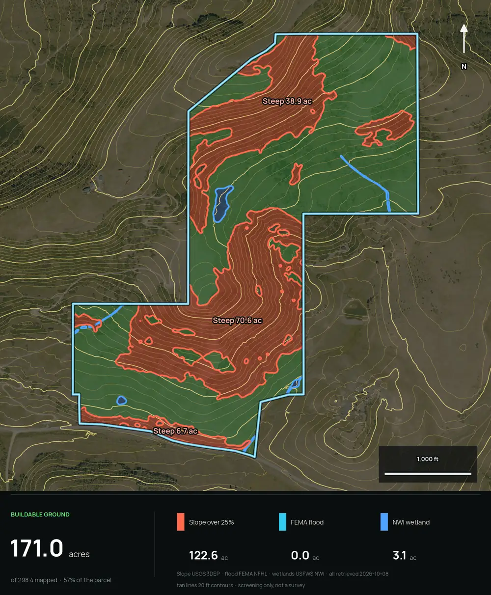
| 10. Slope and buildability | Flat ground for a home, drive or pad | Buildability by slope in Paydirt, plus the contour map |
| 11. Water features | Streams, ponds, perennial or not | Streams and ponds drawn in Paydirt |
| 12. Mineral, timber and water rights | What conveys with the land | Title company and deed |
| 13. Covenants and HOA | Restrictions, fees, architectural rules | Deed, recorded covenants |
| 14. Environmental | Past dumping, tanks, contamination | Environmental assessment if there is a concern |
Screening example
A parcel with real constraints.
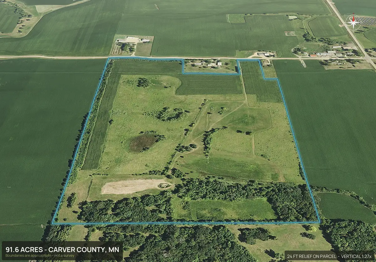
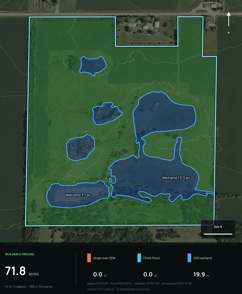
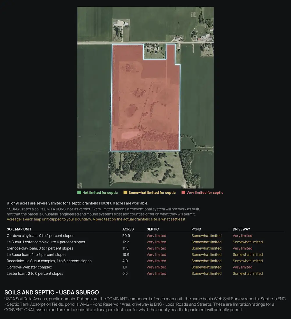
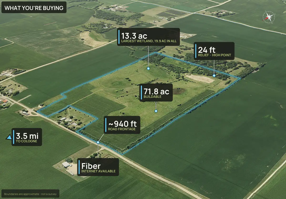
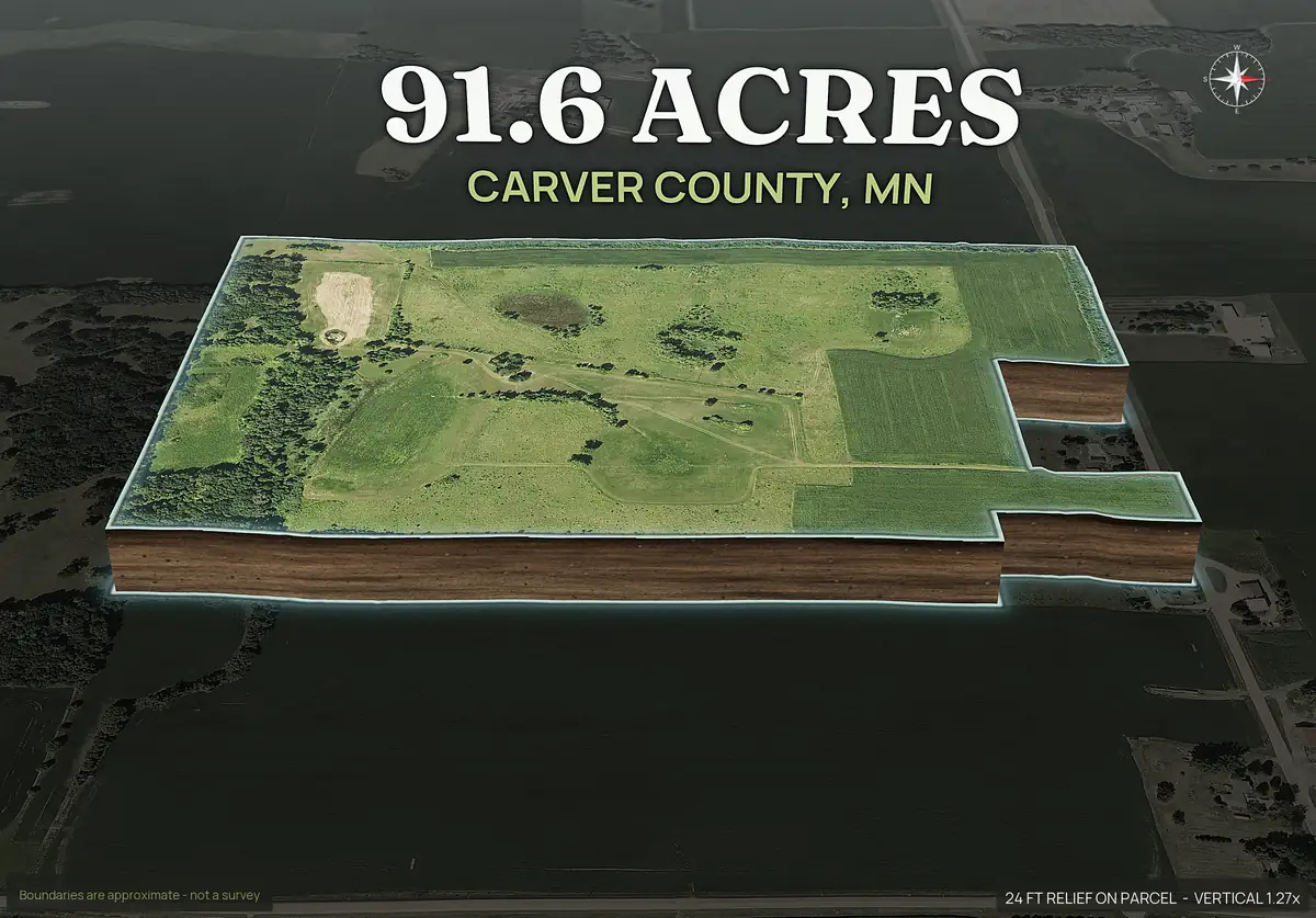
This 92 acre farm looks like open, flat pasture. The screening says otherwise: about 20 acres of mapped wetland, the nearest public water and sewer about three miles away, and soils rated very limited for a conventional septic field. That is the kind of answer to get before an offer.
Why screen the ground first.
The cheap, fast checks come first. If a parcel is mostly floodplain or steep, you can walk away before paying for a survey or a title search. A pack takes ten minutes and is free for a limited time, then $29 or $79 a parcel. Deal makers who look at many parcels use PayDirt Pro at $199 a month for 20 packs.
Utilities, mapped.
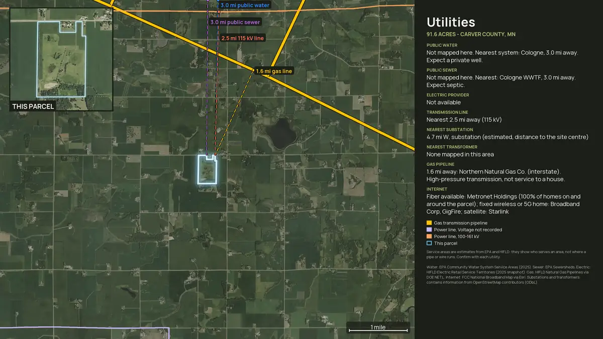
The utilities panel shows the nearest public water and sewer service areas, power lines with voltage and distance, gas, and internet, with the distance to each from the parcel. Where a service area does not reach, it says so, and the answer is a well and a septic system.
Service areas are estimates. Confirm with each utility.
Enterprise
Enterprise: Site Diligence Report.
coming soon, screening only
The 14 items above are the buyer's list. The Enterprise Site Diligence Report is a longer screening, for land buyers and lenders who want the flags before they spend on professionals. It is not a survey, an environmental assessment, an engineering study or a legal opinion, and it does not replace any of them. It is not built yet, and the plan is priced by quote; write to support@dirtflight.com.
What the report is planned to screen:
- Flood zone detail and base flood elevation
- Superfund, brownfield and regulated sites nearby
- Wildfire
- Seismic
- Landslide
- Radon
- Natural-hazard risk
- Foundation and shrink-swell soils
- Depth to bedrock and water table
- Hydric soils
- Access and driveway grade
- Drainage low spots
- Cropland history
- Protected lands and conservation easements
- Critical habitat
- School district
- Demographics
- Permit checklist links
Flags can lag the ground and vary by county. Treat every flag as a reason to ask a professional, not an answer.
What a screening pack cannot do.
- It is not a survey, a title opinion, a wetland delineation or a percolation test.
- It can lag the ground, and its imagery is one to three years old for most parcels.
- It does not show easements, liens, zoning or mineral rights.
Related.
How to list land for sale · Topo map of a property · Farmland · Hunting land
Straight answers
Questions people ask about this.
What is land due diligence?
The checking a buyer does before closing: title, access, zoning, utilities, soils, flood, wetlands, slope and the boundary.
What should I check before buying vacant land?
Start with legal access, title, flood and wetlands, slope and a septic-suitable site. Then zoning, utilities, taxes, covenants and rights.
How long does due diligence on land take?
Screening takes minutes. A survey, title work and percolation testing can take weeks, and contracts commonly set the window.
Can I check flood and wetlands online?
Yes. DirtFlight measures flood zone and mapped wetland in acres inside the boundary on Paydirt. Confirm with the county for a building decision.
Does DirtFlight replace a survey?
No. Boundaries are approximate and are not a survey.
What is the Enterprise Site Diligence Report?
A planned screening for land buyers and lenders covering flood detail and base flood elevation, regulated sites nearby, wildfire, seismic, landslide, radon, soils, bedrock and water table, access and drainage, protected lands and habitat, and permit links. It is coming soon, is screening only, and is not a survey or a legal opinion.
Free for a limited time.
Make an account, enter an APN, and the pack renders in about ten minutes. After launch, Dirt is $29 a parcel, Paydirt is $79, PayDirt Pro is $199 a month for 20 Paydirt packs, and Pro+ is $299 for 45.
Start free