
DirtFlight / Farmland and ranches
Farmland and ranches
Farm and ranch listings that show the soil, slope and water.
Buyers of farm and ranch ground ask about soils, drainage, flood and what can be built. DirtFlight measures those inside the boundary and shows them on the aerial.
Short answer
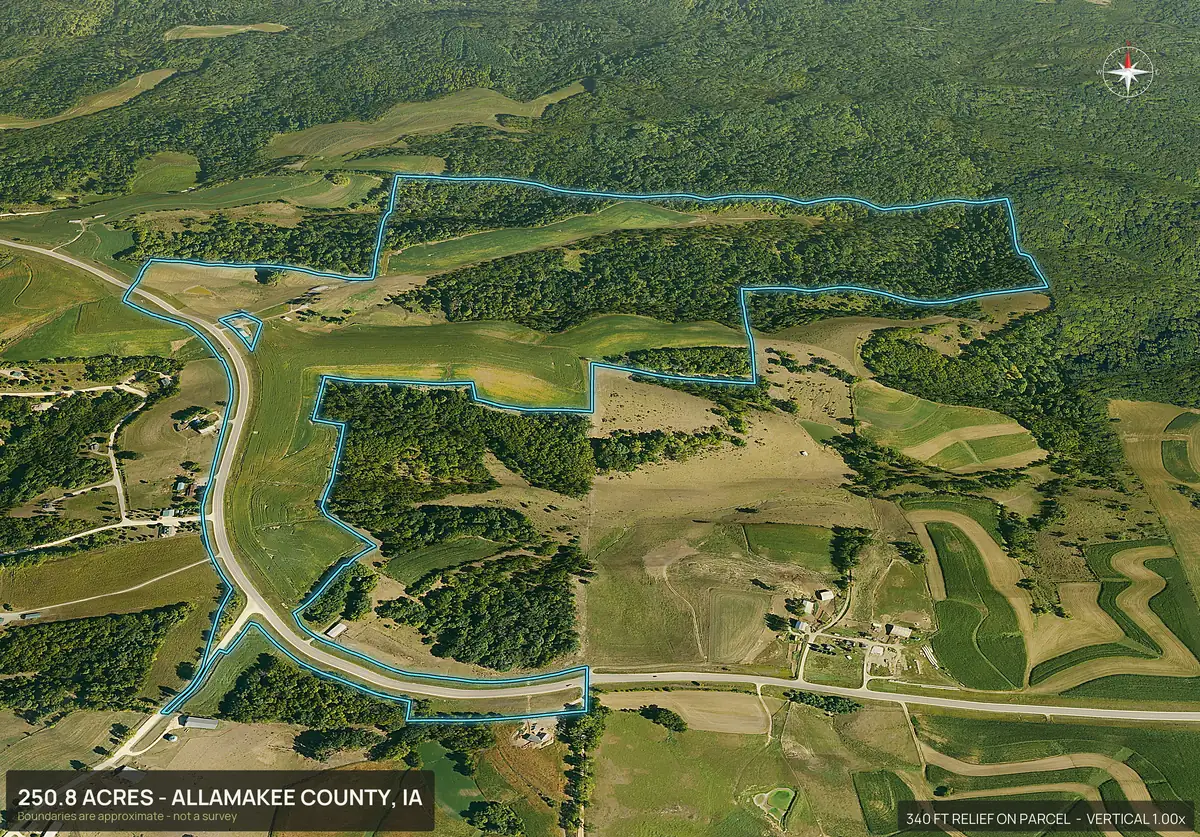
A DirtFlight pack for farm and ranch ground shows the parcel boundary on an aerial and in 3D, with soils and septic limitations per soil map unit, buildability by slope, flood zone and wetland measured in acres, streams and ponds, power lines and a contour map. The aerial shows field edges, timber and water at a glance. It does not report yields, tillable acres or a productivity rating, so use county and soil survey records for those. Boundaries are approximate and are not a survey.
Paydirt layers
The ground facts, in acres.
Soils
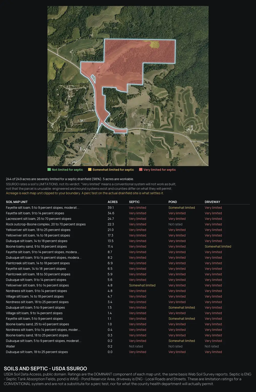
Soil map units inside the boundary, with septic limitations for each, so a buyer sees where a home site is easier.
Slope
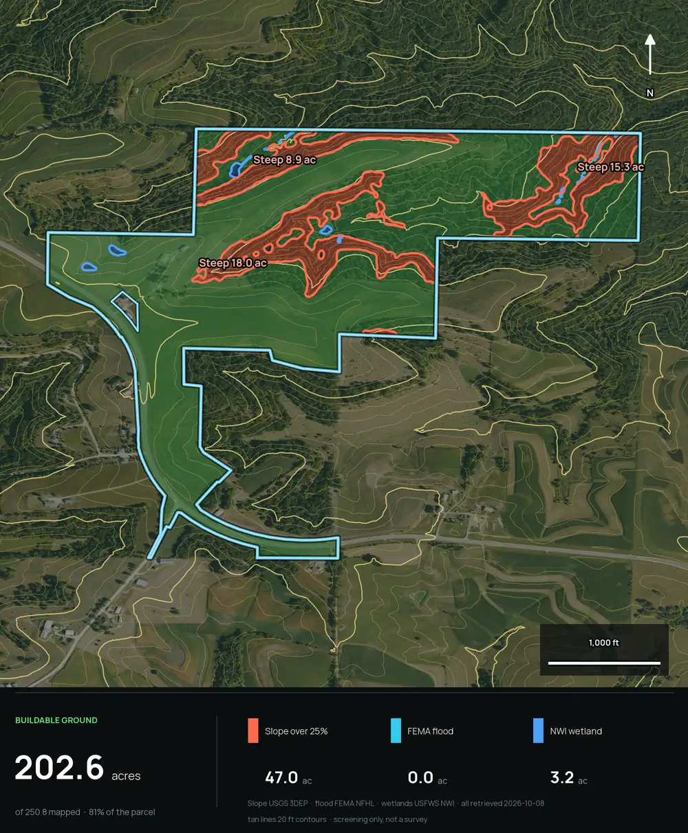
Buildability by slope reports acres that are flat enough to build on, and the contour map shows the lay of the land. Buildable: ground outside mapped slope, flood and wetland areas. A screen, not a zoning, septic or permit approval.
Flood and wetland
Flood zone and mapped wetland are measured in acres inside the boundary.
Water
Streams and ponds, perennial told apart from intermittent.
Power
Power lines with voltage and distance to the boundary.
Frontage
Road frontage on named public roads, so a buyer sees how the tract is reached.
Soils and buildability
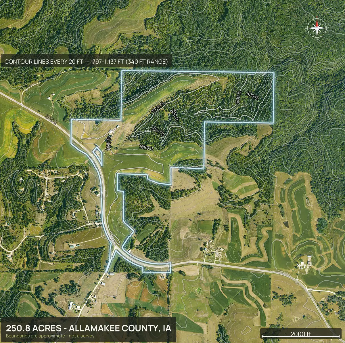
Soils and buildability on a rolling Iowa farm.
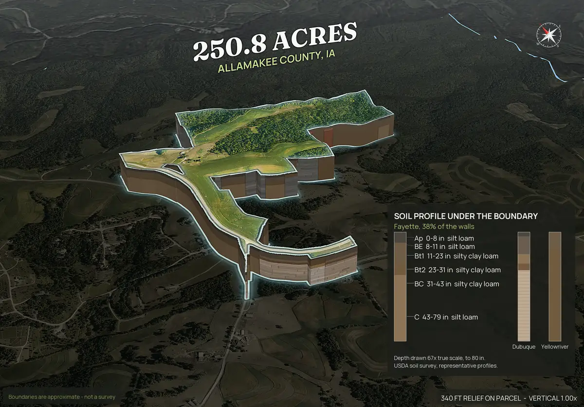
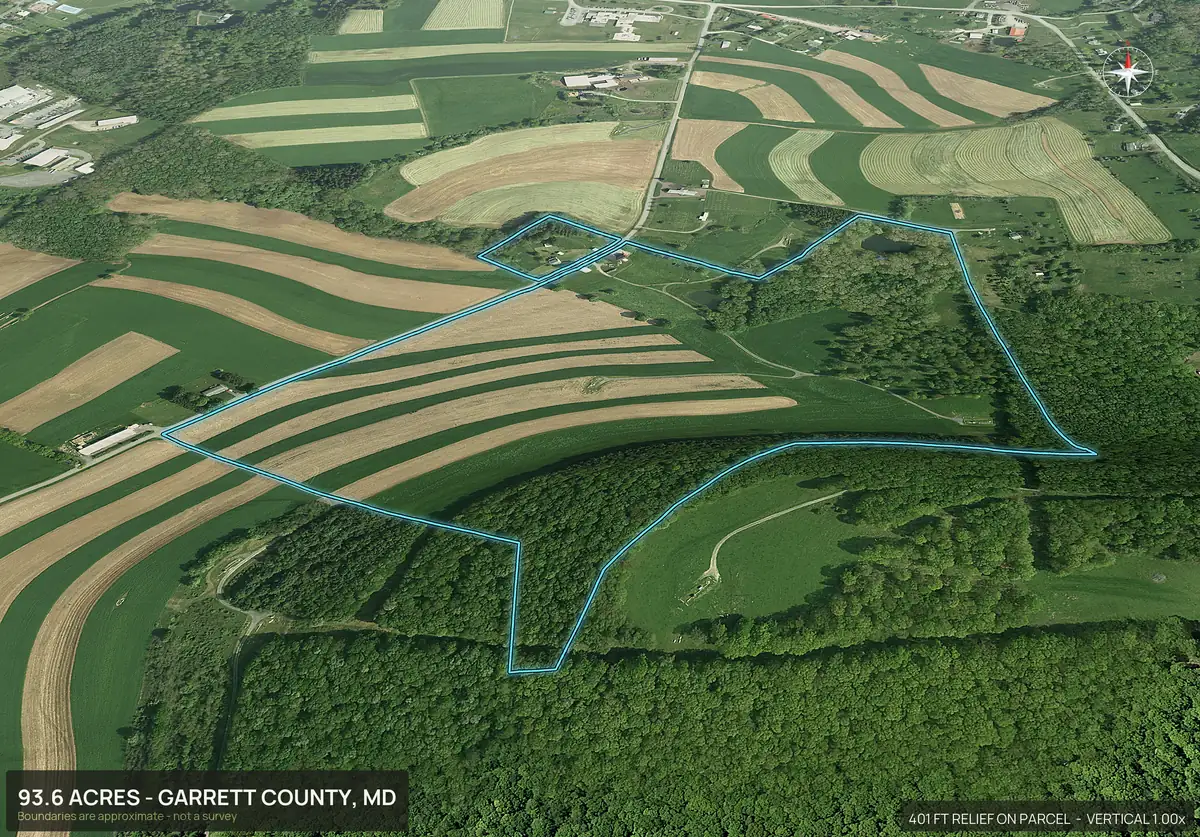
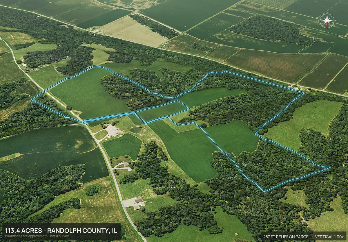
A mixed tract of cropland, pasture and timber on the Driftless hills, with the same set a buyer asks for: soils under the boundary, steep ground, flood and wetland.
Why drainage and slope questions come first.
On farm and ranch ground the same questions repeat: how much of this floods, where does the water leave, and can I put a house on it. The flood and wetland acres, the stream layer and the slope map answer those from the listing page. They are screening facts. Tile, ditches, ratings and yields come from the seller, the county and the soil survey, and a buyer should confirm them.
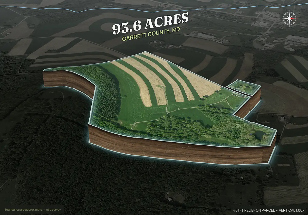
Contoured fields and rounded edges.
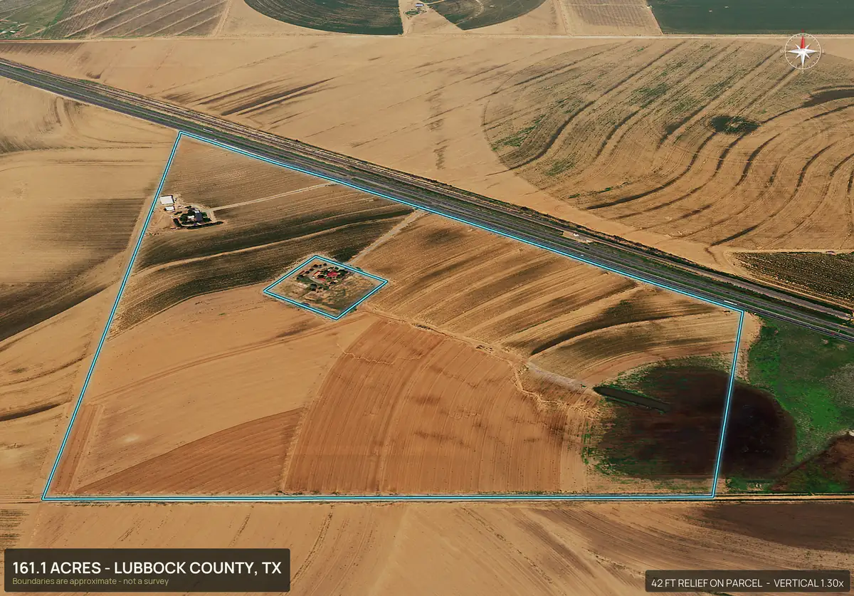
On rolling ground the field lines follow the slope. The 3D views show how strips, terraces and pivots sit on the hills, and the contour map shows the grade under them.
Mixed tracts and adjoining parcels.
Farms are often sold as several parcels. Enter the APNs separated by commas and adjoining parcels merge into one boundary and one pack. If the plan is to split a tract, the app can also produce a pack per lot from a plat PDF or drawn lots.
Farm and ranch land in every state.
Every county in every farm and ranch state works the same way: type the parcel number, or draw the boundary on the map or upload a file.
Farm and ranch states
Every state
Every state has a page, and DirtFlight works in every county in the country. Type the parcel number, or draw the boundary on the map or upload a file. See the coverage page.
- Alabama
- Alaska
- Arizona
- Arkansas
- California
- Colorado
- Connecticut
- Delaware
- Florida
- Georgia
- Hawaii
- Idaho
- Illinois
- Indiana
- Iowa
- Kansas
- Kentucky
- Louisiana
- Maine
- Maryland
- Massachusetts
- Michigan
- Minnesota
- Mississippi
- Missouri
- Montana
- Nebraska
- Nevada
- New Hampshire
- New Jersey
- New Mexico
- New York
- North Carolina
- North Dakota
- Ohio
- Oklahoma
- Oregon
- Pennsylvania
- Rhode Island
- South Carolina
- South Dakota
- Tennessee
- Texas
- Utah
- Vermont
- Virginia
- Washington
- West Virginia
- Wisconsin
- Wyoming
Straight answers
Questions people ask about this.
Does DirtFlight show soil types on a farm listing?
Yes, on Paydirt. Soil map units inside the boundary are shown with septic limitations for each.
Does it give tillable acres or crop yields?
No. It gives total acreage inside the boundary and the ground facts above. Use county records and the soil survey for productivity ratings and tillable acres.
Can it show how much of a farm is in a flood zone?
Yes. Flood zone and mapped wetland are measured in acres inside the boundary.
Can I combine several parcels into one farm pack?
Yes. Enter the APNs separated by commas and adjoining parcels merge into one boundary.
Does it work in my county?
Yes, every county in the country. Type the APN, or draw the boundary on the map or upload a KML, KMZ, GeoJSON or zipped shapefile, and you hear before anything is charged if a parcel will not come up from its number.
Free for a limited time.
Make an account, enter an APN, and the pack renders in about ten minutes. After launch, Dirt is $29 a parcel, Paydirt is $79, PayDirt Pro is $199 a month for 20 Paydirt packs, and Pro+ is $299 for 45.
Start free