
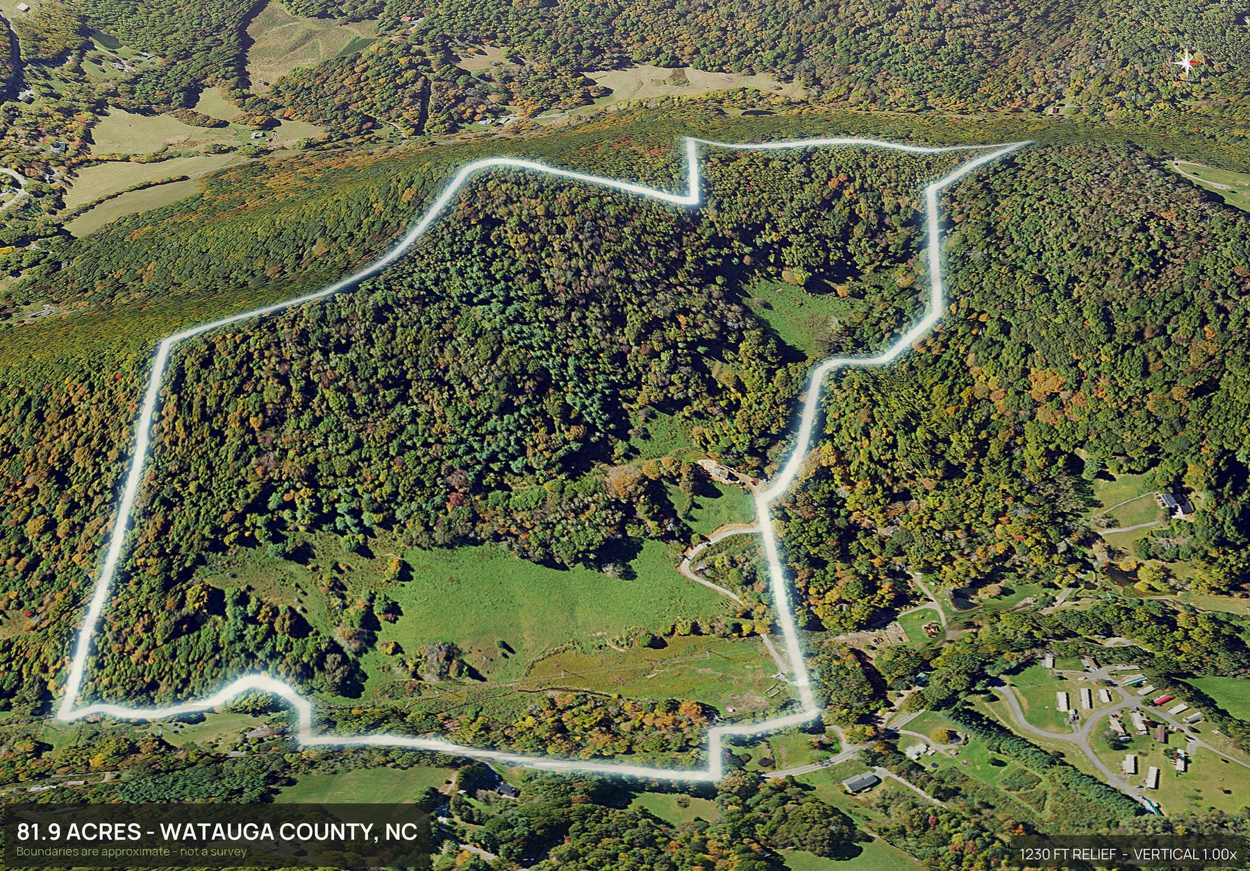
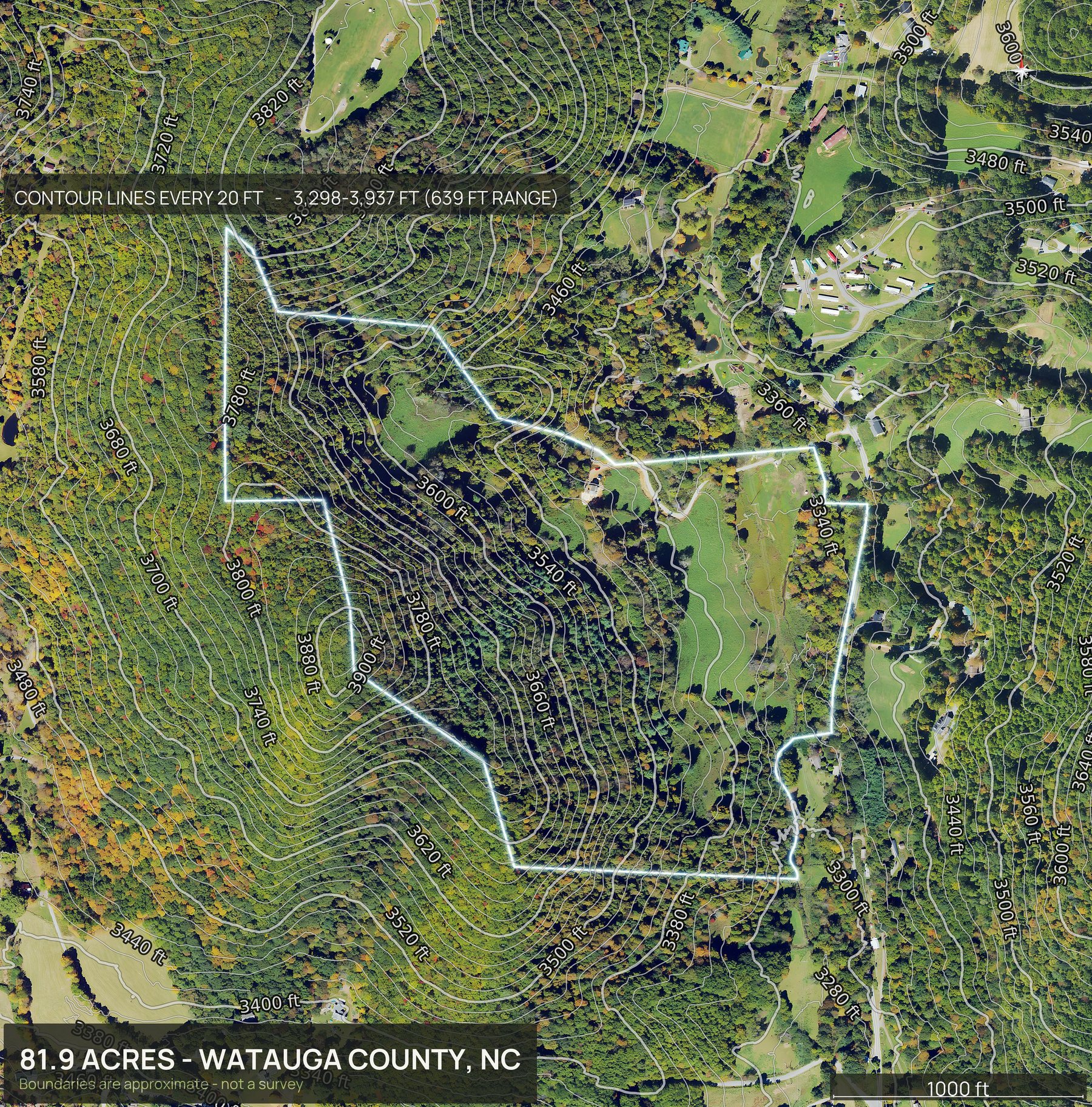
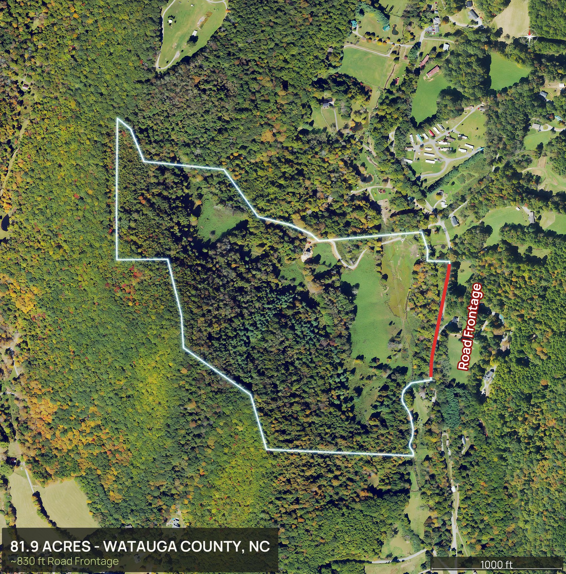
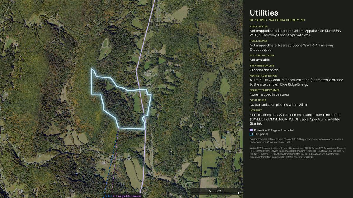
DirtFlight is not a drone photography service. To get aerial photos of land in North Carolina, enter the county and the APN, or draw the boundary on the map or upload a file. The pack renders in about ten minutes: an outlined top down, four cardinal 3D views, an 18 second orbit video, a hosted listing page and a parcel info sheet, with full resolution files of every view. Nobody flies out, so there is no travel charge, and it works anywhere in North Carolina. Dirt is $29 a parcel and Paydirt $79, or $199 a month for PayDirt Pro (20 Paydirt packs a month). Paydirt adds a contour map, the road frontage hero, the infrared land health view, the full social kit with platform captions, a posting plan and silent reels, pop-out photos from nine directions, the interactive 3D explorer and the measured diligence layers.
- Coverage
- All of North Carolina
- Turnaround
- About 10 minutes
- Travel charge
- None, ever
- Imagery age
- One to three years
Mountains, piedmont and blackwater, in one state.
North Carolina buyers ask three different questions depending on where the tract sits. In the mountains it is slope and a building site. In the piedmont it is timber and frontage. Down east it is drainage and how much of it stays wet. One aerial pack answers all three.
A tract in Ashe County renders in the same ten minutes as a lot in Wake County, and slope, planted pine and wet ground read clearly from above.
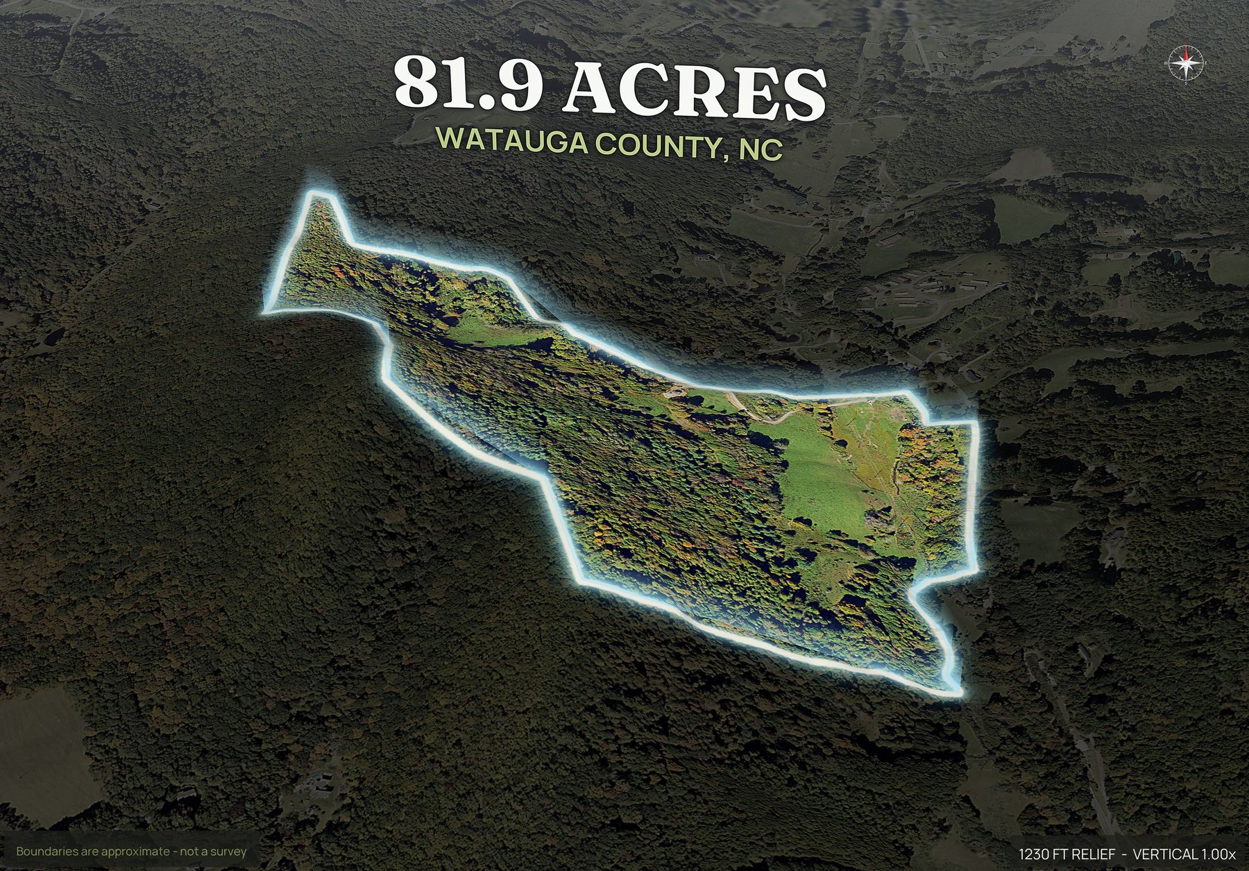
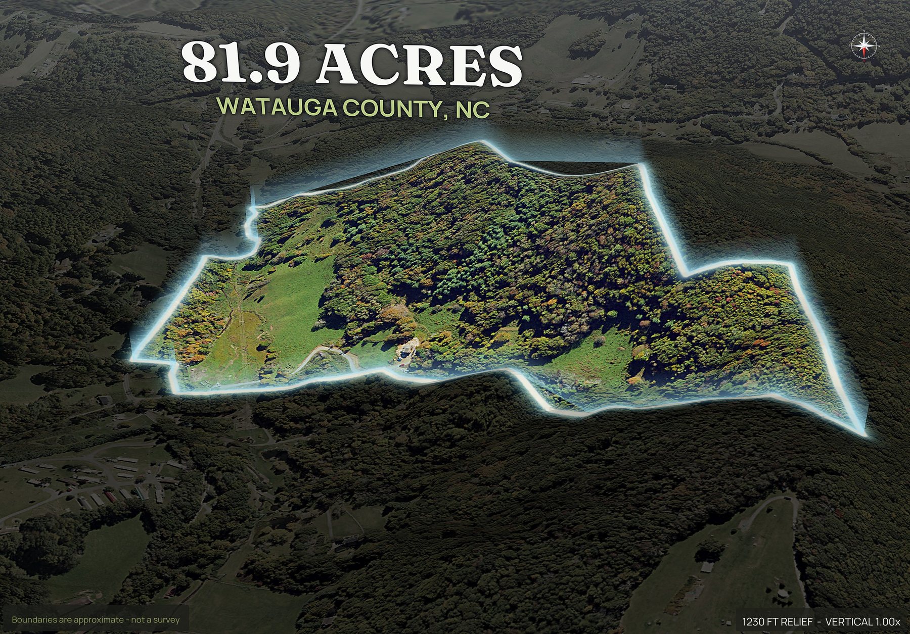
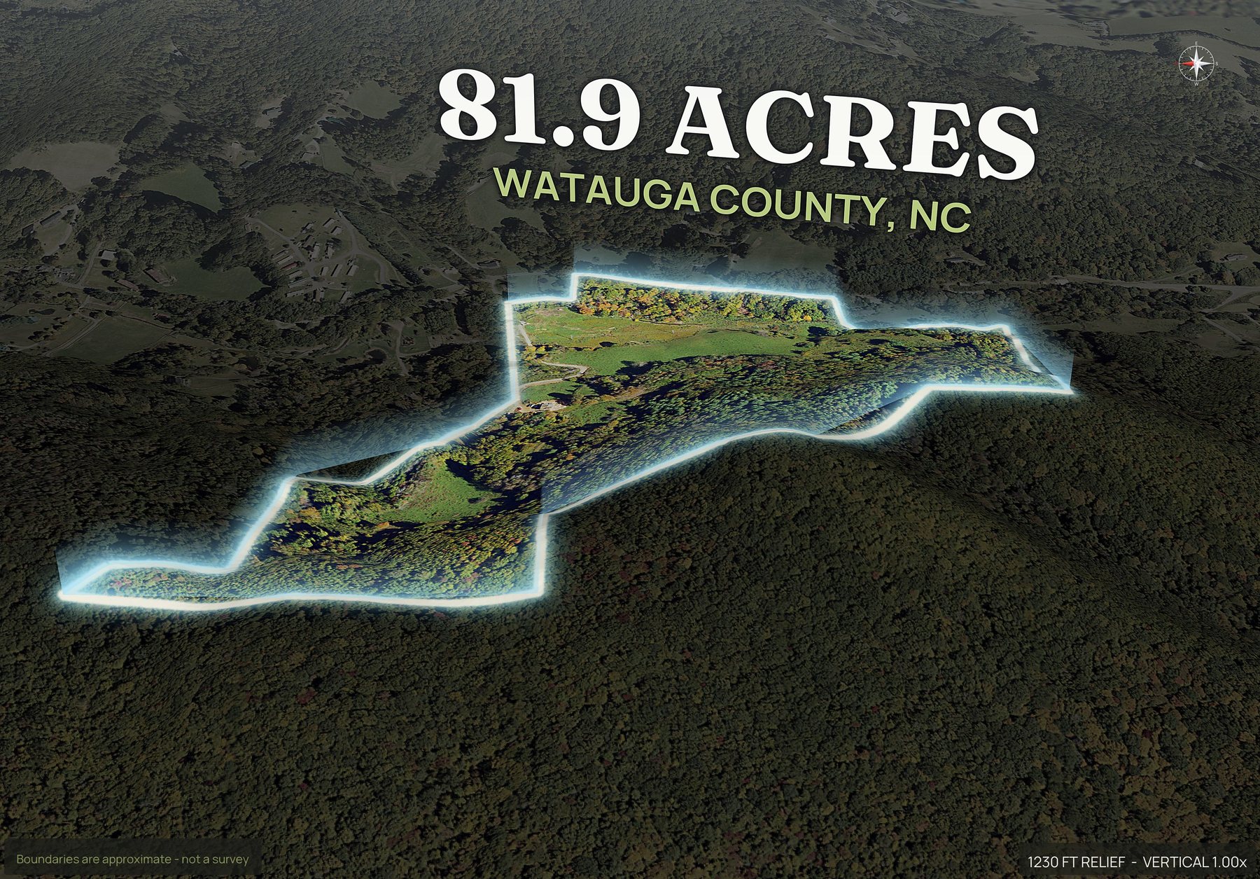
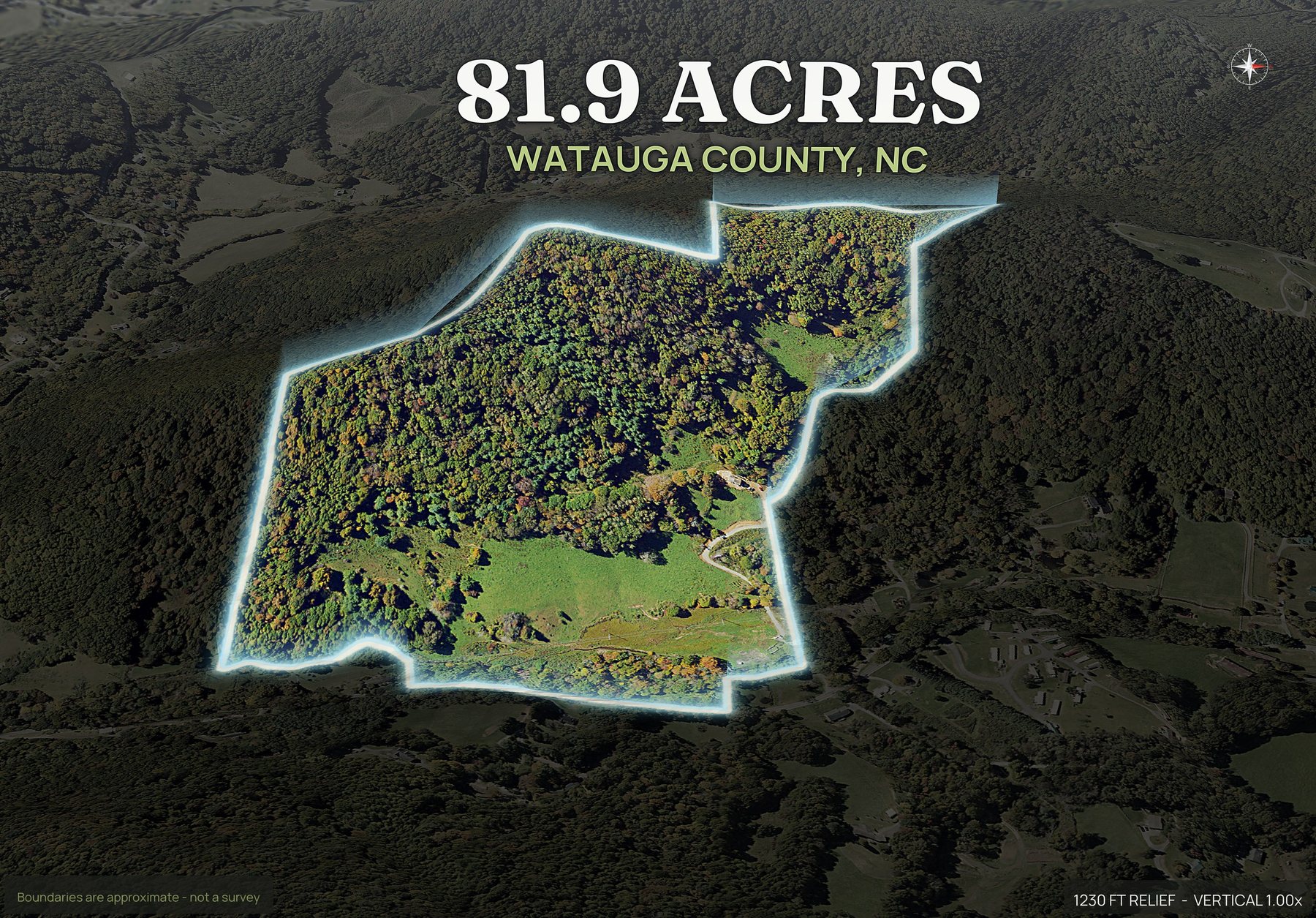
Boundaries are approximate and are not a survey.
One parcel. Everything below.
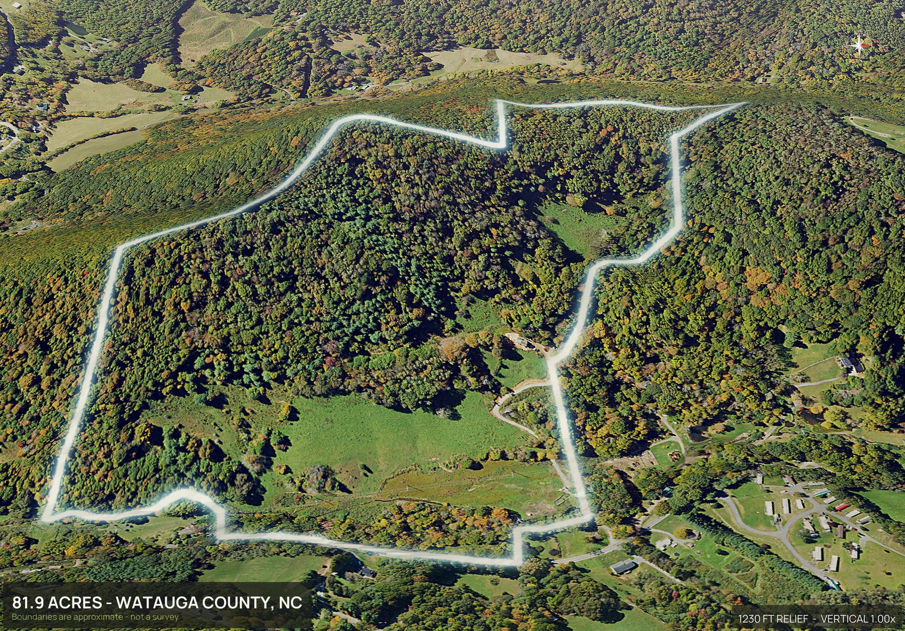
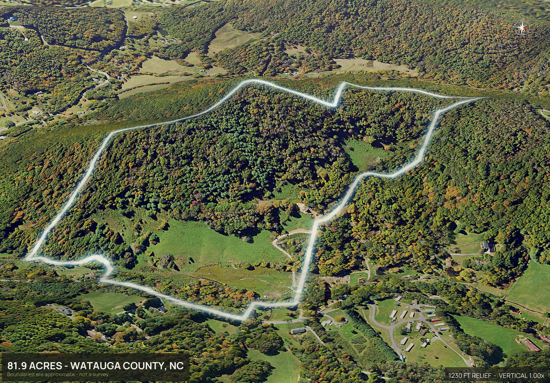
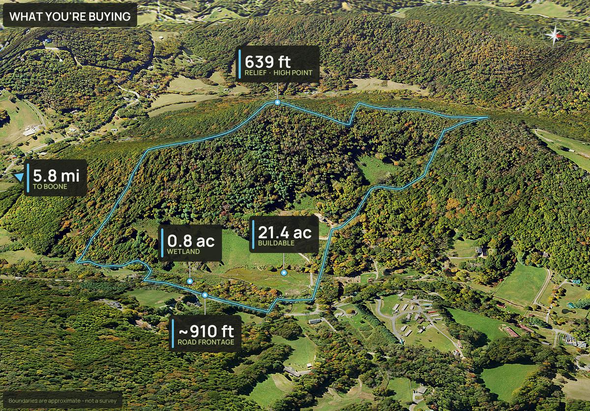
One parcel. Hardwood on the upper slope, a cleared bench with a view to the south, and a gravel road switching up from the state road.
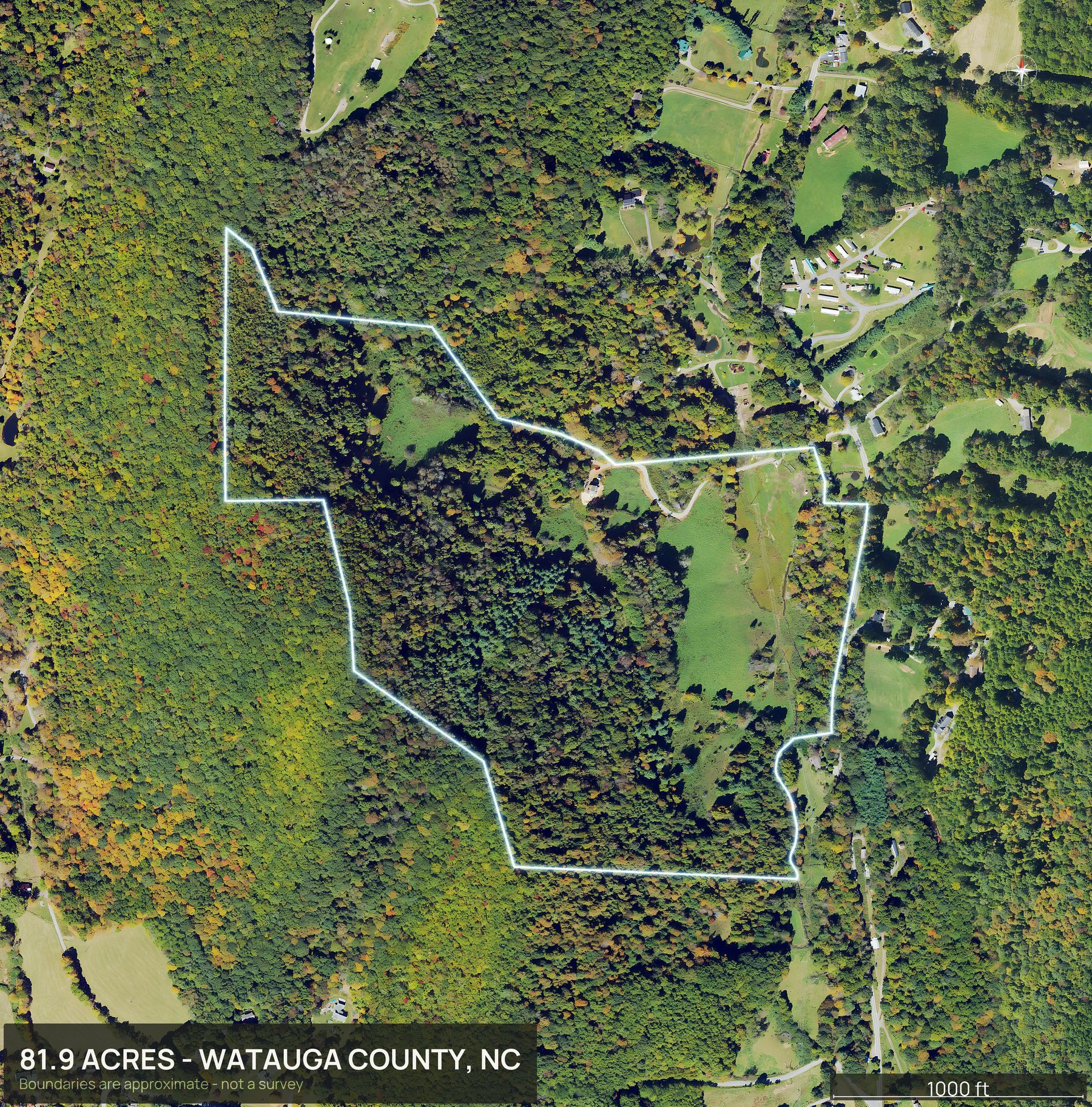
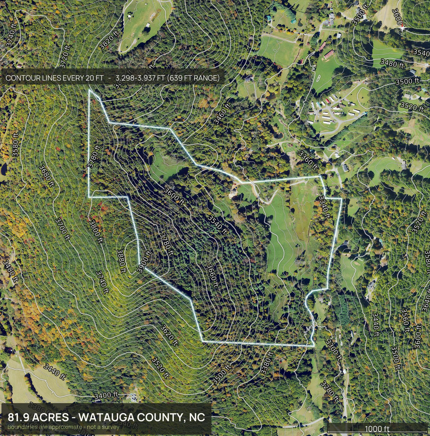
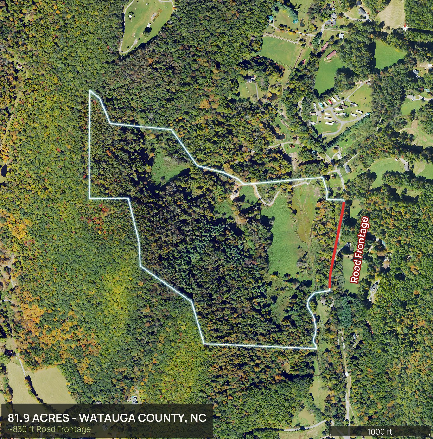
Everything in the pack
This is the whole North Carolina delivery.
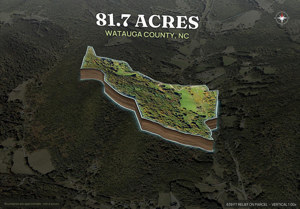
Every view below came back from one parcel, in about ten minutes, with no pilot and no site visit.
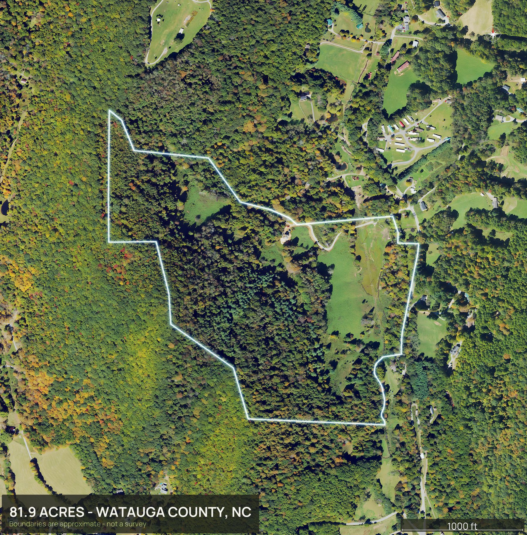
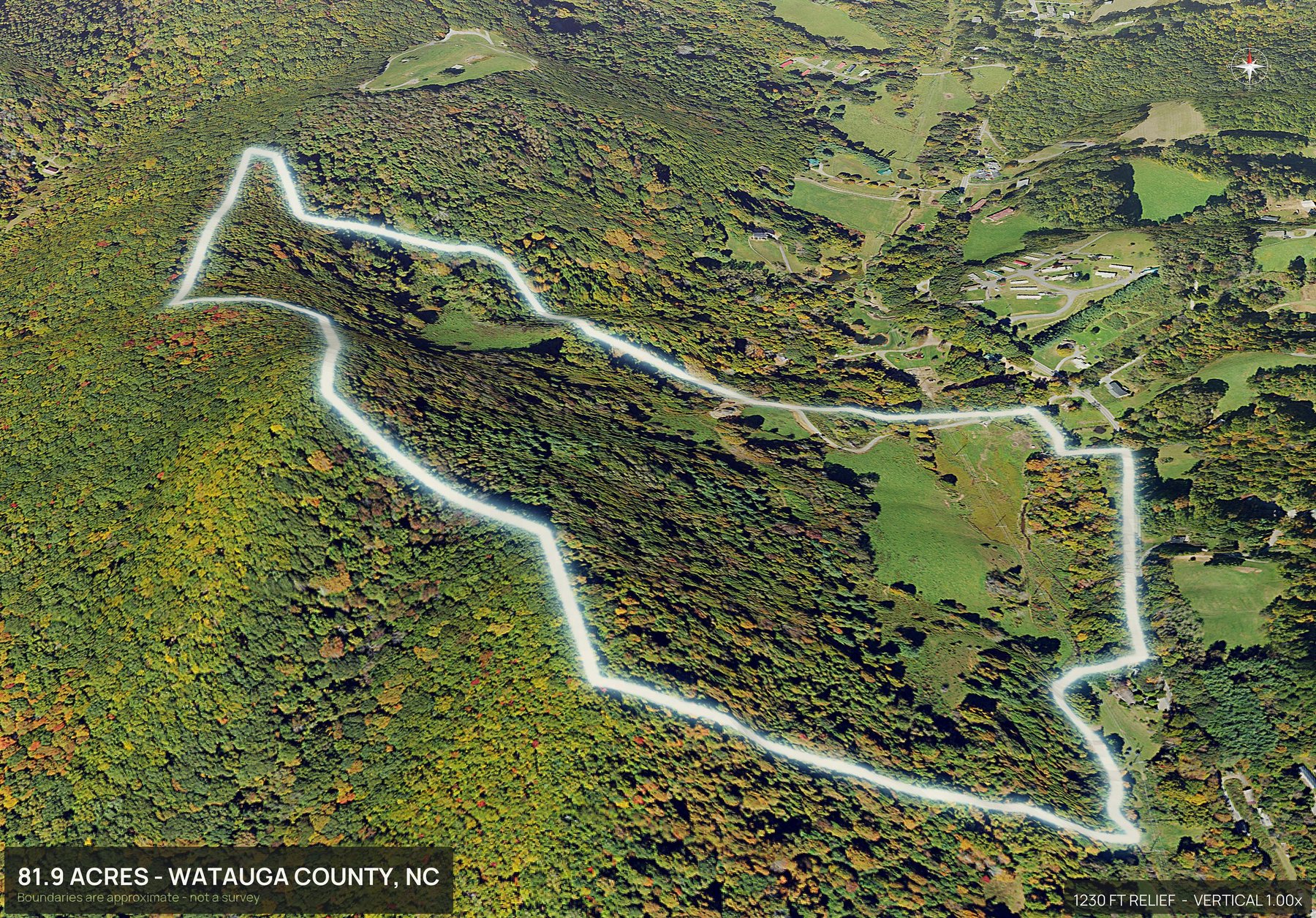
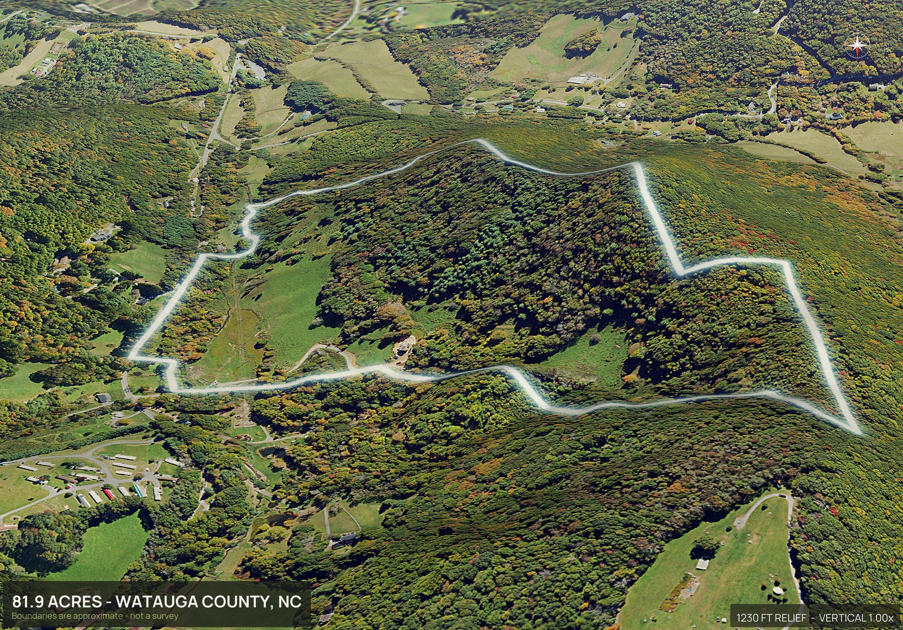
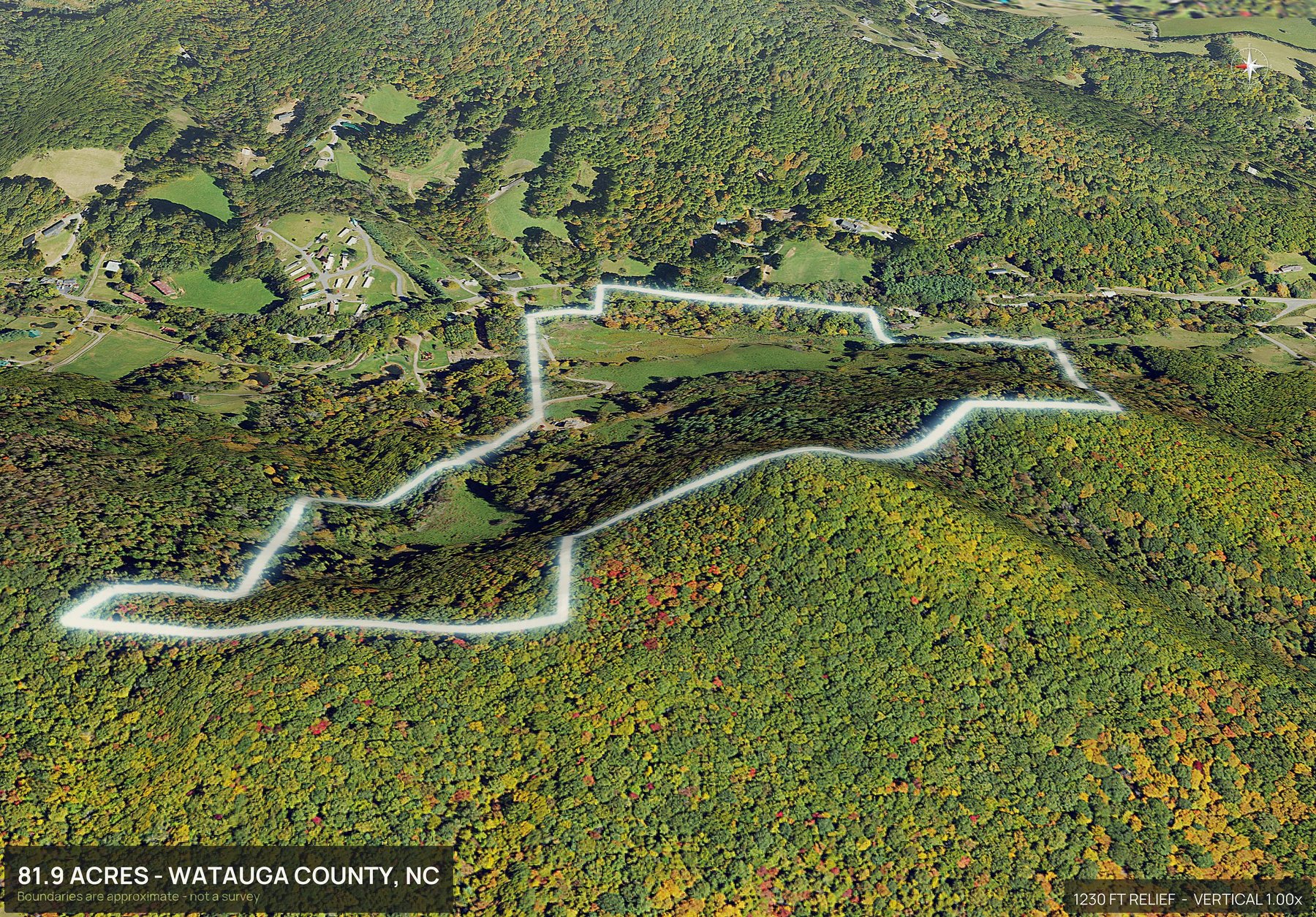
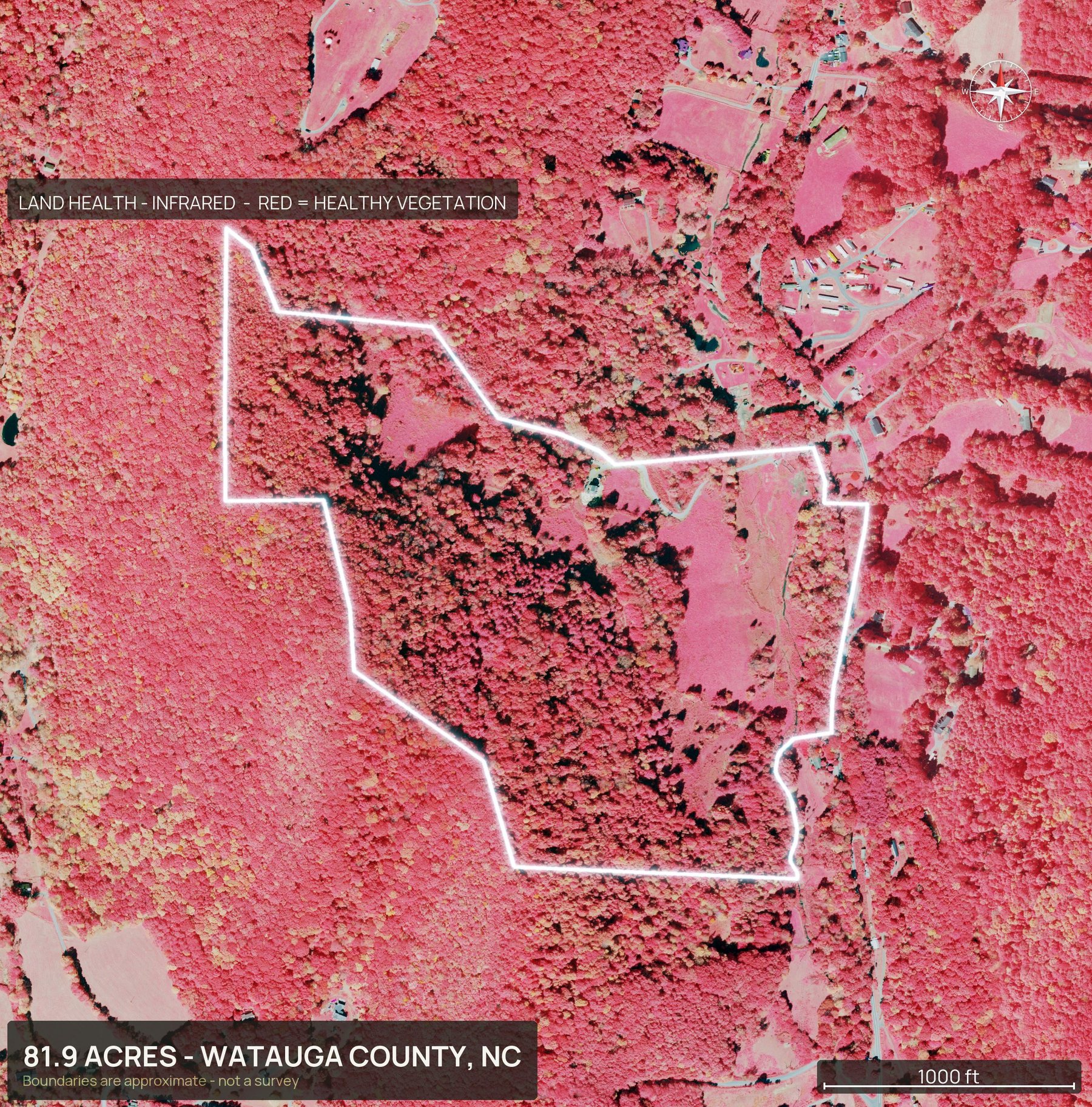
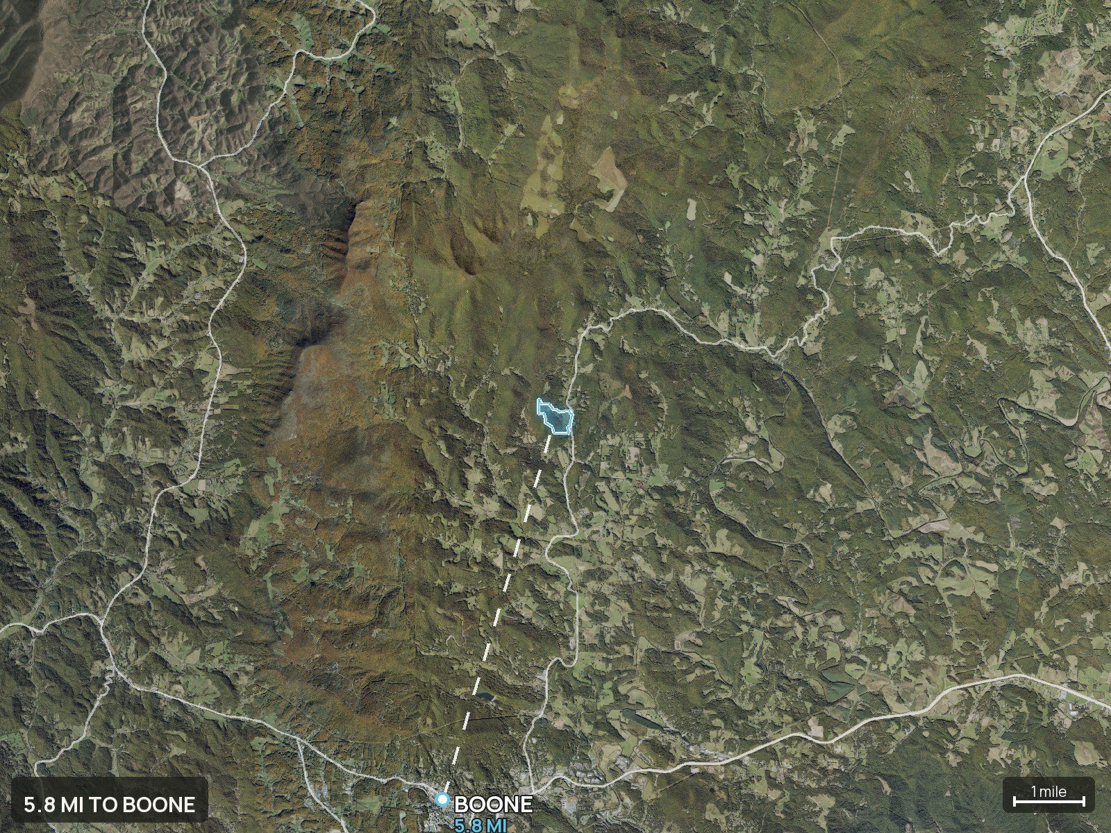
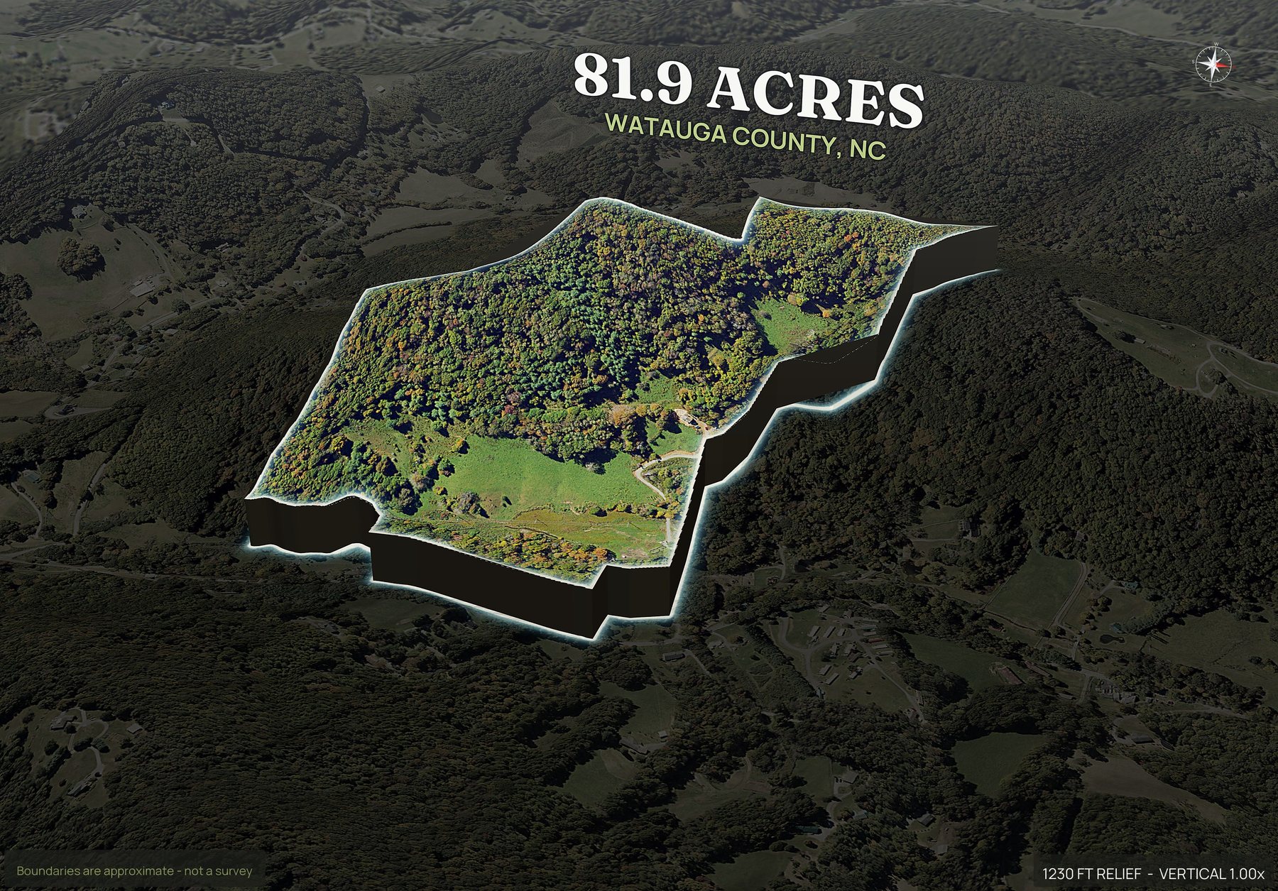
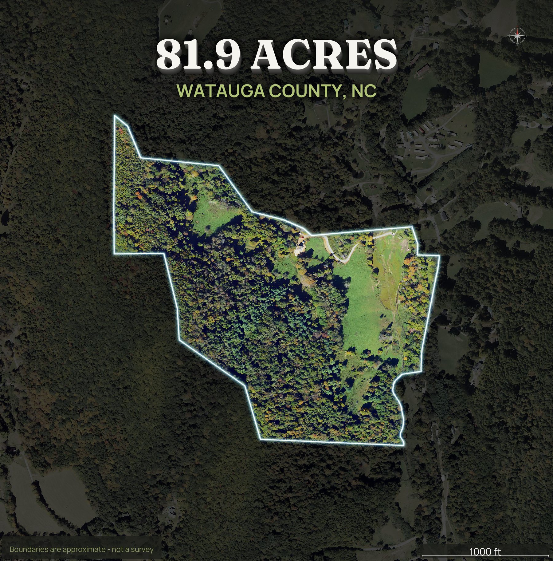
Where North Carolina land actually trades.
These are the counties land buyers ask about most.
Any North Carolina county works: type the parcel number, draw the boundary on the map, or upload a KML, KMZ, GeoJSON or zipped shapefile. Try your APN free, and if a parcel will not come up from its number you hear that before anything is charged.
What to know before you order a North Carolina parcel.
- Coverage
- Any North Carolina county works: type the APN, draw the boundary on the map or upload a file. See coverage.
- Common land
- Mountain and foothill acreage in the west, farms and woodlots across the Piedmont, and row crop and timber ground on the coastal plain.
- Typical uses
- Homesites and cabin sites, hunting and recreation, farms, and timber.
- Reads well from above
- Slope and ridgelines in the mountains, field and woodlot patterns in the Piedmont, and ditches, low ground and wetlands on the coastal plain.
- Your parcel number
- The number to look for is the parcel number or PIN on the tax record.
- Boundary and imagery
- The boundary is approximate and is not a survey. Imagery is the most recent aerial available for that county, usually one to three years old.
Rules for splitting a North Carolina tract differ by county, so start with the county planning office. How to subdivide land walks through the steps, subdivide land photos renders a pack for every lot from a plat or a drawn split, and land home packages screens where a home can go on a lot.
Also: drone photography vs DirtFlight · what land aerial photography costs · land listing photos checklist
Asked by people selling North Carolina ground.
Which North Carolina counties can you do?
Any North Carolina county works. Send the county and the APN and DirtFlight renders the pack. If a parcel will not come up from its number, you hear that before anything is charged, and you can draw the boundary on the map or upload a KML, KMZ, GeoJSON or zipped shapefile instead. The pack comes back the same.
Does DirtFlight suit mountain, Piedmont and coastal plain land in North Carolina?
Mountain and foothill acreage in the west, farms and woodlots across the Piedmont, and row crop and timber ground on the coastal plain. Typical uses there: homesites and cabin sites, hunting and recreation, farms, and timber.
Will slope and a possible building site show up?
The contour map shows the slope honestly and the imagery shows the cleared benches, which together is how mountain buyers judge whether a house site exists. Whether one can be permitted is a county and soils question.
Can you show wet ground on a tract down east?
Yes. Ditching, sitting water, cypress and the darker wet ground read from above, and the contour map shows the fall on flat tracts where inches matter. On eastern North Carolina land that is the first question.
Do I enter the PIN or the parcel number for a North Carolina tract?
In North Carolina, the number to look for is the parcel number or PIN on the tax record. Enter the county and the APN as it appears on the tax record, or a street address, and DirtFlight draws the boundary. If a parcel will not come up from its number, you are told before anything is charged, and you can draw the boundary on the map or upload a boundary file instead.
What does a North Carolina tract look like from above, mountains to coast?
Slope and ridgelines in the mountains, field and woodlot patterns in the Piedmont, and ditches, low ground and wetlands on the coastal plain. The boundary is drawn on every view, and the imagery is the most recent aerial available for that county, usually one to three years old, with the date on the pack.
List your North Carolina parcel today.
Send the county and the APN, or draw the boundary on the map or upload a file. Free for a limited time.