
DirtFlight / For land investors
For land investors
Screen the parcel before you buy, and list it the day you close.
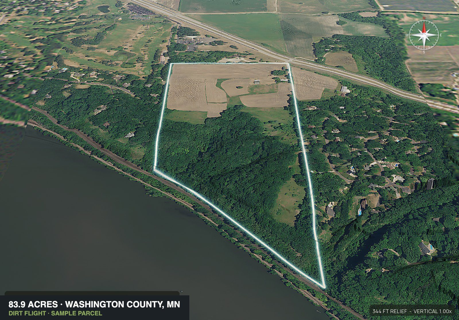
Enter the parcel number and DirtFlight renders the boundary aerial, 3D views, orbit video and a listing page in about ten minutes. A Paydirt pack adds the contours, road frontage, flood, wetland and soils, so the screen happens before the offer and the marketing happens the day you close.
Short answer
DirtFlight gives a land investor a finished aerial pack from the parcel number in about ten minutes. Before the offer, a Paydirt pack shows the boundary, the contours, road frontage, flood, wetland and soils. After the close, the same pack supplies the images and the listing page. It is a screen, and boundaries are approximate, not a survey.
The screen
What a pack answers before you make an offer.
The same first questions come up on every parcel. This table gives what a pack shows for each and what still needs a professional. The rows are Paydirt. A Dirt pack carries the boundary aerial, the four 3D views, the orbit video and the listing page.
| The investor asks | What the pack shows | What still needs a professional |
|---|---|---|
| How much of it can I use? | Buildable acres after slope over 25 percent, flood zone and mapped wetland are taken out, drawn on the aerial with the acres reported. | Zoning, setbacks, septic approval and a site plan from the county. The pack is a screen, not an approval. |
| Can I get to it? | Road frontage in feet on named public roads, an access view and a context map of the roads around the tract. | The deed, recorded easements and the driveway permit. |
| Is any of it wet? | Flood zone and mapped wetland in acres inside the boundary, with streams and ponds drawn and the floodway marked in the 3D explorer. | A flood determination or a wetland delineation. |
| How rough is the ground? | A contour map with elevation stats, four 3D views and an orbit video. | A grading plan or a site visit. |
| Will it take a septic system? | Soil map units inside the boundary, each with its septic limitations. | A percolation test or site evaluation by a licensed professional, and the health department permit. |
| Are utilities near? | Who serves the area, power lines with voltage and distance, water and sewer service areas, gas pipelines and broadband. | The provider's confirmation and the connection cost. Service areas are estimates and mains are not shown. |
| What is around it? | A context map of the neighbors and roads, and distance to the nearest towns. | A site visit. |
The listing
List it the day you close.
A parcel carries cost until it is listed. A pack gives the listing what it needs on the day the deal closes: the boundary on every view, the orbit video and a hosted listing page you can send to any buyer who asks. On Paydirt, the pack adds a pop-out photo and a social kit with a cover, a carousel and reels sized for Instagram and Facebook.
Send each inquiry the same link, so every buyer gets the same facts. How to list land for sale walks through the steps, and the land listing photos checklist says which photos to take yourself.
The split
Selling the lots too.
A tract that goes out in pieces gets a Paydirt pack for the whole and one for each lot, up to five, and each lot has its own listing page. Upload the surveyor's plat PDF, draw the lots on the map, or enter adjoining parcels you already hold. Cutting a parcel into new lots still needs the county's approval first.
Subdivide / Multi-parcel pack: $149 for the whole tract plus up to 5 lots. 6 or more: contact us for a quote.
Read how to subdivide land for the steps and the county's part, subdivide land photos for what each lot gets, and how to read a plat map when the surveyor's plat arrives.
The guides
Pick the guide for the job.
Before the offer
The land due diligence checklist lists 14 things to check and who checks each one.
Splitting a tract
How to subdivide land covers the steps, typical costs and timelines, and the pitfalls. Rules vary by county.
Selling the lots
Subdivide land photos turns a surveyor's plat into a pack and a listing page for every lot.
Land and home packages
Land home packages screens where a home fits a lot before you sell the package.
Listing the parcel
How to list land for sale goes from the deed to the post, step by step.
Cost against a drone
What land aerial photography costs sets a rural drone shoot beside a pack, by number of listings.
Plans
Which plan fits.
Pay per parcel when the volume is low, and move to a monthly plan when the count climbs. Three Paydirt packs in a month cost more than PayDirt Pro, which is 20 Paydirt packs a month with no roll-over.
| How you buy | Plan | Price | What it covers |
|---|---|---|---|
| A parcel now and then, and the pictures are enough | Dirt | $29 a parcel | The boundary aerial, four 3D views, the orbit video and the listing page. It does not carry the ground facts. |
| A parcel you may buy | Paydirt | $79 a parcel | Adds the contour map, road frontage, flood, wetland and soils, utilities, the pop-out photo and the social kit. |
| A tract to cut into lots | Subdivide / Multi-parcel pack | $149 for the whole tract plus up to 5 lots | A Paydirt pack for the whole tract and one for each lot, each lot with its own listing page. |
| Several parcels a month | PayDirt Pro | $199 a month, 20 packs, $9.95 a pack | 20 Paydirt packs a month, your logo on the imagery, the social kit and the listing page, and embed code. |
| More than 20 parcels a month | PayDirt Pro+ | $299 a month, 45 packs, $6.64 a pack | 45 Paydirt packs a month and everything in PayDirt Pro. |
| A team | Enterprise | Custom. Please reach out | Teams and seats, bulk import and higher volume. |
Prices apply after launch; every pack is free until December 31, 2026.
Honest limits
What it does not do.
- It is a screen, not a survey, a title search or a legal opinion. Boundaries are approximate.
- It does not find deals, set a price or run comparable sales. It starts when you have a parcel number.
- It is rendered, not photographed, so a clearing, a road or a build since the aerial was taken will not show. A drone or a visit does that.
- It does not replace the surveyor, the septic evaluation, the utility quote or the county's permit review.
- A parcel that will not come up from its number is said so before anything is charged. Draw the boundary on the map or upload a file instead.
Land in every state.
Every state
Every state has a page, and DirtFlight works in every county in the country. Type the parcel number, or draw the boundary on the map or upload a file. See the coverage page.
- Alabama
- Alaska
- Arizona
- Arkansas
- California
- Colorado
- Connecticut
- Delaware
- Florida
- Georgia
- Hawaii
- Idaho
- Illinois
- Indiana
- Iowa
- Kansas
- Kentucky
- Louisiana
- Maine
- Maryland
- Massachusetts
- Michigan
- Minnesota
- Mississippi
- Missouri
- Montana
- Nebraska
- Nevada
- New Hampshire
- New Jersey
- New Mexico
- New York
- North Carolina
- North Dakota
- Ohio
- Oklahoma
- Oregon
- Pennsylvania
- Rhode Island
- South Carolina
- South Dakota
- Tennessee
- Texas
- Utah
- Vermont
- Virginia
- Washington
- West Virginia
- Wisconsin
- Wyoming
Related.
Land due diligence checklist · How to subdivide land · For land brokerages · Topo map of a property · Hunting land · Farmland and ranches · About DirtFlight
See a sample pack, a finished listing page for a Paydirt pack. A Dirt pack carries the boundary aerial, the four 3D views, the orbit video and the listing page. The topography, access, context, pop-out, callout and utilities views on the sample are Paydirt.
Straight answers
Questions people ask about this.
What does DirtFlight do for a land investor?
It turns a parcel number into a finished aerial pack in about ten minutes. Before an offer, a Paydirt pack shows the boundary, the contours, road frontage, flood, wetland and soils. After the close, the pack supplies the images and a listing page to send to buyers.
Can I screen a parcel before I make an offer?
Yes. A Paydirt pack measures buildable ground after slope, flood and mapped wetland, flood zone and wetland in acres, road frontage, and soils with their septic limitations. It is a screen, not a survey, a percolation test or a permit, so the county, a surveyor and the health department decide the rest. Buildable: ground outside mapped slope, flood and wetland areas. A screen, not a zoning, septic or permit approval.
Does DirtFlight replace a survey or a title search?
No. Boundaries are approximate and are not a survey, and the pack is not a title search or a legal opinion. Use it to decide which parcels to take further.
How do I market the lots after a split?
Upload the surveyor's plat PDF, draw the lots on the map, or enter adjoining parcels. DirtFlight renders a Paydirt pack for the whole tract and one for each lot, and each lot gets its own listing page. Cutting a parcel into new lots still needs the county's approval first.
Which plan fits a land investor?
Dirt or Paydirt per parcel suits a parcel now and then, and the Subdivide / Multi-parcel pack suits a tract cut into lots. PayDirt Pro suits several parcels a month: it is 20 Paydirt packs, and three Paydirt packs in a month cost more than the plan. Every pack is free until December 31, 2026.
Can I put my logo on the images?
Yes, on PayDirt Pro, PayDirt Pro+ and Enterprise. A single Paydirt pack is delivered unbranded.
Does DirtFlight find deals or run comps?
No. It starts when you have a parcel number. It does not find deals, set a price or run comparable sales.
Does it work in my county?
Yes, every county in the country. Type the APN, or draw the boundary on the map or upload a KML, KMZ, GeoJSON or zipped shapefile, and you hear before anything is charged if a parcel will not come up from its number.
Is the boundary accurate enough to list with?
The boundary and acreage are fine for marketing and illustration. They are approximate and are not a survey.
Free until December 31, 2026.
Make an account, enter an APN, and the pack renders in about ten minutes. After launch, Dirt is $29 a parcel, Paydirt is $79, PayDirt Pro is $199 a month for 20 Paydirt packs, and Pro+ is $299 for 45.
Start free